Download
1 / 27
270 likes | 438 Views
Observing System Simulation Experiments in the Joint Center for Satellite Data. Lars Peter Riishojgaard and Michiko Masutani JCSDA. Joint OSSE Team. JCSDA: Joint Center for Satellite Data Assimilation SWA: Simpson Weather Associates

E N D
Observing System Simulation Experiments in the Joint Center for Satellite Data Lars Peter Riishojgaard and Michiko Masutani JCSDA WMO OSE Workshop, Geneva 05/2008
Joint OSSE Team JCSDA: Joint Center for Satellite Data Assimilation SWA: Simpson Weather Associates ESRL: Earth System Research Laboratory(formerly FSL, CDC, ETL) NCEP: Michiko Masutani, John S. Woollen, Yucheng Song, Stephen J. Lord, Zoltan Toth ECMWF: Erik Andersson KNMI: Ad Stoffelen, Gert-Jan Marseille JCSDA: Lars Peter Riishojgaard NESDIS: Fuzhong Weng, Tong Zhu, Haibing Sun, SWA: G. David Emmitt, Sidney A. Wood, Steven Greco NASA/GFSC: Ron Errico, Oreste Reale, Runhua Yang, Emily Liu, Joanna Joiner, Harper Pryor, Alindo Da Silva, Matt McGill, NOAA/ESRL:Tom Schlatter, Yuanfu Xie, Nikki Prive, Dezso Devenyi, Steve Weygandt MSU/GRI: Valentine Anantharaj, Chris Hill, Pat Fitzpatrick, JMA Takemasa Miyoshi , Munehiko Yamaguchi JAMSTEC Takeshi Enomoto So far most of the work is done by volunteers.
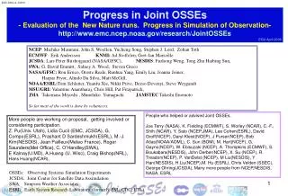
OSSEs • Observing System Simulation Experiment • Typically aimed at assessing the impact of a hypothetical data type on a forecast system • Not straightforward; EVERYTHING must be simulated • Simulated atmosphere (“nature run”) • Simulated reference observations (corresponding to existing observations) • Simulate perturbation observations • (object of study) • => Costly in terms of computing and manpower WMO OSE Workshop, Geneva 05/2008
Data assimilation Nature (atmospheric state) Assessment End products Sensors Observations (RAOB, TOVS, GEO, surface, aircraft, etc.) Short range product Analysis Forecast model Initial conditions
OSE, conceptual model Nature (atmospheric state) Assessment End products Sensors Reference observations (RAOB, TOVS, GEO, surface, aircraft, etc.) Short range product Analysis Forecast model Candidate observations (e.g. AIRS) Initial conditions WMO OSE Workshop, Geneva 05/2008
OSSE, conceptual model Nature run (output from high resolution, high quality climate model) Assessment End products Simulator Reference observations (RAOB, TOVS, GEO, surface, aircraft, etc.) Forecast products Analysis Forecast model Candidate observations (e.g. GEO MW) Initial conditions WMO OSE Workshop, Geneva 05/2008
Role of a National OSSE Capability • Impact assessment of future missions • Decadal Survey and other science and/or technology demonstration missions (NASA) • Future operational systems (NOAA) • Objective way of establishing scientifically sound and technically feasible user requirements for observing systems • Tool for assessing performance impact of engineering decisions made throughout the development phases of a space program or system • Preparation/early learning pre-launch tool for assimilation users of data from new sensors WMO OSE Workshop, Geneva 05/2008
Why a Joint OSSE capability? • OSSEs are expensive • Nature run, entire reference observing system, additional observations must be simulated • Calibration experiments, perturbation experiments must be assessed according to standard operational practice and using operational metrics and tools • OSSE-based decisions have many stakeholders • Decisions on major space systems have important scientific, technical, financial and political ramifications • Community ownership and oversight of OSSE capability is important for maintaining credibility • Independent but related data assimilation systems allows us to test robustness of answers WMO OSE Workshop, Geneva 05/2008
Main OSSE components • Data assimilation system(s) • NCEP/EMC GFS • NASA/GMAO GEOS-5 • NCAR WRF-VAR • Nature run • ECMWF • Plans for embedded WRF Regional NR • Simulated observations • Reference observations • Perturbation (“candidate”) observations • Diagnostics capability • “Classical” OSE skill metrics • Adjoint sensitivity studies WMO OSE Workshop, Geneva 05/2008
ECMWF Nature Run (Erik Andersson) • Based on recommendations/requirements from JCSDA, NCEP, GMAO, GLA, SIVO, SWA, NESDIS, ESRL • “Low Resolution” Nature Run • Free-running T511 L91 w. 3-hourly dumps • May 12 2005 through June 1 2006 • Two “High Resolution” periods of 35 days each • Hurricane season: Starting at 12z September 27,2005, • Convective precipitation over CONUS: starting at 12Z April 10, 2006 • T799 L91 levels, one-hourly dump • Initial condition from T511 NR WMO OSE Workshop, Geneva 05/2008
Nature Run validation • Purpose is to ensure that pertinent aspects of meteorology are represented adequately in NR • Contributions from Emmitt, Errico, Masutani, Prive, Reale, Terry, Tompkins and many others • Clouds • Precipitation • Extratropical cyclones (tracks, cyclogenesis, cyclolosis) • Tropical cyclones (tracks, intensity) • Mean wind fields • …. WMO OSE Workshop, Geneva 05/2008
Initial Nature Run validation Study of drift in NR Michiko Masutani (NCEP) Area averaged precipitation Tropics Zonal wind June 2006 By Juan Carlos Jusem (NASA/GSFC) NCEP reanalysis Nature Run Convective precipitation Large Scale precipitation Total precipitation Two to three weeks spinup in tropical precipitation. - Michiko Masutani (NCEP/EMC)
Tropical cyclone NR validation Preliminary findings suggest good degree of realism of Atlantic tropical cyclones in ECMWF NR. HL vortices: vertical structure Vertical structure of a HL vortex shows distinct eye-like feature and prominent warm core; low-level wind speeds exceed 55 m/s • Reale O., J. Terry, M. Masutani, E. Andersson, L. P. Riishojgaard, J. C. Jusem (2007), Preliminary evaluation of the European Centre for Medium-Range Weather Forecasts' (ECMWF) Nature Run over the tropical Atlantic and African monsoon region, Geophys. Res. Lett., 34, L22810, doi:10.1029/2007GL031640.
Extratropical Cyclone StatisticsJoe Terry NASA/GSFC 1) Extract cyclone information using Goddard’s objective cyclone tracker • Nature Run • One degree operational NCEP analyses (from several surrounding years) • NCEP reanalysisfor specific years (La Nina, El Nino, FGGE) 2) Produce diagnostics using the cyclone track information (comparisons between Nature Run and NCEP analyses for same month) • Distribution of cyclone strength across pressure spectrum • Cyclone lifespan • Cyclone deepening • Regions of cyclogenesis and cyclolysis • Distributions of cyclone speed and direction
Evaluation of Cloud Simpson weather associates
Case Events Identified from ECMWF HRNR(Plotted from 1x1 data) May 2-4: squall line affecting all points along US Gulf coast MSLP (hPa) 3-h convective precipitation (mm) . May 7-8: decaying squall line over TX Oct 10-11: squall line / tropical wave Christopher M. Hill, Patrick J. Fitzpatrick, Valentine G. Anantharaj Mississippi State University
Simulation of observations • Conventional observations (non-radiances) • “Resample NR at OBS locations and add error” • Problem areas: • Atmospheric state affects sampling for RAOBS, Aircraft observations, satellite AMVs, wind lidars, etc. • Correlated observations errors • J. Woollen (NCEP), R. Errico (GMAO) • Radiance observations • “Forward radiative transfer on NR input profiles” • Problem areas: • Treatment of clouds has substantial impact on availability and quality of observations • Desire to avoid “identical twin” RTMs • H. Sun (NESDIS), R. Errico (GMAO) WMO OSE Workshop, Geneva 05/2008
OBS91L Jack Woollen (NCEP/EMC) For development purposes, 91-level NR variables are processed at NCEP and interpolated to observational locations with all the information need to simulate data (OBS91L). OBS91L for all footprints of HIRS, AMSU, GOES are produced for a few weeks of the T799 period in October 2005. Thinned footprints for the entire period. Thinning of the footprint is based on operational use of radiance data. The OBS91L are also available for development of a Radiative Transfer Model (RTM) for development of other forward model.
Radiance Simulation System for OSSEGMAO, NESDIS, NCEPRon Errico, Runhua Yang, Emily Liu, Lars Peter Riishojgaard (NASA/GSFC/GMAO)Tong Zhu, Haibing Sun, Fuzhong Weng (NOAA/NESDIS)Jack Woollen(NOAA/NCEP) Other resources and/or advisors David Groff , Paul Van Delst (NCEP) Yong Han, Fuzhong Weng,Walter Wolf, Cris Barnet, Mark Liu (NESDIS) Erik Andersson (ECMWF); Roger Saunders (Met Office) NASA/GMAO developing optimized strategies to simulate complete set of footprints. This includes development of cloud clearing algorithm. NESDIS, NCEP working on thinned data. Full resolution data for GOES-R. Initial data set (OBS91L) produced by Jack Woollen at NCEP Existing instruments experiments must be simulated for control and calibration and development of DAS and RTM Test GOESR,NPOESS, and other future satellite data
OBS91L Jack Woollen (NCEP/EMC) For development purposes, 91-level NR variables are processed at NCEP and interpolated to observational locations with all the information need to simulate data (OBS91L). OBS91L for all foot prints of HIRS, AMSU, GOES are produced for a few weeks of the T799 period in October 2005. Thinned foot prints for the entire period. Thinning of the foot print is based on operational use of radiance data. The OBS91L are also available for development of a Radiative Transfer Model (RTM) for development of other forward model.
Radiance Simulation System for OSSEGMAO, NESDIS, NCEPTong Zhu, Haibing Sun, Fuzhong Weng(NOAA/NESDIS)Jack Woollen(NOAA/NCEP)Ron Errico, Runhua Yang, Emily Liu, Lars Peter Riishojgaard (NASA/GSFC/GMAO) Other resources and/or advisors David Groff , Paul Van Delst (NCEP) Yong Han,Walter Wolf, Cris Bernet,, Mark Liu, M.-J. Kim, Tom Kleespies, (NESDIS) Erik Andersson (ECMWF); Roger Saunders (Met Office) OBS91L is produced by Jack Woollen at NCEP NASA/GMAO is developing best strategies to simulate and work on complete foot prints. This include development of cloud clearing algorithm. NESDIS and NCEP are working on thinned data. Full resolution data for GOESR. Existing instruments experiments must be simulated for control and calibration and development of DAS and RTM Test GOESR,NPOESS, and other future satellite data
Simulation of GOES-R ABI radiances for OSSE Tong Zhu et al. :5GOESR P1.31 at AMS annual meeting http://www.emc.ncep.noaa.gov/research/JointOSSEs/publications/AMS_Jan2008/Poster-88thAMS2008-P1.31-OSSEABI.ppt Simulated from T511 NR. GOES data will be simulated to investigate its data impact
Current set of “prototype” simulated observations at the GMAO derived from the ECMWF Nature Run HIRS3, HIRS2, AMSU-A/B, AIRS,+ Conventional Obs. The satellite data is thinned, but less so than used operationally. Thinning is based on time of report and defined effect of clouds. Clouds are treated as black at their tops, when defined as present. The presence of clouds affecting IR is determined by a tunable stochastic function using NR-provided cloud fractions. This function is intended to account for holes in grid-boxes and allows simple tuning for possible unrealism in the NR cloud distribution. The same CRTM is used as in GSI (the only RTM available to us). Locations of cloud track winds are independent of NR clouds. The list of simulated obs. types will be expanded along with the realism of the simulations and their associated errors as resources permit. We hope to have a suitably tuned (validated) set of “prototype” simulated obs. available by the end of Sept. 2009. Slide from Errico
OSSEs planned OSSEs to investigate data impact of GOES and prepared for GOES-R Tong Zhu, Fuzhon Weng, J. Woollen (NCEP) M.Masutani(NCEP) and more OSSE to evaluate UAS N. Prive(ESRL), Y. Xie(ESRL) possible at NCEP and others OSSE to evaluate DWL M.Masutani(NCEP), L. P Riishojgaard (JCDA), NOAA/ESRL, and others OSSEs for THORPEX T-PARC Evaluation and development of targeted observation Z. Toth, Yucheng Song (NCEP) and other THORPEX team Regional OSSEs to Evaluate ATMS and CrIS Observations Cris M. Hill, Pat. J. Fitzpatrick, Val. G. AnantharajGRI- Mississippi State University (MSS) Lars-Peter Riishojgaard (NASA/GMAO, JCSDA)
Next steps • Calibration; impact of main classes of observation should mimic what is seen in operational OSEs • GMAO will calibrate GEOS-5 using adjoint sensitivity tools • EMC will calibrate GFS OSSE using OSEs • Goal is to have calibrated systems available for actual OSSEs by late summer 2008 • Funding • NASA ROSES proposal • NOAA JCSDA-led budget initiative • ESA/EUMETSAT encouraged by ADMAG to participate WMO OSE Workshop, Geneva 05/2008
Summary • OSSEs are expensive, but can be a cost-effective way to optimize investment in future observing systems • OSSE capability should be multi-agency, community owned to avoid conflict of interest • Independent but related data assimilation systems allows us to test robustness of answers • Joint OSSE collaboration remains only partially funded but appears to be headed in right direction WMO OSE Workshop, Geneva 05/2008