Download
1 / 11
110 likes | 205 Views
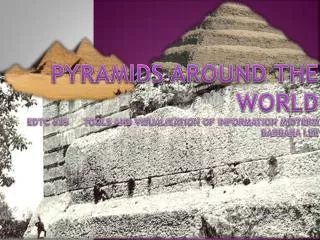
Pyramids Around the World EDTC 635 Tools and Visualization of Information Midterm Barbara Lee. Author:. Project Overview:. Barbara Lee. Title:. Pyramids Across the World.

E N D
Pyramids Around the WorldEDTC 635 Tools and Visualization of Information MidtermBarbara Lee
Author: Project Overview: Barbara Lee Title: Pyramids Across the World This lesson is designed to integrate various cultures’ use of pyramidal structures. Many students think of the Egyptian pyramids; however, pyramids exist from prehistoric times to current times throughout the world. For some reason, China has some spectacular pyramids which are blocked from Google Earth, but pictures exist throughout Google. Class: Tools for the Visualization of Information EDTC 635
Objectives: TSW measure the distance between the Egyptian necropolis and other pyramids. Curriculum: World History and Cultures Intended Grade Level: 5-8 Grade Level. May be adapted for younger students; however, my students are functioning on a low to middle high school reading level.
Planning and Development Class: World History and Cultures Timeline (length of time for the Project): 1 weeks of 5 days with a 45 minute period List and Description of Activities: Expected outcome: Measure Distance: TSW measure the distance between Egyptian necropolis and other pyramid sites. Calculate the Direction: TSW measure the direction between the Egyptian necropolis and other pyramid sites. Determine Composition of Site: TSW write composition of the building material of the pyramid.
Common Core/ Other Standards 6.1.4.B.1 Compare and contrast information that can be found on different types of maps, and determine when the information may be useful. 6.1.4.B.3 Explain how and when it is important to use digital geographic tools, political maps, and globes to measure distances and to determine time zones and locations using latitude and longitude. 6.2.8.B.4.e Analyze the motivations for civilizations to modify the environment, determine the positive and negative consequences of environmental changes made during this time period, and relate these changes to current environmental challenges. 8.1.4.A.4 Create a simple spreadsheet, enter data, and interpret the information. 8.1.4.A.5 Determine the benefits of a wide range of digital tools by using them to solve problems.
List and Description of Activities: Identifying Your Own Home: • TSW pair up as a team and find their homes and record the season when that the pictures were taken. Discuss Latitude and Longitude • Introduce latitude and longitude. TSW research from the web the latitude and longitude of 10 museums. Illustrate how Wikipedia has the location of most major structures on the upper right side of the page and a brief history of the construction: • Demonstrate how various statues are explained both with location and history of the images. Illustrate how Wikipedia has the location of most major structures on the upper right side of the page and a brief history of the construction: • Demonstrate how various statues are explained both with location and history of the images • Measure Distance and Specify Construction: • TSW measure and record the distance between Egyptian necropolis and other pyramid sites. • TSW use the websites www.google.com, www.wikipedia.org and http://www.european-pyramids.eu/wb/pages/european-pyramids/italy/santa-agata.php to read the latitude, longitude, age shape and construction purpose for the 12 pyramid sites.
Web Resources: • http://www.european-pyramids.eu/wb/pages/european-pyramids/italy/santa-agata.php • http://en.wikipedia.org/wiki/Giza_Necropolis • http://en.wikipedia.org/wiki/Pyramids_of_Meroe_(Begarawiyah) • http://en.wikipedia.org/wiki/Greek_pyramids • http://en.wikipedia.org/wiki/Bosnian_pyramid_claims • http://en.wikipedia.org/wiki/Silbury_Hill • http://en.wikipedia.org/wiki/Pyramid_of_the_Magician • http://en.wikipedia.org/wiki/Chichen_Itza • http://en.wikipedia.org/wiki/Tikal • http://en.wikipedia.org/wiki/Xochicalco • http://en.wikipedia.org/wiki/Cuicuilco • http://en.wikipedia.org/wiki/Monks_Mound
Picture citations: http://www.fromquarkstoquasars.com/wp-content/uploads/2014/05/Pyramids.jpg http://i.dailymail.co.uk/i/pix/2011/05/25/article-1390667-0CA4F4B4000005DC-982_634x286.jpg http://1.bp.blogspot.com/-mCVe87cFPz4/ULiju6GL- EI/AAAAAAAAEiI/Lf4R9SAQMdE/s640/Baalbke+Terrace.jpg
Link to Google Map for Exercise: https://www.google.com/maps/@0,0,1z/data=!3m1!4b1!4m2!6m1!1szvvG1NTERscg.kL6xNSBAfA9g?hl=en
List and Description of Extension Activities: • 1. TSW use a Venn Diagram with three intersecting circles to compare and contrast three civilization’s pyramids and give a reason why their environment may have changed the structure’s features. (Logical- Mathematical) • 2. TSW create a spreadsheet which (Logical- Mathematical) • 3. TSW list seven reasons why a culture might create a pyramid. (Logical- Mathematical) • 4. TSW create a map of a pyramid’s important characteristics. (Visual- Spatial) • 5. TSW write a newspaper summary of the history of a culture and the impact on their culture of creating a pyramid. (Verbal- Linguistic) • 6. TSW demonstrate as a team how the blocks could have been moved using ancient technology. (Body- Kinesthetic)