Download
1 / 18
180 likes | 349 Views
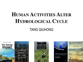
H UMAN A CTIVITIES A LTER H YDROLOGICAL C YCLE. TANG QIUHONG. Human activities alter hydrological cycle. Introduction Research area Some ideas. Modified from Peter M. Vitousek et al. [1]. Human Domination of Earth’s Ecosystems [1]. Human alteration of earth is substantial and growing.

E N D
HUMAN ACTIVITIES ALTER HYDROLOGICAL CYCLE TANG QIUHONG
Human activities alter hydrological cycle • Introduction • Research area • Some ideas
Modified from Peter M. Vitousek et al.[1] Human Domination of Earth’s Ecosystems[1] Human alteration of earth is substantial and growing.
(Modified from [5]) Human activities & hydrological cycle[2,3,4] • Most of human activities that alter rainfall-runoff flow is unconscious. • The actions people manage water resources are the actions people try to influence dissipative flow. Land transformation Intake from river, reservoir …
Spring (Modified from William M. Alley et al [6]) Focus on Dissipative Flow 1.Natural Dissipative flow (“without human interpose”) • Flow or seepage to ‘lowland’ because of hydraulic head without human interpose • To simulate NDF we need know groundwater, elevation well. But “the inability to describe heterogeneity in aquifer characteristics is a fundamental problem in groundwater hydrology and will continue.”[6]
E E P Soil water Soil water Root zone Groundwater Water content is controlled 2.Manmade Dissipative flow (“direct human interpose”) 70% of man-used water is used in agriculture[7] City River Soil water Soil water Groundwater Groundwater irrigated land NON-irrigated land Use population, economic growth etc to estimate it . (about 30%)
(Modified from Illinois Water Resources Center (IWRC) [8]) Visualization Runoff flow (direct): Surface runoff is lagged by ridge of field. Dissipative flow (direct): Keeping soil moist when it is dry. <indirect> Human activities affect latent and sensible fluxes to the atmosphere. Feedback to atmosphere (evaporation, albedo, etc) Feedback E P
Human activities alter hydrological cycle • Introduction • Research area • Some ideas
Scale • We need to incorporate the mechanics of soil moisture redistribution, and this demand us to predicate the response of this system on a timescale not long. • Type of soil and vegetation should be specified (We need to consider groundwater because a shallow water table provides moisture for the soil and vegetation and such acts as a source term for evapotranspiration to the atmosphere[9]. Of cause, because of the inability to know spatial heterogeneity, we should simplified it ). This limits the spatial scale. • Research area: a catchment (Yellow River) • Timescale: month (timestep: days/hours)
Why We Choose Yellow River We should choose a river basin in semiarid area. arid area: no efficient runoff flow(e.g. Tarimu River ) humid area: dissipative flow is not remarkable perennial perennial Fig 1. Comparison between precipitation of 1998 and perennial in Yellow River[10] Fig 2. Comparison between streamflow of 1998 and perennial in Yellow River [10]
Human activities alter hydrological cycle • Introduction • Research area • Some ideas
Atmosphere Soil & Vegetation Groundwater Model description() • Coupling with atmosphere • Physically base on Soil water model • Consider Groundwater • Watershed-scale Horizontal boundary conditions Given by a large scale model (GCM or a nested grid model) (pressure, humidity, temperature, wind gradients …) Internal Cycle (Timestep: hours or less?) To calculate (atmosphere radiation, wind speed, pressure, humidity, temperature, and precipitation) (FAO) Penman-Monteith equation:
Atmosphere Soil & Vegetation Groundwater Model description() Atmosphere-Soil interaction 1.Atmosphere model gives parameters for Penman-Monteith equation -> Evaporation (latent heat flux) 2. Atmospheric radiation -> sensible heat flux land use type Root zone water balance Irrigation (soil moisture) P P Et hortonian overland flow Soil water Soil water saturation overland flow( water table rises above the land surface) Groundwater Groundwater irrigated land NON-irrigated land Evapotranspiration from water table If water table depth >5m, it is zero.
Atmosphere Soil & Vegetation Groundwater Model description() Groundwater balance Soil water Soil water Exchange River Groundwater Groundwater irrigated land NON-irrigated land Exchange =f(water level,water table) ? depended on elevation
Model description(total) Atmosphere Land surface Soil water Ground water grid of large scale model ? Cycle in atmosphere (interaction) Penman-Monteith equation (no data) Groundwater (initial water table) given by repeatedly running the model (not sure) Riverway storage(including reservoir, lake) we should give a simple operation rule on it[12].
Next step Specify the research area Collect dataset Coding ,put it into action …… (from Tsinghua Alumni Association Website, URL: http://www.tsinghua.org.cn/) 行勝於言 Acts speak louder than words.
Acknowledge Some of the ideas come from reference [9] and [12]. Also I would like to appreciate my supervisor Dr. HU Heping in Tsinghua University, Beijing China for references [2][3][4]. Reference • [1] Vitousek et al., Human Domination of Earth's Ecosystems, Science 1997 277: 494-499 • [2] 干旱区平原绿洲耗散型水文模型—— I:模型结构,胡和平,汤秋鸿, 田富强, 水科学进展 (已接受)(in Chinese)HU Heping, TANG Qiuhong, and TIAN Fuqiang. A Dissipative Hydrological Model for Arid Plain Oasis, I: Model Structure, Advance in water science, (in press) • [3] 干旱区平原绿洲耗散型水文模型—— II:模型应用,汤秋鸿, 田富强,胡和平, 水科学进展 (已接受)(in Chinese)TANG Qiuhong, TIAN Fuqiang, and HU Heping. A Dissipative Hydrological Model for Arid Plain Oasis, II: Applications of Model, Advance in water science, (in press) • [4] 基于散耗流的流域水文模型研究, 胡和平,汤秋鸿, (in Chinese, English version is under construction) HU Heping, TANG Qiuhong. A Study of Hydrological Model Based on Dissipative Flow, (personal document). • [5] The Environment in Tokyo - Aquatic Environment 2/2. URL: http://www.kankyo.metro.tokyo.jp/kouhou/english2001/we_2.htm • [6] Alley et al., Flow and Storage in Groundwater Systems, Science 2002 296: 1985-1990 • [7] Human Appropriation of Renewable Fresh Water ,Sandra L. Postel, Gretchen C. Daily, and Paul R. Ehrlich , Science 9 February 1996; 271: 785-788 (in Reports). • [8] Website of Illinois Water Resources Center (IWRC) URL: http://www.environ.uiuc.edu/iwrc/faq.htm
Reference (continued) • [9] York, J. P., M. Person, W.J. Gutowski and T. C. Winter, 2002: Putting aquifers into atmospheric simulation models: An example from the Mill Creek Watershed, northeastern Kansas. Adv. Wat. Res., 25, 221-238. • [10] 黄河水资源公报, 水利部黄河水利委员会 (in Chinese) Bulletin of Yellow River water resources, Yellow River Conservancy Commission, ministry of water resources of the People’s Republic of China. • [11] Gutowski, W. J., C. J. Vorosmarty, M. Person, Z. Otles, B. Fekete and J. York, 2002: A Coupled Land-Atmosphere Simulation Program (CLASP). J. Geophys. Res., 107 (D16), 4283,10.1029/2001JD000392 • [12] Chong LI, Dawen YANG, Guangheng NI and Heping HU, 2004: Simulation of irrigation consumption in the Yellow River basin using a distribution hydrological model. (in press, personal communication)