Download
1 / 20
200 likes | 362 Views
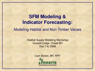
SFM Modeling & Indicator Forecasting: Modeling Habitat and Non-Timber Values. Habitat Supply Modeling Workshop Quaaot Lodge, Chase BC Dec 7-8, 2006. Cam Brown, MF, RPF. Introduction. There are two main drivers currently pushing habitat modeling into forest estate modeling projects in BC:

E N D
SFM Modeling & Indicator Forecasting: Modeling Habitat and Non-Timber Values Habitat Supply Modeling Workshop Quaaot Lodge, Chase BC Dec 7-8, 2006 Cam Brown, MF, RPF
Introduction • There are two main drivers currently pushing habitat modeling into forest estate modeling projects in BC: • SFM indicator forecasting in support of certification initiatives. For example, CSA Z809-02 SFM standard requires forecasting to understand future implications of management options • Multiple accounts analysis in support of strategic silviculture planning (mitigation strategies to address MPB impacts)
SFM Modeling / Multiple Accounts Analysis • Both aim to predict stand and landscape level conditions into the future relative to different management regimes. For Example: • Current Practices • Harvest Nothing • Pure Timber Emphasis • Low Risk Biodiversity • Enhanced Silviculture
Indicators • Indicators are required to make comparisons and assess relative impacts to key values: • Economic values • Timber supply, jobs, income levels, revenue to gov’t, etc. • Social values • Visual quality, recreation opportunity, cultural values • Environmentalvalues • Landscape Biodiversity (patch distribution, seral rep., rare sites rep., etc) • Stand Level Biodiversity (WTP’s, CWD/snags, tree species diversity) • Water Values (road densities, ECA’s, etc) • Terrestrial Habitat Elements (cover/forage/nesting habitat)
Hardwoods on CFLB (Ecological) Equivalent hardwood area on the CFLB over time based on the % of stands with hardwoods present and the % hardwood within those stands. (DFA CFLB area) Harvesting tends to result in increased presence of deciduous species in many ecosystems. Deciduous species are most common in younger seral stands.
Carbon Stored in Trees (Ecological) Carbon mass (kg) stored in trees on the CFLB over time – based on growing stock (net tree volumes). (TSA CFLB area) Harvesting tends to reduce the total growing stock on the land base to a long term sustainable level.
Indicator Modeling Issues • Scale / Resolution • Indicator quality • Data Requirements to Support Predictions • Discrete vs Continuous Thresholds • Modeling Tool Capabilities • Influence solutions or simple reporting • If influencing How? • Simulation vs Optimization • Example Forest Estate Modeling Tools
Indicator Scale / Resolution • Deciduous in riparian areas • too small a scale to track in most forest estate modeling projects (but not impossible) • Deciduous occurring in cutblocks • Tends to get generalized in growth and yield as long as it remains at low levels (stand gaps) • Can be included in regeneration assumptions but then remains fixed (consistent with assumptions) • We tend to have a poor handle on predicting or representing the natural diversity that occurs within reforestation practices – we tend to simplify regeneration outcomes into tidy uniform groups.
Indicator Quality • Are they clearly defined and meaningful? • Averages (simple) vs distributions (complex) • Indicators need to be relatively simple to make then comprehensible over long reporting time frames • Simple averages can be misleading though. Snags / ha
Data Requirements to Support Predictions • Habitat forecasting quality depends on data: • Ecosystems mapping (PEM/TEM) • Riparian classifications / fish distributions • Local data on CWD and snags in natural stands • Need to be able to correlate these stand attributes to stratums and stand ages. • Definitions of rare ecosystems • Correlations between SAR species and habitats • Future road locations - needed to support density tracking. • In general – the datasets required to support habitat modeling are often sparse.
Discrete vs Transitional Thresholds • Discrete Thresholds • Simple and easy but not very realistic. • Can result in issues when inventory data is not very accurate (a 99 yr old stand is worth nothing…vs a 100 yr old stand). • Transitional Thresholds • Not as easy to define but tend to be more realistic. • Often avoids issues with inaccurate inventory data (a 99 yr old stand is worth almost as much as a 100 yr old stand).
Modeling Tool Capabilities • There are a range of forest estate models in use. They each have different capabilities for including indicator forecasting: For Example: • Can the indicator be fully represented in the model or is a surrogate required? • UWR cover: tree species, crown closure, and stand age - usually simplified to just age. • OR, is the indicator not in the model at all and must be assessed using post processing (i.e. road densities)
Modeling Tool Capabilities • Can the indicator be used to influence model outcomes (harvest allocation decisions) or does the model simply allow tracking and reporting of attributes? • If influencing How? • Hard Constraints • Hard Constraints with Recruitment • Soft Constraints (Targets and Priorities)
Modeling Tool Capabilities • Hard Constraints • When a requirement is not met, no harvesting is allowed in its associated area. (i.e. Not enough old growth in an LU so no harvest is allowed). Harvesting can never result in thresholds being exceeded. • Hard Constraints with Recruitment • When a mature or old forest requirement is not met, the oldest available stands are ‘locked up’ to meet the target and any remaining stands old enough for harvest become eligible. Harvesting can never result in thresholds being exceeded. • Soft Constraints (Targets and Priorities) • Users define targets and prioritizes them. They are then used to calculate an objective function value that represents how well a solution meets the targets. Harvesting can result in thresholds being exceeded but only if the overall solution is better off.
Modeling Tool Capabilities • Why do I care about hard vs soft? • Indicators often do not have a clear threshold where they should suddenly result in harvesting restrictions. • Sometimes we don’t want indicators to act as rigid requirements. (patch size objectives, ECA’s) • Some indicators may be more important to manage for than others (relative priorities). • Because it impacts how or if indicators can be used to influence model solutions.
Modeling Tool Capabilities • Value of Optimization (heuristics) • If we want to manage for certain values (indicators) more than others, then targets and priorities are required. These can only be achieved using goal seeking optimization (heuristics when spatial). • Optimization can allow better habitat solutions to be found because of the ability to: • Explore numerous options/alternatives and test their ability to meet the stated objectives (explore the solution space). • Immediately understand implications in future periods when making a decision in earlier periods. • Include factors that are important but not rigid (patching). • Optimization does not have to mean optimal timber supply, it can mean optimal habitat supply.
Utopia • A model where all indicators can be fully represented using transitional thresholds and used to influence the solution when desired. • Does it exist…….. No. • But some good stand-ins do. • Key is to: understand how to get the most out of the model that is used.
A Relatively New Option: PATCHWORKSTM • Commercial software (Tom Moore – Spatial Planning Systems, Deep River, Ontario.) • Fully Spatial (patch size distributions, etc) • Goal Seeking Optimization Heuristic • Objective function can be completely customized to include most indicators discussed here (including weightings). • Interactive – can adjust targets and weightings on the fly so easy to do tradeoff analysis. • Supports the uses transitional thresholds • Can select between multiple treatment options for each stand in the model. • Can include roads (building / hauling costs, multiple products to multiple destinations)