Download
1 / 17
170 likes | 205 Views
Learn about Fulton County's electronic as-built standards for water and wastewater networks, including benefits, authority, and templates. Discover the efficient CAD verification process and cost-saving options.

E N D
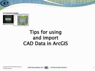
Digital Data Submission (CAD) Standards Fulton County Department of Public Works Colin Gowens GIS Manager
GOAL: KEEPING THE NETWORKS UP-TO-DATE! WATER NETWORK WASTEWATER NETWORK
Why are we doing this? • NPDES Permitting • GASB 34 • MNGWPD • EPD Audit Checklist • CMOM • More……
Why Electronic As-Builts • The “Best” Way • More efficient than paper • Review process can be automated • Imports into GIS making data more timely Our Authority? • Section 4.2.3, ~ C-4 of FC Subdivision Regulations Final Plat
Electronic As-Builts • Standards • Tied to GPS Monument Network • Spatially Referenced • Topology, Layer Names, Contents • Templates created to make easier to implement • Review • Easy to Flag Errors • Review Database • Automatic Follow-up Letter • Import • One Step Hands Free (FME) • Convert CAD to GDB keeping scale intact • GPS Field Verify Subset of Points • Support • Training! • Information On Web Site
Modeled on CCWA Standard • Already is proven and accepted • Builds standardization in the Metro Area for development community to follow • Other communities are also looking at this model
Work with Development Community • Hold educational workshops for easy transition to new standard • Make standards available online • Have easy to use templates available • Incentives • 1) Sharing of GIS data (aerials, contours, etc.) • 2) Increase approval turn-around time
County Staff • Hold training workshops for County staff • Have automated review system to reduce review errors and misunderstanding • Have an appeal process if submission fails
About the Templates • Created for basic & advanced CAD packages including AutoCAD, AutoCAD LT, TurboCAD, IntelliCAD and so on • Includes DWG, DWS, DWT, & DXF • Working on Microstation seed files & cell libraries
Overview of Process • Advantages • Eliminate Unnecessary Steps • Automation • Use of SOP • Data Structures • Only What is Needed • Consistency • Receive Report with Errors
ANOTHER OPTION FOR WATER/SEWER • Annual Contract for Survey & Inventory • Deliver GIS Data • Include CCTV Data • Increase Impact Fee or Inspection Fee • Per Point Cost (Water, Wastewater) • Linear Foot Cost (CCTV Inspection) • QA/QC Cost • Option to do themselves • How do we quantify cost savings?


![Object-Oriented Data Bases [OODBs] Data Model [OODM] Prog. Langs [OOPLs]](https://cdn2.slideserve.com/4527952/slide1-dt.jpg)