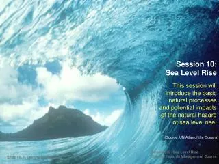
Sea Level Rise
Predicting Sea Level Rise Impacts on Hawaii’s Anchialine Pool Ecosystems Lisa Marrack UC Berkeley Ala Kahakai National Historical Park. Sea Level Rise. Sea level is expected to rise between 0.5 to 1.6m by 2100 (IPCC 2007; Vermeer&Rahmstorf 2009). Observed. Predicted Impacts.


Sea Level Rise
E N D
Presentation Transcript
Predicting Sea Level Rise Impacts on Hawaii’s Anchialine Pool Ecosystems Lisa MarrackUC BerkeleyAla Kahakai National Historical Park
Sea Level Rise Sea level is expected to rise between 0.5 to 1.6m by 2100 (IPCC 2007; Vermeer&Rahmstorf 2009) Observed
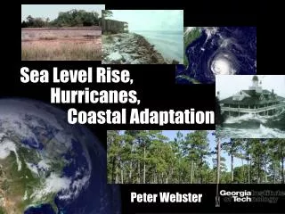
Predicted Impacts Water Withdrawal and Non-Point Source Pollution • Coastal inundation • Storm run up • Habitat shifts http:/www.yfrog.com/gzt4wyrj Ali’i Drive, Kona, HI March 11, 2011
Anchialine Pools Figureby: Jonathan D. Craft, Auburn University Scott Santos
The Spirit of Kaloko-Honokohau Cultural and Natural Resources Megalagrion xanthomelas Metabetaeus lohena & Halocaridina rubra
Questions Questions • What coastal features will be inundated by 2100 along the west coast of Hawaii due to a 1 meter sea level rise? • Where will we expect new anchialine pool habitats to emerge within the arid coastline of west Hawaii?
DATA Elevation Data • FEMA – Lidar 2006 • Average point distance is 3 ft • 1074 tiles on Big Island • 500,000 bare earth pts /tile • ± 0.51 ft vertical accuracy (95% CI)
Kaloko Honokohau National Historical Park Geospatial anchialine pool data -abiotic and biotic (Marrack & Beavers 2009)
High Tide 2.28ft
Sea Level Rise (1 m) 3.28 ft
Sea Level Rise + High Tide 5.57 ft (5.57 ft)
Where will we expect new anchialine pool habitats to emerge?
Inundation of pools by 2100 Inundation of pools by 2100 81% of 194 current pools will be inundated by 1 m SLR at High Tide (5.57 ft)
Future and Present Pools (5.57 ft)
What next? • Include archaeological features, wetlands, fishponds • Expand analysis within Ala Kahakai NHP corridor • Make products available to researchers, managers, and planners
What are the distribution and dispersal patterns of invasive M. lar in anchialine pools in the State of Hawaii? - population genetics of M. lar populations - stream and anchialine pools Hawaii, Guam, French Polynesia 2) What are the relative and combined impacts of M lar, invasive fishes (poeciliids, Tilapia) and elevated nutrients on anchialine pool habitats? - expand spatial coverage of surveys - experimental manipulations - nutrient flow through food web (isotopes) Distribution, dispersal, and impacts of the introduced Macrobrachium lar within anchialine pool ecosystems
Mahalos Rick Gmirkin & Arik Arakaki - Ala Kahakai National Historical Park, Sallie Beavers-NPS, Delwyn Oki-USGS, Eric Grossman-USGS, Rebecca Most-UH Hilo, Scott Santos – Auburn University
Macrobrachium lar study • Samples • Stream – Mike Blum, Tulane Univ. >300 n • Samoa – NPS 20 n • Anchialine Pool • July 2010 & July 2011 25n, 6 sites 147n, 8 sites 47n, 4 sites 15n, 2 sites 52n, 6 sites
Macrobrachium lar study • Samples • Stream – Mike Blum, Tulane Univ. >300 n • Samoa – NPS 20 n • Anchialine Pool • July 2010 & July 2011 • 65n, Ohiki • Makalawena • Mauna Lani • Halape • Kapoho • Puako (1) Successful PCR with 1 COI primer set. Several sequences produced MORE NEEDED!
DATA Lidar Vertical Datum Local Tidal Datum Kawaihae/Hilo 5.57 ft (1.698m) Sea Level Rise + High Tide 3.28 ft 1 m Sea Level Rise 2.29 ft (0.698 m) Highest Observed Tide 0 Mean Sea Level