Download
1 / 11
110 likes | 240 Views
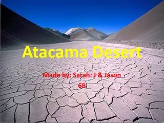
Site B Introduction Life in the Atacama 2005 Science & Technology Workshop January 6-7, 2005. Pre-landing analysis Derived hypotheses Daily planning & program Post-ops overview A. N. Hock UC LA. Site B. Remote science ops: Cabrol, Dohm, Fisher, Hock, Piatek, Warren-Rhodes, Weinstein

E N D
Site B IntroductionLife in the Atacama 2005Science & Technology WorkshopJanuary 6-7, 2005 Pre-landing analysis Derived hypotheses Daily planning & program Post-ops overview A. N. HockUCLA
Site B • Remote science ops: • Cabrol, Dohm, Fisher, Hock, Piatek, Warren-Rhodes, Weinstein • Goals • Find life! • Evaluate habitability with onboard instrumentation • Test rover ability (trafficability, data acquisition, etc.) • Long traverse • Strategy • Pre-landing analysisi.d. potential habitatslong-term planningdaily planning • Regional geologic/biologic survey ‘tuned’ to spatially-scaled hypotheses (orbital-local-micro scale observations) • Traverse summary • 7 sols • 14 unique locales • ~6 km planned traverse NASA Ames Research Center /Carnegie Mellon
Pre-landing analysis NASA Ames Research Center /Carnegie Mellon
Derived hypotheses • Possible carbonate mineralogic signatures identified using thermal emission spectra indicates ancient/recent aqueous activity, including weathering and secondary mineralization. • a. Geologic materials exposed at the surface with both high reflectance in the near infrared and relativelylow reflectance in the visible wavelength spectra using VNIR suggests the presence of chlorophyll and/or evaporite minerals (e.g. gypsum). • b. Geologic materials within some of the surface runoff features (e.g., individual valleys and valley networks) display high red reflectivity; the signature of these materials may vary with season, indicating potential water-induced secondary mineralization and increased potential for viable habitats. • Topographically-controlled flow and deposition of atmospheric watervapor (clouds, fog--both marine and radiative) enables life in arid regions where surface water may otherwise not be available. • Features associated with surface water flow (individual valleys and valley networks, ancient basins, sites of potential groundwater seeps--ancient/recent/geothermal activity and/or groundwater migration along basement structures and geologic contacts--and Salar Grande) increase the potential of identifying prime life-containing environments because of the implied presence of ancient/recent hydrologic/hydrogeologic activity. • Solar insolation (a function of location time of year, local atmospheric conditions and micro- to macro-topography) provides a strong control on habitability--we indicated general solar direction on our schematic map to indicate this. Certain locations may benefit from increased insolation while others may benefit from shade (e.g. many non-polar desert ecosystems). NASA Ames Research Center /Carnegie Mellon
Daily planning & program • Rover (Chile) Science Ops (Pittsburgh) • 0600 Wake up • Wake up 0630 • 0700 Ops opens / more analysis • 0730 Specify survey traverse • 0900 Finalize target selection • Charged up / Downlink 0930 Uplink rover traverse • Begin traverse 1030 • Conclude traverse / 1600 Downlink / initial analysis • Uplink science data / • hibernate • 1900 Ops closes • Wake up, night operation2100 • Subsurface option 2130 • Sleep (low power) 2200 NASA Ames Research Center /Carnegie Mellon
Daily planning & program • Phase I science ops recap: Daily planning • 0. Pre-downlink: make an outline plan of tomorrow’s operations & strategy beyond final locale. • 1. Post-panorama: consider alterations to outline plan based on results from final locale. • 2. Planning, 3 stages: • A. As a team, plan using homemade MS Excel template. • B. Input plan to Eventscope. • C. Write up text support document. • 3. Team review of plan; after deadline, no more changes to plan. • 4. Upload. NASA Ames Research Center /Carnegie Mellon
Site B: post-ops overview • Sol 1 (locale 1): Landing day—high res pan & long-term planning • Sol 2 (2, 3): local exploration, bearing N to topographic low and potential change in surface mineralogy • Sol 3 (4-6): cont’d… • Sol 4 (7-11): new geology? Heading W towards geologic contact & ancient drainage • Sol 5 (14, 19): continuing upslope to valley in coastal range—terrific mobility (autonomous?) • Sol 6 (19b-d): moving S across several fan units; follow the water (vapor!) • Sol 7 (20, 24): …runout. Attempted return to landing area foiled by weather NASA Ames Research Center /Carnegie Mellon
Site B: post-ops overview NASA Ames Research Center /Carnegie Mellon
Site B critical analysis - logistics • Better commumications with rover team. • Understanding level of Zoe’s autonomy prior to planning. • Some level of silent, introspective review time is important as a team. • Current schedule for plan upload redundant, time-consuming • Instrument-specific lessons: • Fluorescence imager: single images effective; dye penetration?; conversion from web-images to science product—parallel image display. • Meteorology: install instruments on Zoe; request data! • VIS/NIR Spectrometer: time requirements (software)? NASA Ames Research Center /Carnegie Mellon
Site B critical analysis – science • The ‘sage brush’ lesson • Sol 4, locale 08 Sol 5, locale 14 • More time/staff needed for data review • Bore-sighted VNIR spectrometer • Weather instruments mission-critical • Processed data product available online? NASA Ames Research Center /Carnegie Mellon
Site B critical analysis – science • The ‘fovial pan’ lesson: • Near field: low resolution • Mid field: high resolution, less solar panels • Far field: low resolution * Minimizes bandwidth use for maximal data return NASA Ames Research Center /Carnegie Mellon