Download
1 / 21
210 likes | 676 Views
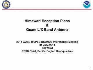
Himawari Reception Plans & Guam L/X Band Antenna. 2014 GOES-R/JPSS OCONUS Interchange Meeting 31 July, 2014 Bill Ward ESSD Chief, Pacific Region Headquarters. Initial Himawari Support within NOAA.

E N D
HimawariReception Plans & Guam L/X Band Antenna 2014 GOES-R/JPSS OCONUS Interchange Meeting 31 July, 2014 Bill Ward ESSD Chief, Pacific Region Headquarters
Initial Himawari Support within NOAA • Initial Himawari data delivery and processing development is being funded with Sandy Supplement and comes with a number of Congressionally monitored caveats (see notes). • NOAA is leveraging this development for support (to extent possible) real-time users of Western Pacific Imagery and products. • Initial capabilities include: • HimawariCast at Guam, Hawaii and relay to AK • Full resolution imagery (subset) to AR, PR, NCEP • AMVs, Cloud Mask, Cloud Height, Cloud Type (modification of GOES-R algorithms)
JMA & HOPE(Takashi Mori, Takuya Miyakawa, Ryo Yoshida, NOAA-JMA meeting 7-2-2014) • Himawari-8/9 satellites and ground equipment are operated by a special purpose company (SPC) named: • HOPE: “Himawari Operation Enterprise Corporation” • Receives data from Advanced Himawari Imager (AHI) and Data Collection Platform (DCP) and transmits to JMA. • JMA MSC: • Processes those data and disseminates products to users.
Himawari-8 Himawari Ground System(Takashi Mori, Takuya Miyakawa, Ryo Yoshida, NOAA-JMA meeting 7-2-2014) Telemetry, Command, Ranging Telemetry, Command, Ranging (12-13 GHz band) (12-13 GHz band) AHI data, DCP data AHI data, DCP data (18 GHz band) (18 GHz band) (402 MHz band) Secondary Station Primary Station Antenna Site (Kanto/Saitama) DCPs Antenna Site / Data Center (Hokkaido) Himawari-9 control AHI data, DCP data control Data Center (Kanto/Tokyo) AHI data (Level 1A & Ancillaries), DCP data AHI data (level 1a), DCP data HOPE AHI data (Level 1A& Ancillaries) DCP data JMA MSC surveillance and remote control over Osaka system Japan Meteorological Agency Osaka Regional Headquarters (Osaka) (Back Up) Japan Meteorological Agency Meteorological Satellite Centre (Tokyo) Himawari Standard Data, HRIT files, edited DCP data, etc. HimawariCast cloud GTS Users ・Citizens, disaster prevention agencies, mass media, etc. ・ Foreign meteorological organizations, DCPs user, etc.
Tentative Data Delivery Timelines 2014 2015 Sep Oct Nov Dec Jan Feb Mar Apr May Jun Jul Aug Sep Oct Nov JMA-to-NSOF cloud-service tests H8 Launch Pre-Operational Data Transmission JMA-to-NOAA Operational Data Transmission JMA-to-NOAA NESDIS/STAR Pre-PDA (Best Effort) Preliminary Distribution / Testing NWS GRP distribution / AWIPS2 Testing NESDIS/STAR Pre-PDA Best Effort Production and NWS GRP distribution Himawari-Cast Testing NWS Himawari-Cast (HI & Guam, backup transmit to AK)
NWS Off-CONUS Product Distribution Priorities * IR-WV / Vis
HIMAWARI CTS BRODCAST • JMA plans to produce HRIT files (VIS, IR1, IR2, IR3, IR4) and disseminate them via a communication satellite (HimawariCast). • NESDIS and NWS users, including representatives of Alaska and Pacific regions, have expressed the view that, in their opinion, a slightly different set would be closer to the current MTSAT bands we are now using and would more closely meet their needs.
AWIPS-2 H8 Display • Format Imagery and Derived Products per GOES-R PUG and SCMI ICD so that AWIPS-II functionality prepared for GOES-R can be reused. • Initial capability for ABI SCMI developed and tested against 14.2.1 • Target incorporation of “Himawari Package” for Operational Release 14.4.1 • Code Check-In: December 2014 • Deployment: June 2015 • Approach • Define TOWR-G Threads for mission activities that incorporate AHI data • Develop and test as part of GOES-R readiness activity • Continuous Integration on NAPO platform (internet accessible) • Using Vlab/Ken Sperow approach • Realtime simulated input via RaFTR-CIMSS-SIM • Periodic Structured Tests by Raytheon on NHDA (next one in October 2014) • Initial capability for operational use via ATAN to appropriate facilities • Need to establish working group (coordination – Eric Guillot)
Schedule of Distribution/Dissemination Operation of Satellites Extended Observation In-orbitstandby Operational In-orbitstandby Launch Operational Manufacturing Launch Imagery Distribution/Dissemination Extended Dissemination Operational (MTSAT-2 imagery) (MTSAT-2 imagery) Test Operational (Himawari-8 imagery) (Himawari-8 imagery) Operational Operational (MTSAT-2 imagery) (Himawari-8 imagery) • The cloud service will start its test operation in March, 2015. • Before then, it may be possible to do a delivery test between NESDIS and the cloud. It would be also useful to find out the best settings for the cloud. Parallel Dissemination for users’ smooth transitions
NWS Network Project for Flowing Himawari Data to NWS Field Offices The NWS network project for flowing Himawariimagery to NWS field offices will managed out of the NOAA Integrated Dissemination Program’s Ground Readiness Project. Project Objective: To upgrade NWS networks needed to flow Himawari imagery and other Level 2 products to NWS field offices. Primary focus on higher priority products Start Date: March 2014 Target Completion Date for Top Priority Offices: August 2015
Himawari Products Planned Utilization at NOAA/NWS Notes 1. AHI radiances - 16 spectral channels (Level 1b). 2. Further details of priorities of Off-CONUS imagery on next slide.
Himawari Training Plan • Plans to move forward: • Upon request of developing this training plan the following regions and centers were contacted to provide their Himawari AHI training requirements: OPC, AWC, NHC, WPC ARH and PRH • The primary reason for contacting these locations was to discover what everyone requires, cross reference those requirements and understand the scope of the training requirements • The NWSTC, Satellite Liaisons and OST Satellite Lead were very instrumental in lending support and direction in support of this proposal. • a. What exists now from the GOES-R PG? What can we use that has already been developed? Expect to get parts of the full resolution Himawari 8 data sets in the summer of 2015. • -COMET Modules: • - GOES-R ABI: Next Generation Satellite Imaging • - GOES-R: Benefits of Next Generation Environmental Monitoring • - Multispectral Satellite Applications: RGB Products Explained • - Pull out the guts of these modules, not use the whole thing (most • - important points and applications) • - Liaison/Developer Training, PPTs, Quick Guides, Leverage the use of blogs (CIMSS, CIRA, SPoRT, Liaisons) • b. Assess the correct training path to do the training development. Focus on the use of the 16 channel imagery, AMVs, RGBs, Temporal and Spatial improvements, channel combinations. • c. Assemble training packages • - COMET willing to help develop training specific to Himawariusing GOES-R material • c. Prepare the deliverables and how they will be presented • d. Availability of actual Himawari 8 data test sets
Himawari 8/9 Training Proposal • Training Description: • The Himawari 8 geostationary satellite will be launched in the fall of 2014 and become operational by midsummer 2015. This satellite will be the first of its kind to contain 16 separate channels. In order to properly prepare forecasters • Associated Costs: • Initial training should incorporate all available training developed via COMET, the GOES-R PG sites that have developed training for similar channels for the Advanced Baseline Imager that are common with the Advanced Himawari Instrument (AHI). • Estimated costs to pull together completed modules and develop further modules to ensure all 16 channels are covered will be $100K.
Himawari Training Plan OCONUS Data Requirements: • 1. Highest priority Himawari/AHI CMI (CORL-supported day-night CMI) full resolution, NetCDF4, refresh 10 mins • - AHI ch3 0.64 um (red / vis) • - AHI ch7 3.9 um (shortwave ir) • - AHI ch9 6.9 um (water vapor) • - AHI ch14 11.2 um (IR window) • 2. 2nd Priority CMI • - AHI ch1 0.46 um (blue) • - AHI ch2 0.51 um (green) • 3. 3rd Priority CMI • - AHI ch8 6.19 um • - AHI ch10 7.34 um • - AHI ch12 9.61 um
Himawari Training Plan • 4. Highest priority derived products (these could be delivered via AWIPS DDS by subscription). Propose that these are not new/additional products but simply modification to currently planned GOES-R baseline products since GOES-R/ABI and Himawari/AHI are nearly identical. Therefore, NWS GRP needs to base estimate solely on extension of GOES-R product to areas covered by Himawari. • - AMV's via modified GOES-R algorithm...propose this is not new/additional product but modification to currently planned GOES-R baseline • - Volcanic Ash detection and height • - Hurricane Intensity • - Total Precipitable Water • - any others, including future capabilities would be included in GOES-R ESPC processing requests
Latest information • Please check the following URLs for the latest information.Leaflet (4.3MB)http://www.jma.go.jp/jma/kishou/books/himawari/2014_Himawari89.pdf orhttp://www.jma.go.jp/jma/jma-eng/satellite/news/himawari89/himawari89_leaflet.pdfLeaflet in JPG format (140KB)http://www.jma.go.jp/jma/jma-eng/satellite/news/himawari89/himawari89_leaflet_1.jpgFor information on data distribution/dissemination planhttp://www.jma.go.jp/jma/jma-eng/satellite/index.htmlFor technical informationhttp://mscweb.kishou.go.jp/himawari89/index.html https://www.wmo.int/pages/prog/sat/meetings/documents/EC-65-SideEvent-UserPrep_Doc_02_JMA.pdf
Questions & Contact Information Bill Ward ESSD Chief, PRH Honolulu, Hawaii bill.ward@noaa.gov 808.725.6010 (Office) 808.722.9961 (Cell)