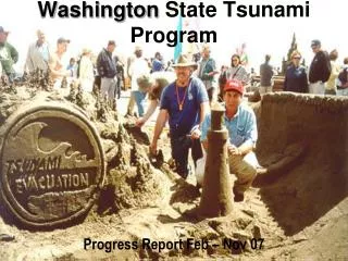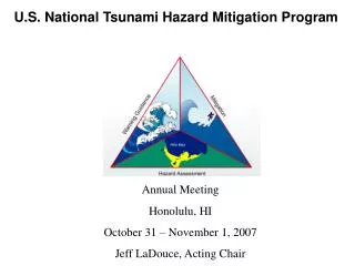
Tsunami Program Overview
Tsunami Program Overview. Jenifer Rhoades Date: June 16, 2008. NOAA’s Tsunami Program Areas of Focus. Tsunami Warning Program Tsunami Hazard Mitigation Program Tsunami Research and Development Global Tsunami Warning and Mitigation Network

Tsunami Program Overview
E N D
Presentation Transcript
Tsunami Program Overview Jenifer Rhoades Date: June 16, 2008
NOAA’s Tsunami Program Areas of Focus • Tsunami Warning Program • Tsunami Hazard Mitigation Program • Tsunami Research and Development • Global Tsunami Warning and Mitigation Network Significant involvement and coordination with NOS, NESDIS, OAR, and Federal and State Partners
Tsunami Program 2004(Pre-Strengthening Effort) Note: NTHMP funding at $2.3M 1997-2006; Additional $2M Earmark 2003-2005
Tsunami Program 2004 (Pre-Strengthening Effort) • Tsunami Warning Program • 2 Warning Centers staffed 8hrs/day 5days/wk. • 6 experimental Deep-ocean Assessment and Reporting of Tsunami stations • 0 national water level stations (NWLON) configured to support tsunami • Insufficient global seismic data and communications; local Hawaii network limited • Regional seismic networks implemented in Alaska and west coast through NWS and NTHMP • Tsunami Hazard Mitigation Program • 11 TsunamiReady™ communities recognized • 5 member states in the National Tsunami Hazard Mitigation Program • 3 Gb quality controlled data archived for tsunami observations and events • 2 inundation forecast models completed • Coastal tsunami forecast methodology implemented at TWCs • Tsunami Research and Development • Transitioned DART technology from PMEL to NDBC in 2001; operational in 2003 • PMEL and NDBC awarded DOC Gold Medal in 2004 for successful transition • No national research plan • Global Tsunami Warning and Mitigation Network • No functional international coordination outside Pacific • International Tsunami System and Information Center for Pacific only
Administration Commitment to Strengthen The Nation’s Tsunami Warning Program In the aftermath of the 2004 Tsunami, the Administration made a commitment to strengthen the Tsunami Program FY 2005 Tsunami Supplemental Funding: $17.2M (+ USGS $13M) FY 2006 NOAA Appropriation: $ 9.7M FY 2007 NOAA Appropriation: $19.1M FY 2008 NOAA Appropriation: $23.2M FY 2009 PB: $23.2M PRIMARY FOCUS: Accelerate and Expand the Nation’s Tsunami Detection and Warning Capabilities Additional Administration Response Defense: Relief = $250M State (USAID): Reconstruction = $660M ($16M for IO tsunami warning system) NSF: Research surveys = $1M
Today’s Tsunami Program Strengthened Warning and Mitigation System: NOAA Major Project Completion Date 3-31-08 • Tsunami Warning Program • 2 Warning Centers staffed and operating 24x7, 365 days/yr • TWC AORs expanded to all Indian Ocean and Caribbean nations as well as all US and Canada coasts. • Notification provided to all UNESCO/IOC Focal Points in Pacific and Indian Oceans and Caribbean Sea • 39/39 DART® II stations in operational status • 8/8 new Hawaii broadband seismic stations operational; integrated 9 USGS Global Seismic Network affiliate stations and Test-ban Treaty arrays • 16/16 new + 33 upgraded TsunamiReady™ water-level stations (136 NWLON stations configured to support tsunami) • Tsunami Hazard Mitigation Program • 57 TsunamiReady™ Communities recognized • 28 member States in the National Tsunami Hazard Mitigation Program • 3.2 Tb tsunami quality controlled data (event, earthquake, volcano, DART, water level, DEMs) • 26/26 Site-specific inundation models, digital elevation models and bathymetric maps completed for Forecast Operations • Bathymetric survey of Puerto Rico completed • Forecast system Phase 1 implementation “tsunami at a glance” tested • SIFT coastal estimate tool resident at TWCs along with the TWC coastal forecast system
U.S. Strengthening Project NOAA Project Accomplishments (cont.)* • Tsunami Research and Development • Developed a National Tsunami Research Plan and a NOAA Research Plan that include: • Improvements and cost reductions of warning operations; • Development of next generation forecast models that address local tsunami problems • Social Science studies (in partnership with NSF) • Global Tsunami Warning and Mitigation Network • Provided technical assistance and training for International TWC development • Improved preparedness and developed capacities • Provided detection and communication equipment • Promoted data-sharing practices and policies • Established education/training capability at accredited universities * Not required by the U.S. Strengthening Project Plan
Administration Commitment to Strengthen The Nation’s Tsunami Warning Program Tsunami Warning and Education Act of 2006: [NOAA Authorized $135M for Program (FY2008 – FY2012)] Tsunami Forecast & Warning Program including integrated observing systems National Tsunami Hazard Mitigation Program 27% Tsunami Research Program 8% Global Tsunami Warning and Mitigation Networkincluding International Tsunami Information Center (ITIC), technology transfer (WMO, IOC) and contributing to GEOSS Deficit Reduction of 2005; Title III: [NOAA Authorized $50M for Program (FY2008 – FY2012)] For Tsunami Warning and Coastal Vulnerability Program Enhanced Tsunami Warning and Forecast Capability A. Including R&D Improved Outreach and Education Effort
Tsunami Warning Program(P.L. 109-424) SEC. 4. TSUNAMI FORECASTING AND WARNING PROGRAM The Administrator, through the National Weather Service and in consultation with other relevant Administration offices, shall operate a program to provide tsunami detection, forecasting, and warnings for the Pacific and Arctic Ocean regions and for the Atlantic Ocean, Caribbean Sea, and Gulf of Mexico region. Shall maintain or establish—(A) a Pacific Tsunami Warning Center in Hawaii; (B) a West Coast and Alaska Tsunami Warning Center in Alaska; and(C) any additional forecast and warning centers determined by the National Weather Service to be necessary Utilize and maintain an array of robust tsunami detection technologies; Maintain detection equipment in operational condition to fulfill the detection, forecasting, and warning requirements of this Act; Provide tsunami forecasting capability based on models and measurements, including tsunami inundation models and maps for use in increasing the preparedness of communities, including through the TsunamiReady program; Maintain data quality and management systems to support the requirements of the program; Ensure that maintaining operational tsunami detection equipment is the highest priority within the program carried out under this Act.
Tsunami Hazard Mitigation Program(P.L. 109-424) SEC. 5. TSUNAMI HAZARD AND MITIGATION PROGRAM. The Administrator, through the National Weather Service and in consultation with other relevant Administration offices, shall conduct a community-based tsunami hazard mitigation program to improve tsunami preparedness of at-risk areas in the United States and its territories. Shall establish a Coordinating Committee comprising representatives of Federal, State, local, and tribal government officials. The Administrator may establish subcommittees to address region-specific issues. PROGRAM COMPONENTS.—The program under this section shall— (1) use inundation models that meet a standard of accuracy defined by the Administration to improve the quality and extent of inundation mapping, including assessment of vulnerable inner coastal and nearshore areas, in a coordinated and standardized fashion to maximize resources and the utility of data collected; (2) promote and improve community outreach and education networks and programs to ensure community readiness, including the development of comprehensive coastal risk and vulnerability assessment training and decision support tools, implementation of technical training and public education programs, and providing for certification of prepared communities; (3) integrate tsunami preparedness and mitigation programs into ongoing hazard warning and risk management activities, emergency response plans, and mitigation programs in affected areas, including integrating information to assist in tsunami evacuation route planning; (4) promote the adoption of tsunami warning and mitigation measures by Federal, State, tribal, and local governments and nongovernmental entities, including educational programs to discourage development in high-risk areas; (5) periodic review of the program
Tsunami Warning Program(P.L. 109-424) SEC. 6. TSUNAMI RESEARCH PROGRAM. The Administrator shall, in consultation with other agencies and academic institutions, and with the coordinating committee established under section 5(b), establish or maintain a tsunami research program to develop detection, forecast, communication, and mitigation science and technology, including advanced sensing techniques, information and communication technology, data collection, analysis, and assessment for tsunami tracking and numerical forecast modeling. Research program shall— (1) consider other appropriate research to mitigate the impact of tsunami; (2) coordinate with the National Weather Service on technology to be transferred to operations; (3) include social science research to develop and assess community warning, education, and evacuation materials; and (4) ensure that research and findings are available to the scientific community.
Tsunami Warning Program(P.L. 109-424) SEC. 7. GLOBAL TSUNAMI WARNING AND MITIGATION NETWORK International Tsunami Warning System International Tsunami Information Center DETECTION EQUIPMENT; TECHNICAL ADVICE AND TRAINING.— Data Sharing Requirement
Administration Commitment to Strengthen The Nation’s Tsunami Warning Program Note: NOAA meets funding mandates required by the Tsunami Warning & Education Act of 2006
Tsunami Warning Program Sustain 24x7 capability at 2 TWCs Operate & maintain existing observational networks and integrate other networks DART™ II, seismic, and TsunamiReady™ water level Tsunami Hazard Mitigation Program Recognize 50 additional TsunamiReadyTM communities National Tsunami Hazard Mitigation Program Continue data archive and data quality control Complete 49 site-specific inundation models, Digital Elevation Models and bathymetric maps for Forecast Operations Move SIFT to operations Integrate TWC Forecast Models with SIFT GUI Tsunami Research and Development Improve accuracy and lead-time of tsunami warnings Implement improvements to tsunami warning, education, and mitigation efforts, including social science studies Global Tsunami Warning and Mitigation Network Tsunami Watch-Provider for Indian Ocean, Pacific, and Caribbean countries Research and development agreements with Australia and Indonesia Promote capacity development, technology transfer, and data exchange policies Support through IOC, WMO, GEO Continue ITIC support Continue to support the University of Puerto Rico’s capacity building in the Caribbean Background & DiscussionU.S. Tsunami Program Plan 2008 – 2013* * Excludes Spectrum Plan Funding
Summary/Priorities • Significant achievements since 2004 • Coordination and activities on-going to maintain and improve TWS • Near-Term gains for Warning System, NTHMP and Research expected to be achieved through Spectrum Sale Funding • Implementation of Strategic Plan • IT Convergence • Coordination with Other Los • Execution of Spectrum Funds
Warning Operations and Notification Warning and Information Centers Global area of responsibility serving national needs Operating 24x7 Fast, reliable, and trusted
Global DART™ II NetworkA contribution to GEOSSDetection and Verification:Full Operational Capability March 2008
Forecast SystemGeneration, propagation, and site-specific decisionsPhase 1 West Coast, Alaska and HI Total: 4 models pre-strengthening + 26 new models completed 19
Forecast SystemGeneration, propagation, and site-specific decisionsPhase 1, East and Gulf Coasts, PR and USVI Total: 4 models pre-strengthening + 26 new models completed
NOAA’s Tsunami Program Hazard Assessment 75 72 63 54 45 36*1 30 21 13 4 * Deferred delivery of 3 inundation models in FY08 to put resources on transitioning models to operations. 1 Opportunity to accelerate and expand #models completed to address more at-risk communities w/Spectrum Sale.