Download
1 / 14
140 likes | 152 Views
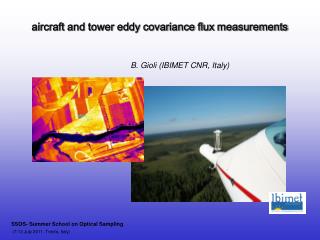
JRC - GLC 2000 "Final Results" Workshop - Ispra 24-26/03/03. IMPROVEMENT OF EWS PRODUCTS BY LAND COVER DATA. Giancarlo Pini Institute of BioMeteorology (IBIMET) - National Research Council (CNR). JRC - GLC 2000 "Final Results" Workshop - Ispra 24-26/03/03. PROJECT BACKGROUND.

E N D
JRC - GLC 2000 "Final Results" Workshop - Ispra 24-26/03/03 IMPROVEMENT OF EWS PRODUCTS BY LAND COVER DATA Giancarlo Pini Institute of BioMeteorology (IBIMET) - National Research Council (CNR) IMPROVEMENT OF EWS BY LAND COVER DATA – Giancarlo Pini – IBIMET-CNR
JRC - GLC 2000 "Final Results" Workshop - Ispra 24-26/03/03 PROJECT BACKGROUND The “Eritrea EWS for Food Security and Environmental Monitoring based on Africover database” is a pilot project, funded by FAO, to test Early Warning System development under limited data availability. In Eritrea data on population, food crops, livestock, and meteorology are very limited in terms of time series and geographical distribution the pilot project has been developed in a particularly difficult environment as consequence Actions Data retrieval Database building Conceptual system design Vulnerability assessment (structural analysis) Food crisis prevention (current analysis) IMPROVEMENT OF EWS BY LAND COVER DATA – Giancarlo Pini – IBIMET-CNR
JRC - GLC 2000 "Final Results" Workshop - Ispra 24-26/03/03 PRESENT PROJECT PRODUCTS Databases - upgraded version of Crop Production System Zone (FAO) database using Africover and new administrative division - long series Meteosat dekadal rainfall data and profiles related to CPSZ and selected areas (agriculture and pastoral) - NDVI dekadal data (1981-2000 series) and profiles related to CPSZ and selected areas (agriculture and pastoral) Analysis - Land characterisation based on land cover database (Africover) - NDVI dekadal inter-annual variability and land characterisation - Selection of monitoring area for agriculture and pasture (using Africover) and application of dekadal monitoring (rainfall and NDVI) for the season 2002 IMPROVEMENT OF EWS BY LAND COVER DATA – Giancarlo Pini – IBIMET-CNR
JRC - GLC 2000 "Final Results" Workshop - Ispra 24-26/03/03 SOME PRODUCTS obtained by LAND COVER DATA Definition of zones interested by rainfed cereal cultivation based on CPSZ Zone of interest using the FAO Africover database: zone with cereal area >5000 ha Zone of interest using the FAO Africover database: zone with cereal area >3000 ha CPSZ (1994) IMPROVEMENT OF EWS BY LAND COVER DATA – Giancarlo Pini – IBIMET-CNR
JRC - GLC 2000 "Final Results" Workshop - Ispra 24-26/03/03 SOME PRODUCTS obtained by LAND COVER DATA Land characterization based on the Africover database : distribution of agriculture and natural vegetation based on CPSZ IMPROVEMENT OF EWS BY LAND COVER DATA – Giancarlo Pini – IBIMET-CNR
JRC - GLC 2000 "Final Results" Workshop - Ispra 24-26/03/03 LAND COVER DATA APPLICATIONS Test of Africover and GLC2000 for 1 - simulation of coping capacity by cereal production 2 - identification of monitoring areas with the characteristics to be totally occupied by agriculture (100%) IMPROVEMENT OF EWS BY LAND COVER DATA – Giancarlo Pini – IBIMET-CNR
JRC - GLC 2000 "Final Results" Workshop - Ispra 24-26/03/03 Eritrea GLC2000 v.1 January 2003 Eritrea GLC2000 v.3 March 2003 ZOOMING ON MAIN AGRICULTURE AREAS Eritrea Africover Agriculture areas in pink IMPROVEMENT OF EWS BY LAND COVER DATA – Giancarlo Pini – IBIMET-CNR
JRC - GLC 2000 "Final Results" Workshop - Ispra 24-26/03/03 1 - simulation of coping capacity by cereal production IMPROVEMENT OF EWS BY LAND COVER DATA – Giancarlo Pini – IBIMET-CNR
JRC - GLC 2000 "Final Results" Workshop - Ispra 24-26/03/03 IMPROVEMENT OF EWS BY LAND COVER DATA – Giancarlo Pini – IBIMET-CNR
JRC - GLC 2000 "Final Results" Workshop - Ispra 24-26/03/03 2 - identification of monitoring areas (100% agriculture) Example of monitoring activity Monitoring areas (100% agriculture) identified by using Africover In GLC2000, croplands are always mixed with different land cover typologies. At the moment, area identification is not possible result IMPROVEMENT OF EWS BY LAND COVER DATA – Giancarlo Pini – IBIMET-CNR
JRC - GLC 2000 "Final Results" Workshop - Ispra 24-26/03/03 RESULTS and LIMITS IN APPLYING GLC2000 - first test: the main limit is the estimation of cropland area extension - second test: the main limit is the identification of area totally occupied by agriculture. The limits come directly from the interpretation of the legend The agriculture areas are not clearly defined, on the contrary the croplands are mixed with different land cover typologies and in different percentages. As consequence, for the moment, it is difficult to use the GLC2000 into EW and food security analysis. IMPROVEMENT OF EWS BY LAND COVER DATA – Giancarlo Pini – IBIMET-CNR
JRC - GLC 2000 "Final Results" Workshop - Ispra 24-26/03/03 GLC2000 in EW and FOOD SECURITY ANALYSIS GLC2000 merits : global coverage possibility to be regularly updated free access to information (internet) GLC2000 limitations: classification mainly oriented to natural vegetation agriculture classes not clearly defined and identified prevalence of remote sensing analysis approach, poor attention to territorial reality (field validation, utilisation of local knowledge,…..) IMPROVEMENT OF EWS BY LAND COVER DATA – Giancarlo Pini – IBIMET-CNR
JRC - GLC 2000 "Final Results" Workshop - Ispra 24-26/03/03 remote sensing experts land cover experts users community local expertise and CONCLUSIONS Land Cover is a fundamental information for EW and food security analysis it has to be accurate, clear, reliable and usable for the different international and national users the final validation has to consider the users needs by means of effective and operating networks of LC information meets with users needs and can be used for different applications (EW, FS,…..) but so how result IMPROVEMENT OF EWS BY LAND COVER DATA – Giancarlo Pini – IBIMET-CNR
JRC - GLC 2000 "Final Results" Workshop - Ispra 24-26/03/03 thank you !!! IMPROVEMENT OF EWS BY LAND COVER DATA – Giancarlo Pini – IBIMET-CNR