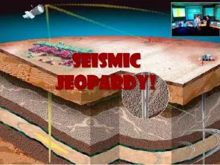
Seismic Jeopardy: Understanding Earthquake Science
550 likes | 644 Views
Explore earthquake science with Seismic Jeopardy! Learn about tools, landforms, safety measures, aftershocks, and more. Discover how seismic waves help reveal Earth’s interior secrets.

Seismic Jeopardy: Understanding Earthquake Science
E N D
Presentation Transcript
What are 2 tools that scientists use to monitor fault movement?
Creep meters Laser-ranging devices Tilt meters Satellites Back to Menu
Elevationis a landform’s height above sea level. Reliefis the difference between highest and lowest elevations. Back to Menu
Falling objects. Back to Menu
What are 3 types of landforms? Describe their elevations and reliefs.
Plains:have varying elevations (Coastal / Interior) and low relief. Plateaus:a flat top with high elevation and relief. Mountains: high elevations & reliefs. Back to Menu
Where is the safest area to be during an earthquake? What areas should you avoid?
The safest area is outside, away from falling objects. Avoid outer walls and windows. Back to Menu Final Jeopardy
Aside from buildings, what other important things can earthquakes damage?
Power lines Water mains Gas lines Roads Bridges Back to Menu
An earthquake has just occurred and you’re still alive! But you are not out of danger yet. Why?
Aftershocks– smaller, residual quakes – can occur shortly after the primary quake. Back to Menu
Liquefactionis when soil turns into a liquid mud. This is due to rapid, violent vibrations in the earth. Back to Menu
Describe the process that can cause a Tsunamiout in the middle of the ocean.
When one plate subducts, the friction can cause the overlying plate to bend. Releasing this energy (an earthquake) can trigger a massive wave. Back to Menu
The materials / soil of this road were loosely packed An earthquake occurred with a lot of motion to cause Liquefaction Back to Menu Final Jeopardy
Along a Fault, or break in Earth’s surface where plates move past one another. Back to Menu
What is the difference between the Focusand the Epicenterof an earthquake?
The Focusis the starting point of a quake, underground. The Epicenteris the point directly above the focus at the surface. Back to Menu
What are the 3 types of seismic waves? Give a characteristic of each.
Primary Waves: first to arrive, compression / tension stress. Secondary Waves: arrive second, up & down or side to side motion. Surface Waves: P & S waves that reach the surface, severe ground movement. Back to Menu
How can we use seismic waves to learn more about Earth’s interior?
P-waves can travel through any state of matter. S-waves can not pass through liquids or air. Back to Menu
200 400 600 800 1000 1200 1400 1600 1800 2000 2200 2400 2600 2800 3000 3200 3400 3600 3800 4000 4200 4400 4600 4800 5000 (km) What do the shapes below represent? Explain.
200 400 600 800 1000 1200 1400 1600 1800 2000 2200 2400 2600 2800 3000 3200 3400 3600 3800 4000 4200 4400 4600 4800 5000 (km) The circles represent seismograph stations. Using time between P & S waves, they can tell how far away a quake occurred. Using 3 or more stations, they can triangulate the exact location. Back to Menu Final Jeopardy
Stressis the measure of force applied to a given area. Back to Menu
Deformation, which changes the shape or volume. Back to Menu
Compression stress and Tension stress. Back to Menu
Anticlinesare an upward fold or peak in rock. Synclines are a downward fold or smile in rock. A Back to Menu
Describe the 3 types of Faults. What types of stress are they associated with?
Normal faults are when the hanging wall moves down from Tension stress. Reverse faults are when the hanging wall moves up from Compression stress. Strike-slip faults are when plates slide past each other from Shear stress. Back to Menu Final Jeopardy
A measure of the amount of energy released by an earthquake. Back to Menu
Rates earthquake according to damage dealt. Was not accurate. Back to Menu
Developed by Charles Richter, this scale measures the intensity of ground movements. Back to Menu
What is Moment Magnitude? Why is it the preferred method for measuring earthquakes?
Moment Magnitude measures the total energy an earthquake releases. Preferred because it can measure any size earthquake, no matter how far. Total Energy Back to Menu