Download
1 / 69
700 likes | 892 Views
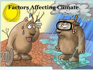
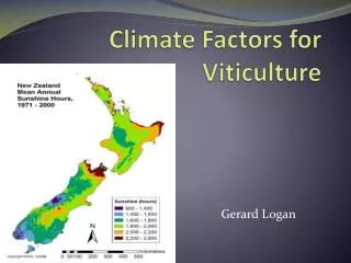
Climate Factors for Viticulture. Gerard Logan. Some Definitions. Meteorology : The branch of science that deals with the atmosphere and its phenomena, usually over short time periods .

E N D
Climate Factors for Viticulture Gerard Logan
Some Definitions Meteorology: The branch of science that deals with the atmosphere and its phenomena, usually over short time periods. Climatology: The average state of the atmosphere over extended periods of time, arbitrarily defined as 30 years.
Solar Energy as Radiation Figure 1.1 Nearly 150 million kilometers separate the sun and earth, yet solar radiation drives earth's weather.
Composition of the Earth’s Atmosphere Near the Surface • Nitrogen (N2) 78.08% • Oxygen (O2) 20.95% • Argon (Ar) 0.93% • Neon (Ne) 0.0018% • Water Vapor (H2O) up to 4% • Carbon Dioxide (CO2) 0.037%
Atmospheric Gases Nitrogen, oxygen, argon, water vapor, carbon dioxide, and most other gases are invisible. Clouds are not gas, but condensed vapor in the form of liquid droplets. Ground based smog, which is visible, contains reactants of nitrogen and ozone. Figure 1.3
Earth's Atmosphere Figure 1.2 99% of atmospheric gases, including water vapor, extend only 30 kilometer (km) above earth's surface. Most of our weather, however, occurs within the first 10 to 15 km.
Incoming Solar Radiation Figure 2.15 Solar radiation is scattered and reflected by the atmosphere, clouds, and earth's surface, creating an average albedo of 30%. Atmospheric gases and clouds absorb another 19 units, leaving 51 units of shortwave absorbed by the earth's surface.
Earth's Tilt & Atmosphere Figure 3.5 Figure 3.6 Earth's atmosphere reduces the amount of insolation striking earth's surface. Earth's atmosphere and tilt combine to explain variation in received solar radiation.
Earth's Unequal Heating Figure 3.7 Incoming solar radiation is not evenly distributed across all lines of latitude, creating a heating imbalance.
Earth's Energy Balance Earth's annual energy balance between solar insolation and terrestrial infrared radiation is achieved locally at only two lines of latitude. A global balance is maintained by excess heat from the equatorial region transferring toward the poles. Figure 3.8
Solstice & Equinox Figure 3.3 Earth's tilt of 23.5° and revolution around the sun creates seasonal solar exposure and heating patterns. A solstice tilt keeps a polar region with either 24 hours of light or darkness. A equinox tilt perfectly provides 12 hours of night and 12 hours of day for all non-polar regions.
Local Solar Changes Northern hemisphere sunrises are in the southeast during winter, but in the northeast in summer. Summer noon time sun is also higher above the horizon than the winter sun. Figure 3.10
Temperature Lags Earth's surface temperature is a balance between incoming solar radiation and outgoing terrestrial radiation. Peak temperature lags after peak insolation because earth continues to warm until infrared radiation exceeds insolation. Figure 3.14
Cold Dense Air Figure 3.17 Nighttime radiational cooling increases air density. On hill slopes, denser air settles to the valley bottom, creating a thermal belt of warmer air between lower and upper cooler air.
Controls of Temperature • Earth's air temperature is governed by length of day and intensity of insolation, which are a function of: • latitude • Additional controls are: • 2) land and water (‘continentality’) • 3) ocean currents • 4) elevation
January Isotherms Latitude determines that earth's air temperatures are warmer at the equator than at the poles, but land and water, ocean currents, and elevation create additional variations. Figure 3.21
July Global Isotherms The southern hemisphere has fewer land masses and ocean currents that encircle the globe, creating isotherms that are more regular than those in the northern hemisphere. Figure 3.22
Regional Temperatures Regional differences in temperature, from annual or daily, are influenced by geography, such as latitude, altitude, and nearby water or ocean currents, as well as heat generated in the urban area. Figure 3.24
Heating Degree Day Figure 3.25 Temperature data are analyzed to determine when living space will likely be heated (e.g. when below 65° F) and how much fuel is required for that region.
Cooling & Growing Degree Days Figure 3.26 Daily temperature data are also used to determine cooling loads for living space above 65° F, as well as growing hours for specific crops above a base temperature.
Relative Humidity Trends Figure 5.11 Relative humidity (RH) indicates air parcel proximity to saturation. Saturation can be achieved, or RH increased, by adding more water or dropping the air temperature. Dew point is the temperature at which saturation occurs.
Formation of Dew & Frost Figure 6.2 Figure 6.1 As air cools to its saturation, or dew point, vapor molecules slow down and can adhere as dew on the ground surface or as frost when air temperature drops below freezing. Daily temperature lows often occur by radiational cooling, forming dew at night or early morning.
Summary of Cloud Types Figure 6.20
Polar Orbiting Satellites Figure 6.30 Satellites can detect more than clouds, and polar orbits allow for lower altitudes and more image resolution. These satellites take multiple passes of the earth before returning to the same location.
Satellite Imaging Options Sensors on board the satellite are able to detect visible and other electromagnetic signals, such as infrared, to determine cloud heat and infer its height. Figure 6.33
Visible & Infrared Images Figure 6.32B Figure 6.32A Visible imagery captures all clouds as white, but infrared imagery can distinguish differences.
Computer Image Enhancement Infrared imagery can be evaluated and enhanced by a computer program that highlights changes in temperature and cloud types. Figure 6.33
Pressure Fluctuations Figure 9.3 Solar heating of ozone gasses in the upper atmosphere, and of water vapor in the lower atmosphere, can trigger oscillating thermal tides of sea-level pressure change.
Pressure Measurement Figure 9.6 Changes in atmospheric pressure are detected by a change in elevation of a barometric fluid or change in diameter of an aneroid cell, which indicates changing weather. Average sea level pressure is 29.92 in Hg, or 1013.25 mb. Figure 9.5
World Extremes in Air Pressure Maximum: 1083.8 mb (32.005” Hg) at Agata Lake, USSR 31 December 1968 1078.4 mb at Northway, AK USA 31 January 1989 Minimum: 870.0 mb (25.69” Hg) Typhoon Tip, eastern Pacific, 12 October 1979 883.0 mb* Hurricane Wilma w. Atlantic Oct., 2005
PGF vs. Cyclonic Winds Pressure gradient force (PGF) winds acting alone would head directly into low pressure. Surface observations of winds, such as the cyclonic flow around this low, reveal that PGF winds are deflected by other forces. Figure 9.19
Apparent Coriolis Force Figure 9.20 Earth's rotation transforms straight line motion into curved motion for an outside viewer. The Coriolis force explains this apparent curvature of winds to the right due to rotation. The magnitude of the Coriolis force depends on wind velocity and latitude. Figure 9.21
Coriolis Force Summary • Acts at right angles to the wind, only influencing direction and never speed • Deflects the wind to the right of the intended path in the Northern Hemisphere • Deflects the wind the left of the intended path in the Southern Hemisphere
Wind Speed & Pressure Contours Figure 9.24 Just as a river speeds and slows when its banks narrow and expand, geostrophic winds blowing within pressure contours speed as contour intervals narrow, and slow as contour intervals widen.
Northern & Southern Hemisphere Flow Winds blow counterclockwise around low pressure systems in the Northern Hemisphere, but clockwise around lows in the Southern Hemisphere. Figure 9.27A
Turbulence & Eddies Surface obstructions slow surface winds, which due to viscosity creates eddies of whirling winds in a much thicker layer. The vertical depth of these eddies and gusting winds thickens with surface wind velocity. Figure 10.2A
Wind and Exposed Soil Figure 10.7 Microscale winds can bounce and skip sand grains, expose desert pavement, erode ventifact patterns into rocks, and shape sand dunes with ripples revealing wind direction.
Wind & Vegetation Figure 10.11 Figure 10.10 Wind speeds increase with elevation above earth's frictional surface, where stronger winds sculpt and denude the branches of trees. Shelterbelts may protect downwind property, but may also create unwanted turbulent eddies.
Charting Prevailing Winds Figure 10.15 Figure 10.14 Winds shift in direction, noted by degrees or compass direction, and knowledge of prevailing wind directions are useful in planning. A wind rose of likely directions might be used to orient runways and smoky power plants.
Wind Instruments Figure 10.18 Figure 10.17 Wind vanes point into the wind, or toward its origin, while revolutions of a cup anemometers record wind distance and speed. Aerovanes can measure both speed and direction. Pilot balloons observed with theodolites, infrared radiometers, and lidar are other wind detection tools. Doppler radar detects changes in wind speed within large volumes of atmosphere. The vertical profile may extend 16km, and can help identify developing storms and tornadoes.
Climate Factors for Viticulture Gerard Logan
Mesoclimatic Variables • Aspect and Slope • Shaded areas, especially if South facing, remain damper with reduced temperatures, evaporation and humidity • This also affects vegetation, soil moisture which may, in turn, affect frosts and temperature variations