Download
1 / 15
150 likes | 257 Views
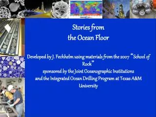
Stories from the Ocean Floor Developed by J. Fechhelm using materials form the 2007 “School of Rock” sponsored by the Joint Oceanographic Institute and the Ocean Drilling Program at TAMU.

E N D
Stories from the Ocean FloorDeveloped by J. Fechhelm using materials form the 2007 “School of Rock” sponsored by the Joint Oceanographic Institute and the Ocean Drilling Program at TAMU
The Deep Sea Drilling Project was begun in 1964 and was designed to investigate the evolution of ocean basins by core drilling of ocean sediments and underlying oceanic crust . • The data used in this activity were taken from cores collected by the drill ship “Glomar Challenger”, on a cruise in 1968. The Deep Sea Drilling Project was the first of 3 international ocean drilling programs that have continued right up to today. http://pubs.usgs.gov/gip/dynamic/glomar.html
This map shows where the 3 ocean drilling programs have drilled into the Earth’s crust. http://iodp.tamu.edu/scienceops/maps/poster/combined.html
Remember that the plates on the surface of the Earth have changed position throughout the Earth’s history. These diagrams show what the Earth looked like 80 million years ago. http://jan.ucc.nau.edu/~rcb7/Late_Cret.jpg
When scientists drill into the sea floor, the oldest sediments are at the bottom, and the newest sediments, those that are just settling to the bottom of the ocean, are at the top.
On the third trip of the Glomar Challenger (Leg 3) the crew drilled holes at 10 different sites along an oceanic ridge between Africa and South America. • What they found astonished many around the world and opened up a whole new area of scientific investigation. http://geology.wr.usgs.gov/parks/province/atlantpl.html
The numbers show the drill sites from Leg 3. The spots along A, B and C show drill sites along the Mid-Ocean Ridge.
When ocean cores are drilled, scientists can then look at the fossils of ancient organisms found in the sediments. From years of study, scientists can tell the age of sediments by looking at the fossils. Some organisms, or their fossils, are used as indicator species. This means that if those organisms are found, scientists can tell the age of the sediments, or when they were deposited on the sea floor.
There are 3 main groups of microscopic organisms that scientists use. • Nanofossils • Very tiny (0.2 to 2 microns!) • 1 micron (or micrometer)= 1 X 10 -6 or 1/1,000,000 • Often occur in massive “blooms” in the ocean – so large they can be seen in satellite pictures! http://www.biol.tsukuba.ac.jp/~inouye/ino/etc/coccolithophorids.jpg
Diatoms • 20 to 200 microns - up to the size of a grain of sand. • Also can occur in massive “blooms” in the oceans. htttp://k55.nu.edu/resources/NU/collateral/newsletterPhotos/diatoms.jpg
Foraminifera • 100 to 10000 microns. • Very important in the dating of ancient deep sea sediments. http://www.palaeos.com/Eukarya/Units/Rhizaria/Images/Foraminifera.jpg http://www.fathom.com/course/10701050/foraminifera.jpg
Now back to Leg 3 of the Glomar Challenger! • Let’s look at the actual data.
Let’s narrow our focus. Site Number Age of sediment above basement (in millions of years) 14 40 m.y. 15 24 m.y. 16 11 m.y. 17 33 m.y. 18 26 m.y. 19 49 m.y. 20 67 m.y. 21 >76 m.y.
On your map, next to each site number, write the age of the sediments. (Remember, these sediments are those at the very bottom, right above the rock.) • Answer questions 1 to 3. • Now let’s make a model of this! • And then answer analysis question 4, 5 and 6.