Download
1 / 55
550 likes | 680 Views
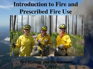
Fire Emissions from 30,000’ – Regional Haze Planning Needs and Level(s) of Effort. Tom Moore & Lee Alter Fire Emissions Joint Forum Meeting Tucson, AZ – December 10, 2003. Fire Emissions from 30,000’. 4 subject areas today - Intercontinental Transport

E N D
Fire Emissions from 30,000’ – Regional Haze Planning Needs and Level(s) of Effort Tom Moore & Lee Alter Fire Emissions Joint Forum Meeting Tucson, AZ – December 10, 2003
Fire Emissions from 30,000’ 4 subject areas today - • Intercontinental Transport • Historic Patterns: Fire Activity Data for Rx, Ag, & Wx • Existing WRAP FEJF Emissions Inventory Methods • Reasonable Progress Demonstration Needs – Approaches & Ideas
Intercontinental Transport JOURNAL OF GEOPHYSICAL RESEARCH, VOL. 107, NO. D24 Asian aerosols in North America: Frequency and concentration of fine dust Richard A. VanCuren Research Division, California Air Resources Board, Sacramento, California, USA Thomas A. Cahill DELTA Group, Department of Applied Science, University of California, Davis, California, USA Received 14 February 2002; revised 27 April 2002; accepted 2 June 2002; published 28 December 2002. http://wrapair.org/forums/dejf/documents/2002JD002204.pdf
Intercontinental Transport http://www.epa.gov/air/airtrends/asian_dust4.pdf
Intercontinental Transport http://www.awma.org/em/pdfs/2003/12/wilcox.pdf
Historic Patterns:Fire Activity Data for Rx & Wx National Interagency Fire Center website http://www.nifc.gov/news/sitreprt.pdf
Historic Patterns:Fire Activity Data for Rx & Wx Total Fires and Acres Reported to NIFC as of December 30, 1999
Historic Patterns:Fire Activity Data for Rx & Wx Prescribed Fires and Acres Reported to NIFC as of December 30, 1999
Emission Inventories for Wildfire, Prescribed Fire & Agricultural Burning Prepared for the Fire Emissions Joint Forum of the Western Regional Air Partnership June 7, 2002 – Denver, CO Prepared by Air Sciences Inc.
WF & Rx: Actual activity data (acres or fuel burned) Calculate emissions. Plume characteristics Rx: Predictive model (1995 FEP) provides 50km emissions Ag: Typical activity data (residue burned per crop per county); calculate emissions. Refine the data Realistic fire sizes Temporally Spatially Plume characteristics Existing WRAP FEJF Emissions Inventory Methods1996 Inventories 2018 Projections Accurate? Can quantify uncertainty. Reasonable? Representative?
Wildfire Activity data collected by ETT from ICS-209 (and others) Prescribed Fire Collected by ETT from state sources augmented by 1202 for DOI (and others) Existing WRAP FEJF Emissions Inventory Methods 1996 Wildfire and Rx Fire – Activity Data Based on ACTUAL acres burned data
Reasonable Progress Demonstration Needs – Approaches & Ideas
Reasonable Progress Demonstration Needs – Approaches & Ideas
Reasonable Progress Demonstration Needs – Approaches & Ideas
Carbon Dating at Yosemite • Lower bound on anthro • Upper bound on biomass burning • Data from abnormally high OC days
http://www.fs.fed.us/rm/ogden/maps/map_products.html Interior West Forest Inventory & Analysis-- Map Products -- We are currently developing spatially explicit map products of several forest attributes for ecoregions in the Interior West. The maps are generated by modelling forest inventory variables as functions of satellite data along with digital topographic and geographic data. Reasonable Progress Demonstration Needs – Approaches & Ideas
Reasonable Progress Demonstration Needs – Approaches & Ideas (http://erg.usgs.gov/isb/pubs/factsheets/fs10800.pdf) Data Classification System Key 11 Open Water 12 Perennial Ice/Snow 21 Low-Intensity Residential 22 High-Intensity Residential 23 Commercial/Industrial/Transportation 31 Bare Rock/Sand/Clay 32 Quarries/Strip Mines/Gravel Pits 33 Transitional 41 Deciduous Forest 42 Evergreen Forest 43 Mixed Forest 51 Shrubland 61 Orchards/Vineyards/Other 71 Grasslands/Herbaceous 81 Pasture/Hay 82 Row Crops 83 Small Grains 84 Fallow 85 Urban/Recreational Grasses 91 Woody Wetlands 92 Emergent Herbaceous Wetlands