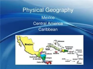
RUSSIAN PHYSICAL GEOGRAPHY
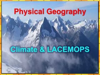
RUSSIAN PHYSICAL GEOGRAPHY. Climate Although Russia has almost every climate region it is mostly Subarctic and Humid Continental. WHY IS IT SO COLD?. Tundra – permafrost grasslands with scattered shrubs in the north Taiga – dense evergreen forest Ideal for Russian lumber industry


RUSSIAN PHYSICAL GEOGRAPHY
E N D
Presentation Transcript
Climate Although Russia has almost every climate region it is mostly Subarctic and Humid Continental WHY IS IT SO COLD?
Tundra – permafrost grasslands with scattered shrubs in the north • Taiga – dense evergreen forest • Ideal for Russian lumber industry • Chernozem – means “black earth” steppe-grassland region • Southern Russia • Ideal for agriculture Tundra Taiga Vegetation Chernozem
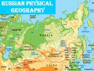
“Transcontinental countries” touch two or more continents • Countries that touch both European and Asian continents are called Eurasia • Ural Mountains is the primary boundary of the two continents EUROPE RUSSIAN PHYSICAL GEOGRAPHY ASIA Beyond the Ural Mountains there are 9 other landforms that separate Europe from Asia, how many can you guess?
Ural Mountains • Ural River • Caspian Sea • Caucasus Mt. (origin of the word Caucasian) • Black Sea • Bosporus Strait • Marmara Sea (smallest sea) • Dardanelles Strait • Aegean Sea • Mediterranean HOW MANY COUNTRIES ARE EURASIAN?
ASIA There are 5 countries that make up Eurasia, what are they? Russia Kazakhstan Azerbaijan Georgia Turkey EUROPE
Russia’s Southern Boundary Black sea, Caucasus Mountains, Caspian Sea, Kazakhstan, Mongolia and China
Caspian Sea is Russia’s largest lake • Caspian is a Sea due to its size and salt content, however, by definition a lake is a landlocked body of water • It is about the same size as California • Caspian Sea contain large amounts of oil RUSSIAN LAKES
Largest fresh water lake in the world in volume. Second only to the Caspian Sea in size (in Russia). • 5370 feet deep (almost the elevation of the Appalachian Mountains) • Contains 20% of all the worlds fresh water • 1,085 species of plants and 1,550 species and varieties of animals – many are found only here. • Scientist believe there are still many species left to find, but water is too dark and deep to explore LAKE BAIKAL
ARAL SEA Shrinking Aral Sea • Aral Sea is also a lake • Aral Sea is shrinking – WHY • Environmental and climatic changes • Diversion of water from the Syr Darya and Amu Darya rivers • Poor management of resources has damaged the region’s environment
Largest River in Russia • Of Russia’s 20 largest cities, 11 are located on the Volga (Including Moscow) Nearly 75% of Russia’s population lives in Europe VOLGA RIVER
Means “STEPPING LAND” • All land located east of the Ural Mountains • No warm ocean currents reach Russia • Many resources; timber, oil (Ob River), and coal mining SIBERIA
TWO REGIONS • West Siberian Plain – is flat frozen tundra and woodlands • Central Siberian Plateau – located in mid-Asia (high flat peaks) SIBERIA
Wooly Mammoths Siberian Arctic Fox Siberian Tiger 480 bear paws from pelt trafficking
Separates the United States from Russia • Only 53 miles wide BERING STRAIT