Download
1 / 47
470 likes | 591 Views
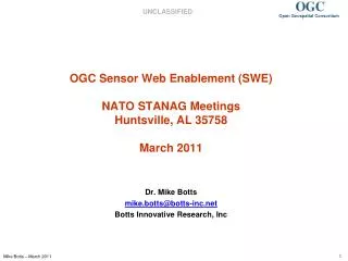
OGC Sensor Web Enablement ( SWE ) NATO STANAG Meetings Huntsville, AL 35758 March 2011. Dr. Mike Botts mike.botts@botts- inc.net Botts Innovative Research, Inc. What is SWE?. SWE is technology to enable the realization of Sensor Webs much like TCP/IP, HTML, and HTTPD enabled the WWW

E N D
OGC Sensor Web Enablement (SWE)NATO STANAG MeetingsHuntsville, AL 35758March 2011 Dr. Mike Botts mike.botts@botts-inc.net Botts Innovative Research, Inc
What is SWE? • SWE is technology to enable the realization of Sensor Webs • much like TCP/IP, HTML, and HTTPD enabled the WWW • SWE is a suite of standards from OGC (Open Geospatial Consortium) • 3 standard XML encodings (SensorML, O&M, SWE Common) • 4 standard web service interfaces (SOS, SAS, SPS, WNS) • SWE is a Service Oriented Architecture (SOA) approach • SWE is an open, consensus-based set of standards
Why SWE? • Break down current stovepipes • Enable interoperability not only within communities but between traditionally disparate communities • different sensor types: in-situ vs remote sensors, video, models, CBRNE • different disciplines: science, defense, intelligence, emergency management, utilities, etc. • different sciences: ocean, atmosphere, land, bio, target recognition, signal processing, etc. • different agencies: government, commercial, private, Joe Public • Leverage benefits of open standards • competitive tool development • more abundant data sources • utilize efforts funded by others • Backed by the Open Geospatial Consortium process • 380+ members cooperating in consensus process • Interoperability Process testing • CITE compliance testing
What are the benefits of SWE? • Sensor system agnostic - Virtually any sensor or modeling system can be supported • Net-Centric, SOA-based • Distributed architecture allows independent development of services but enables on-the-fly connectivity between resources • Semantically tied • Relies on online dictionaries and ontologies for semantics • Key to interoperability • Traceability • observation lineage • quality of measurement support • Implementation flexibility • wrap existing capabilities and sensors • implement services and processing where it makes sense (e.g. near sensors, closer to user, or in-between) • scalable from single, simple sensor to large sensor collections
Basic Vision • Quicklydiscover sensors and sensor data (secure or public) that can meet my needs – based on location, observables, quality, ability to task, etc. • Obtain sensor information in a standard encoding that is understandable by my software and enables assessment and processing without a-priori knowledge • Readily access sensor observations in a common manner, and in a form specific to my needs • Task sensors, when possible, to meet my specific needs • Subscribe to and receive alerts when a sensor measures a particular phenomenon
SWE Standards • Information Models and Schema • SWE Common Data – common data models used throughout SWE specs • Sensor Model Language (SensorML) for In-situ and Remote Sensors - Core models and schema for observation processes: support for sensor components and systems, geolocation, response models, post measurement processing • Observations and Measurements (O&M) – Core models and schema for observations; archived and streaming • Web Services • Sensor Observation Service - Access Observations for a sensor or sensor constellation, and optionally, the associated sensor and platform data • Sensor Alert Service – Subscribe to alerts based upon sensor observations • Sensor Planning Service – Request collection feasibility and task sensor system for desired observations • Web Notification Service – Manage message dialogue between client and Web service(s) for long duration (asynchronous) processes • Registries for Sensors – Discover sensors and sensor observations
Why is SensorML Important? • Discovery of sensors and processes / plug-n-play sensors – SensorML is the means by which sensors and processes make themselves and their capabilities known; describes inputs, outputs and taskable parameters • Observation lineage – SensorML provides history of measurement and processing of observations; supports quality knowledge of observations • On-demand processing – SensorML supports on-demand derivation of higher-level information (e.g. geolocation or products) without a priori knowledge of the sensor system • Intelligent, autonomous sensor network – SensorML enables the development of taskable, adaptable sensor networks, and enables higher-level problem solving anticipated from the Semantic Web
Current Status • Current standards • SensorML – 1.0.1 approved in 2007 (V2.0 anticipated by July 2011) • SWE Common Data – V2.0 approved • SWE Common Services – V2.0 approved • Observations & Measurement – V2.0 approved • WNS – Request for Comments • SOS – V2.0 in final stages • SPS – V2.0 approved • SAS – being folded into SOS (with SOAP WS-N and Pub/Sub) • TML – no traction; looking to deprecate • Approved SWE standards can be downloaded: • Specification Documents: http://www.opengeospatial.org/standards • Specification Schema: http://schemas.opengis.net/
What Does v2.0 Bring • SWE standards are more precise and testable • Conformance classes allow for partial uptake and implementation • More consistent use of SWE Common Data and SWE Common Services throughout SWE standards • Added support in SWE Common Data for disparate messages, nil values, extensions (e.g. security tagging, UncertML), and required tagging to semantic definitions • Better support for data streaming • SOAP implementation supporting security and web notification
Demo: Radiation Attack on NY • OWS4 Demonstration Project (Fall 2006) • Purpose of Demo: illustrate discovery, access to and fusing of disparate sensors • Client: UAH Space Time Toolkit • Services: • SOS – in-situ radiation sensors • SOS – Doppler Radar • SOS – Lagrangian plume model • WCS – GOES weather satellite • SensorML – discovery and on-demand processing • WMS – Ortho Imagery • Google Earth – base maps • See all OWS4 demos (interactive) • Download this demo (AVI: 93MB):
On Demand Geolocation of Satellite Data • NASA • Purpose of Demo: illustrate access to satellite observations and on-demand geolocation • Client: UAH Space Time Toolkit • Services: • SOS – satellite footprints (UAH) • SOS – aircraft observations (NASA) • SOS – satellite observations (UAH) • SensorML – on-demand processing (UAH) • Virtual Earth – base maps • Download this demo
Using SensorML for Processing SensorML processes can be executed in a client SensorML processes can also be executed in a service, an agent, or in a sensor system
SensorML Using SensorML for On-demand Geolocation inCommunity Sensor Model (CSM) DLL Tigershark CSM compliant DLL NITF JP2 SensorML Process Chain SET Tigershark video frame and SensorML-encoded sensor model provided in NITF file. The SensorML process execution engine has been wrapped inside a CSM-compliant DLL. Within a SET, the SensorML-enabled CSM DLL is able to retrieve process chain from NITF and execute the process chain providing on-demand geolocation (completion and testing in progress).
Application: Tigershark UAV-HD Video • Empire Challenge 2008 • Purpose of Demo: illustrate on-demand geolocation and display of HD video from Tigershark UAV • Client: UAH Space Time Toolkit • Services: • SOS – Tigershark video and navigation (ERDAS) • SOS – Troop Movement (Northrop Grumman) • SensorML – On-demand processing (Botts Innovative Research, Inc.) • Virtual Earth – base maps • View this demo • Part 1 • Part 2
Application: NASA/NWS Forecast Model • NASA assimilation of AIRS satellite data into weather forecast model • Purpose of Demo: illustrate the refinement of regional forecast models based on SensorML and SWE services • Client: Web-based client (NASA) • Services: • SOS – NAM forecast model • SOS – phenomenon miner(NASA) • SAS – phenomenon miner (NASA) • SOS – AIRS satellite observations (UAH) • SOS – footprint intersections (UAH) • SensorML – On-demand processing (UAH) • Download this demo
Application: SPOT Image • SPOT SPS and JPIP server • Purpose of Demo: illustrate dynamic query of SPS; show on-demand geolocation of JPIP stream using SensorML • Client: • UAH Space Time Toolkit • Services: • SPS – satellite imagery feasibility [archived or future] (SPOT) • WCS/JPIP server – streaming J2K image with CSM parameters encoded in SensorML (SPOT) • SensorML – On-demand geolocation (UAH) • Virtual Earth – base maps • Download this demo (AVI-divx:16MB) • View this demo
Demo: Real-time Video streaming • UAH Dual Web-based Sky Cameras • Purpose of Demo: demonstrate streaming of binary video with navigation data; on-demand geolocation using SensorML • Client: • 52 North Video Test Client • UAH Space Time Toolkit • Services: • SOS – video and gimbal settings (UAH, 52 North) • SPS – Video camera control (52 North, UAH) • SensorML – On-demand processing (UAH) • Virtual Earth – base maps • View this demo
DLR: Tsunami Early Warning & Mitigation Center Systems Seismic Monitoring GPS Tide Gauges Ocean Bottom Units Buoys EO Data Observations Simulation BMG 5in1 / 6in1 System Geospatial Data Repository Risk- & Vulnerability Modelling
Charlie Neuman, San Diego Union-Tribune/Zuma Press PULSENetTM Applications: Atmospheric/Air Quality – Fire Monitoring/Smoke Forecasting
SAIC Global SensorWeb • Defense/Intelligence implementation of OGC SWE standards • SWE support for UGS and other ISR sensors • Prominent participant in Empire Challenge since 2005
INSPIRE • Major EU Activity standardizing Geospatial data (with legislative backing) • SWE is a part of this
Example Potential Applications within STANAG • Precise geolocation • CSM API, encoding of ISO 19130 sensor models, and on-demand geolocation within any SensorML process execution engine • Large Volume Streaming Data (LSVD) and tasking of video systems • Ground Motion Tracking Indicators (GMTI) • UGS and MASINT assets (e.g. SAIC’s Global SensorWeb implementation of SWE) • On-board web services for high-volume sensor systems (e.g. video, WAS, high-volume imagery) • General discovery of sensor and actuator assets including dynamic systems • Fusion of disparate sensor observations and cross-queing of MULTI-INT assets
Large Volume Streaming Data (LVSD) • Wish to treat panning and zooming within Wide Area Sensor mosaics as if one is tasking a Pan-Tilt-Zoom camera • Has been considering OGC Sensor Planning Service (SPS) and ONVIF as two potential standards • Originally leaning toward ONVIF • Now seems to be leaning toward SPS v2.0 • Would be creating an SPS profile for tasking PTZ motion-imagery systems, similar to the profile created by the European Space Agency for tasking satellite systems
Proposed Applications to GMTI -1- • Provide lineage (“history”) of target reports using SensorML • Target reports could reference SensorML-encoded process chains showing full lineage of an individual track or dwell observation • Could include tasking description, sensors and platform, processing, and QC/QA tests applied (as well as human-in-the-loop steps) • Reference to lineage could be through either: • Unique ID – XML accessible from registry or sensor system services • Online address to XML • Inline the report
Proposed Applications to GMTI -2- • Use SensorML and SWE tracking service to discover other relevant sensors • Enable discovery of other sensors in the area that might provide additional information for target recognition or verification • SensorML provides complete information about sensor’s capabilities and limits • Use of SWE services with SensorML enables a common interface for tasking disparate sensors and receiving observations and alerts
Proposed Applications to GMTI -3- • Use SensorML and SWE Common as efficient standard means of supporting both ASCII and binary data • SensorML/SWE Common provides robust descriptions of the possible output messages (archived or real-time streaming) • SWE Common provides the ability to encode in binary or ASCII, and to provide a complete description for machine readability • Use of SWE Common could provide a single format, combining the GMTI binary format and the GMTI XML • Current message structures could be supported
Proposed Applications to GMTI -4- • Use SensorML to enable configurable on-demand processing • SensorML provides an execution-engine agnostic means of defining processes and algorithms • SensorML processes can be discovered, downloaded, and executed in real-time • SensorML processes can be executed in the client (exploitation tool or on soldier’s arm), at a web service, in a data center, or at the sensor system
Potential Benefits to NATO • Begin to break down stove-pipe systems • Provide consistency and interoperability between disparate sensors and communities • Can begin to be built without breaking or disrupting current systems • Can leverage on work already done • Can simply wrap existing functionality • Can utilize existing ontologies, vocabularies, and models • SWE or something like it is essential to begin to achieve sensor fusion, cross-queing, and workflows involving multiple disparate sensor systems
Conclusions • SWE has been tested and has proven itself • Useful, flexible, efficient, extensible • Simple to add to both new and existing legacy systems • Enables paradigm shifts in access and processing of observations • SWE is getting buy-in from various sensor communities • Commitments from larger communities provide the inertia to realize the full benefits • Commitments from smaller grassroots communities provide additional data and tools from the public and industry sectors • With a few exceptions, sensor vendors will contribute directly to Sensor Web only after user community commitment (or due to big government demands) • SWE open to improvements by the user communities • Tools are being developed to support SWE • Tools will ease buy-in • Tools will assist in realizing the full benefits of SWE • SWE v2.0 provides significant improvements and capabilities
Further References • Wikipedia - http://en.wikipedia.org/wiki/SensorML • Sensor Web Enablement - http://www.ogcnetwork.net/SWE • Sensor Model Language - http://www.opengeospatial.org/standards/sensorml • SensorML - http://www.ogcnetwork.net/SensorML • Botts Innovative Research, Inc - http://www.botts-inc.net • Space Time Toolkit - code • SensorML "PrettyView" - service, code • SensorML Schema Browser - service • SensorML Process Execution Engine - code • SensorML Process Library - code • SensorML Editor - code • SWE Common Data Parser/Writer - code
Sensor Web Vision -1- • Sensors will be web accessible • Sensors and sensor data will be discoverable • Sensors will be self-describing to humans and software (using a standard encoding) • Most sensor observations will be easily accessible in real time over the web
Sensor Web Vision -2- • Standardized web services will exist for accessing sensor information and sensor observations • Sensor systems will be capable of real-time mining of observations to find phenomena of immediate interest • Sensor systems will be capable of issuing alerts based on observations, as well as be able to respond to alerts issued by other sensors
Sensor Web Vision -3- • Software will be capable of on-demand geolocation and processing of observations from a newly-discovered sensor without a priori knowledge of that sensor system • Sensors, simulations, and models will be capable of being configured and tasked through standard, common web interfaces • Sensors and sensor nets will be able to act on their own (i.e. be autonomous)
History -1- • OGC Web Services • Testbed 1.2: • Sponsors: EPA, General Dynamics, NASA, NIMA • Specs: SOS, O&M, SensorML, SPS, WNS • Demo: Terrorist, Hazardous Spill and Tornado • Sensors: weather stations, wind profiler, video, UAV, stream gauges • OGC Web Services • Testbed 1.1: • Sponsors: EPA, NASA, NIMA • Specs: SensorML, SOS, O&M • Demo: NYC Terrorism • Sensors: weather stations, water quality • Specs advanced through independent R&D efforts in Germany, Australia, Canada and US • SWE WG established • Specs: SOS, O&M, SensorML, SPS, WNS, SAS SensorML initiated at University of Alabama in Huntsville: NASA AIST funding 1999 - 2000 2001 2002 2003-2004
History -2- • OGC Web Services • Testbed 3.0: • Sponsors: NGA, ORNL, LMCO, BAE • Specs: SOS, O&M, SensorML, SPS, TML • Demo: Forest Fire in Western US • Sensors: weather stations, wind profiler, video, UAV, satellite • SAS Interoperabilty Experiment • OGC Web Services Testbed 4.0: • Sponsors: NGA, NASA, ORNL, LMCO • Specs: SOS, O&M, SensorML, SPS, TML, SAS • Demo: Radiation, Emergency Hospital • Sensors: weather stations, wind profiler, video, UAV, satellite • OGC Web Services • Testbed 5.1 • Sponsors: NGA, NASA, • Specs: SOS, SensorML, WPS • Demo: Streaming JPIP of Georeferenceable Imagery; Geoprocess Workflow • Sensors: Satellite and airborne imagery • EC07: in-situ sensors, video SWE Specifications approved: SensorML – V1.0.1 TML – V1.0 SOS – V1.0 SPS – V1.0 O&M – V1.0 SAS – V0.0 WNS – Best Practices 2006 2005 2007
Incorporation of SWE into Space Time Toolkit Space Time Toolkit has been retooled to be SensorML process chain executor + SLD stylers
A SWE Portrayal Service can “render” to various graphics standards SWE Portrayal Service SLD SensorML KML Collada SOS Google Earth Client Stylers For example, a SWE portrayal service can utilize a SensorML front-end and a Styler back-end to generate graphics content (e.g. KML or Collada) However, it’s important that the data content standards (e.g. SWE) exist to support the graphical exploration and “drill-down” exploitation !
SWE to Google Earth (KML – Collada) AMSR-E SSM/I MAS TMI LIS
GEOSS SENSOR WEB WORKSHOP May 15/16, 2008. Geneva, Switzerland 40+ participants 17 nations 4 continents Sensor Web: Foundation Layer of GEOSS