Download
1 / 17
170 likes | 352 Views
Topography and Bathymetry in Alaska. Kirk Waters Alaska Wave Climatologies Workshop. CSC Topography and Bathymetry Efforts. CSC Topography and Bathymetry Efforts. ** Existing LiDAR beach coverage (blue) enlarged for visualization. JALBTCX Data On-line. Spring 2004. Fall 2004.

E N D
Topography and Bathymetry in Alaska Kirk Waters Alaska Wave Climatologies Workshop
CSC Topography and Bathymetry Efforts CSC Topography and Bathymetry Efforts ** Existing LiDAR beach coverage (blue) enlarged for visualization
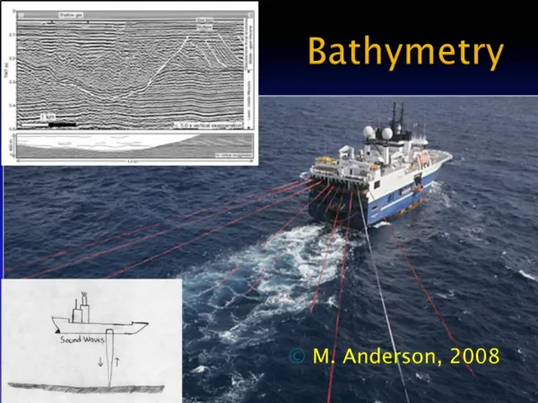
JALBTCX Data On-line Spring 2004 Fall 2004 500 meters landward topography 1000 meters seaward bathymetry Plan to cover CONUS oceanfront where there is sand.
Lidar Topography in Shishmaref and Kivalina • Data collected by Aerometric via NOAA/NGS contract • July and August 2004 • Multiple collections done. Some two-meter resolution, some one-meter resolution. • Classified for bare earth. • Will be available on-line • Approximately 750 million points
NOS Alaska Hydro Surveys NGDC holdings
T-sheet zoom What else should we vectorize? Tundra
Cape Edgecumbe: Lidar Topo/Bathy NGS Data Fusion study Image credit: Jon Swallow
Experiment Objectives • Collect Topographic and Bathymetric information safely and at same temporal scale • Provide NOAA Ship Rainier with shoreline and near shore hydrographic data within days of acquisition • Test a new concept of survey operations
Topo LIDAR Bathy LIDAR Topo/Bathy LIDAR Merged with NOAA Chart
Hydrographic Soundings (fathoms) Topographic Elevations (feet)
Summary • The Coastal Services Center has coastal topography available for most of CONUS. • The shoreline for Alaska has been vectorized from T-sheets where they exist. • More information might be obtainable from the T-sheets if we can determine what is needed. • Limited high-resolution topography exists, but there is data for Shishmaref and Kivalina • Combining technologies can provide a seamless elevation dataset across the land-water interface.