Download
1 / 30
300 likes | 531 Views
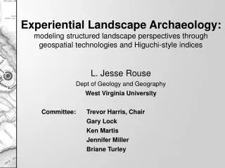
L. Jesse Rouse Dept of Geology and Geography West Virginia University Committee: Trevor Harris, Chair Gary Lock Ken Martis Jennifer Miller Briane Turley.

E N D
L. Jesse Rouse Dept of Geology and Geography West Virginia University Committee: Trevor Harris, Chair Gary Lock Ken Martis Jennifer Miller Briane Turley Experiential Landscape Archaeology:modeling structured landscape perspectives through geospatial technologies and Higuchi-style indices
Directions and ideas • Space to place • Phenomenology • GIS exogenous • Experience • Higuchi (Harris, LaKose and Rouse, 2005) • Formalizing the structure of experience 2
Landscape Archaeology • Cultural Landscapes • Landscape studies/histories • Landscape Archaeology in the UK • Spatial Science and Positivist Archaeology • Post-positivist backlash • GIS and Landscape Archaeology • Phenomenology 3
Tilley’s Experience of Landscape • Tilley (1994) • Phenomenology of Landscape • link between the individual and the landscape • Based on the Phenomenology of Heidegger • Filtered through Tuan • Personal, visual perspective of the landscape 4
Evolution of phenomenology • Critique of phenomenology in LA • Difficult to capture personal experience • Lack of replicability • Individualistic • Phenomenological approaches • Husserl - lebensweldt or “lifeworld” • Heiddeger - dasein or “being in the world” • Merleau-Ponty • Tilley (2004) The Materiality of Stone 5
Geospatial Technologies • Spatial Science • GIS and Archaeology • 1990s • Mapping, recording, predictive modeling • Geographic Information Science • GIS informed by theory • Social critique • Integrating new types of data and representation 6
Sensual GIS • Gillings and Goodrick (1996) looked at moving GIS beyond the flat 2D map • Make the experience interactive • Take full advantage of the senses • Sight, sound, touch, and smell • Primarily based on the representation of information • Visual can play an important role in modeling 7
Holistic landscape assessment based on human physiology and psycho-physical approach how people perceive and view landscapes viewshed elements based on human physiology and landscape aesthetics Tadahiko Higuchi Optimum Angle of elevation Optimum Angle of depression 8
Traditional line-of-sight viewshed analysis 0-2m 2-5m 15-150m 150-1km >1km 20% 40% 10% 10% 20% Time spent on viewing distances Hull and Stewart (1995) 9
Nine indices: Line of sight Depth of invisibility Distance zones Angle of incidence Angle of depression Angle of Elevation Light Depth and texture gradient Temporal Composite index Hi - Higuchi Indices Higuchi, 1986 10
Example Higuchi analysis • Laura LaKose, 2004 • Utilized ideas from Higuchi to consider the landscape architecture of a rural area in WV • Focus is on the impact of an existing power plant on the landscape • Modeled Higuchi indices using COTS software 11
GAP LULC 30-meter Landsat - 26 categories SSURGO GIS model vegetation 10m DEM
Intervisibility Depth and Texture Short Distance Viewshed Light analysis Mid- Distance Viewshed Depth of invisibility Long Distance Viewshed Angle of depression
Composite Analysis Reds – poor viewshed qualities Beige – viewshed quality Green – good to exceptional landscape quality
Converging ideas • Phenomenological approach to landscape archaeology • GIS and landscape archaelogy • Physical and physiological perspective captured through Higuchi indices • Linking ideas and information in order to consider prehistoric cultural landscapes 15
Dissertation Goal • To develop a structured experiential and phenomenological approach to prehistoric landscapes through the linkage of Higuchi and archaeological indices utilizing geospatial technologies. 16
Objective 1 • Review the literature on: • existing ideologies and methodologies used to explore landscape archaeology • geospatial technologies in archaeology, especially at the landscape scale • phenomenology in archaeology, and • Higuchi viewsheds. 17
Objective 2 • Develop the conceptual model to link phenomenology, geospatial technologies and landscape archaeology: • Adapt, amend, and add to Higuchi’s nine viewshed indices to create an archaeological model to support a structured experiential approach to prehistoric landscapes • Insert archaeological specific indices based on taskscapes, resourcescapes, and symbology, and • tie phenomenological research to the spatial frameworks of Geography and landscape archaeology. 18
Objective 3 • Develop GIS-supported Higuchi-based indices to study prehistoric landscapes by: • embedding existing Higuchi indices within GIS to take advantage of geospatial technologies • establishing archaeological indices that blends spatial assessment with interpretations of prehistoric life experience, and • coupling the GIS model results with personal and expert experience to interpret a given landscape that links egocentric and geocentric landscape perspectives. 19
Objective 4 • Implement the developed indices through a case study based on an archaeological landscape by: • Utilizing archaeological and physiologically derived information • Conducting field visit(s) to test the ‘fit’ of the model obtained through implementing the indices in a GIS, and • Assessing how quantitative indices differ from expert/personal experience. 20
Objective 5 • Evaluate the use of structured indices to support an experiential landscape archaeology to: • understand the role and importance of visual and experiential forms of interpretation based on insights gained from case studies, • determine how well the indices support a phenomenological approach to understanding past cultural landscapes, • determine future research avenues for structured indices in prehistoric archaeological landscape analysis. 21
Methods • Build on cognitive, physiological and physical landscape • Generalize visual landscape qualities • GIS data analysis • Dynamic factors - plumes, clouds, mist, smoke • Link Higuchi to phenomenological approach • A structured landscape analysis 22
Ha - archaeology indices • Resourcescapes (Trufkovic, ND) • Taskscapes (Ingold, 1993) • Sustenance • Shelter • Community • Travel/movement • Sacred space 23
Hai – enhanced indices • Blend human physiology and culture to better understand human interaction with landscape • Viewshed • Perception • Biological necessity • Cultural interaction • Cosmology 24
Index perspectives • Egocentric perspective (Hi) • Based on the experience of now • Takes into account memory to support the interpretation of current location • Personal perspective • Requires a personal experience of the current location only • Geocentric perspective (Ha) • Based on memory/knowledge • Builds beyond current location by utilizing knowledge of area beyond current view to link view with the larger landscape • Model perspective • Requires a personal experience of the location and an understanding beyond the current view • Hai 25
Existing attempts have focused on the egocentric Building a shared experience of the landscape Structured approach Phenomenology, Higucghi, and GIS 26
Hai – proposed indices • Line of sight • Depth of invisibility • Distance zones • Angle of incidence, depression, and elevation • Light • Depth and texture gradient • Distance to water • Food acquisition • Material acquisition • Natural shelter 27
Expected findings • Build on existing attempts to integrate Higuchi into a GIS environment • Adapt Higuchi indexes and build additional indexes to better capture cultural landscapes • Merger of phenomenological experiences of landscape with structured indices and GIS 30
Timeline • One year project duration • Dec – Feb • Literature review and data acquisition • Feb – March • Create detailed indices and plan field visits • March – July • Field visits and data capture • Jan – Nov • Chapters as relevant work is completed • Revisions and editing as necessary 31