Download
1 / 37
370 likes | 550 Views
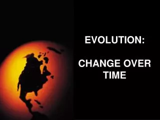
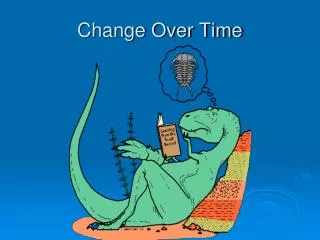
Change Over Time. Lesson on Earth’s Landforms. llhammon. The Forces. Natural Forces from inside the Earth Process: Tectonic Activity. Natural Forces on the surface of the Earth. Process: Weathering. Process: Erosion. Process: Ice (and gravity). Process: Wind (deposition).

E N D
Change Over Time Lesson on Earth’s Landforms llhammon
The Forces Natural Forces from inside the Earth Process: Tectonic Activity Natural Forces on the surface of the Earth Process: Weathering Process: Erosion Process: Ice (and gravity) Process: Wind (deposition) Process: Water (deposition)
Weatheringis the chemical and physical processes that change the characteristics of rocks on the Earth’s surface. It is also known (AKA) as the preparation for erosion. In order for weathering to occur, the environment of a rock sample must change and the rock needs to be exposed to some form of water and the air. Human processes such as pollution, which can be a large factor in acid rain, along with the acts of other living organisms, can cause chemical weathering to occur at faster rates.
Weathering - the various mechanical and chemical processes that cause exposed rock to decompose; or the erosion or breakdown of rock into smaller fragments by natural physical agents with no chemicals involved; also called Desintigration.
Soil Horizons It is C horizon (parent material and rock) where the weathering can occur. USGS
In your geographic dictionary write the definition and sketch for each landform. For the sentence section use the example provided. The definition is in BLACK. The cause is in RED. The example is in YELLOW.
Strait – where 2 landmasses almost meet- tectonic activity (not Atlas!) Strait of Gibraltar Between the continents of Europe and Africa Photo - NASA
Peninsula - a landmass surrounded by water on 3 sides– Florida at night - USA Photo - NASA
NGS Volcano-Erosion – wind– Devil’s Tower, Wyoming - USA
Folded mountains – tectonic activity – Appalachians – East coast United States NGS
Rift –a section of the Earth that has opened– tectonic activity – Great Rift Valley – Eastern coast of African continent NGS
Canyon – a deep narrow depression in the Earth’s surface, aka, gorge-Erosion – water – Grand Canyon - USA http://www.youtube.com/watch?v=VpEIUSWFdbY Lava fall video 3 minutes
NGS Dome mountain - wind /originally tectonic activity – Uluru (Ayers Rock) Outback of Australia http://www.youtube.com/watch?v=h7wdeJ7m1rM
Dome Mountain (tectonic activity) – Enchanted Rock – near Fredericksburg, Texas
Island a landmass surrounded by water on all sides– Volcanic –Tectonic Activity – Large Island of Hawaii – KONA USA http://www.youtube.com/watch?v=6J6X9PsAR5w Kilauea eruption 3 minutes NASA
Glacier -body of ice that forms where the accumulation of snow exceeds its a(melting capacity) over many years– ice/gravity-Patagonia • NASA
Fault-where 2 tectonic plates (tectonic activity) Andes Mountains South America Andes NASA
Butte –isolated hill with steep sides aka (mesa) Erosion – wind - Monument Valley – Utah, USA NGS
Delta – where a river empties into theocean-Deposition – water – Mississippi River Delta – Louisiana - USA NASA
Nile River Delta- Deposition – water – Nile River Delta – Egypt - Africa NASA
River- a natural water source that flows towards the ocean - Water – Amazon River, Brazil – South America NASA
Gulf -a deep inlet of the sea almost surrounded by land, with a narrow mouth.– Gulf of Mexico – Western Hemisphere Rand McNally
Atoll –A ring-shaped reef, island, or chain of islands formed of coral-originally tectonic –volcanic island that sinks. • Atafu Atoll-Tokelau Islands S. Pacific NASA http://www.youtube.com/watch?v=FGKUCPyzTYM Aerial shot of the Blue hole in Belize, show only 2 minutes
Isthmus -a narrow strip of land with sea on either side, forming a link between two larger areas of land – Gulf of Tehuantepec - Mexico NASA
Peninsula -piece of land almost surrounded by water or projecting out into a body of water.– Iberian - Europe NASA
Fjord - a long, narrow, deep inlet of the sea between high cliffs- Erosion - Glacial movement (ice)-Norway fjords http://www.youtube.com/watch?v=3Cs-zZ0Qu5Y NGS http://www.youtube.com/watch?v=AImP8CvPjd8 Live fjord flying
Fault-block Mountains – Tectonic Activity Sierra Nevada - California
(V shaped valley ) Erosion –water- Formed by river Cirque, Oregon
Bay –a broad inlet of the sea where the land curves inward Chesapeake Bay – East coast United States NASA
Glacier -Erosion – ice Tierra del Fuego, Chile NGS
NASA Glacial movement – Ice -Great Lakes - USA
Plateau-An area of fairly level high ground-Erosion (wind) - Colorado Plateau - USA
Barrier Island -a long narrow sandy island (wider than a reef) running parallel to the shoreDeposition – water- South Padre Island NASA
U-shaped valley- carved by a glacial erosion, Little Cottonwood Canyon, Wasatch Mountains, Utah.