Download
1 / 30
300 likes | 596 Views
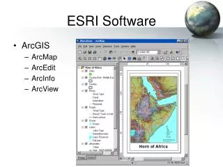
ESRI ArcInfo 8.2 ArcView GIS 3.3 ArcGIS 9.3 ArcView $1,500 ArcEditor $4,000 ArcInfo $10,000. GIS 101: Learning to map in the digital age. Shane Bradt, Geospatial Extension Specialist UNH Cooperative Extension. GIS: GEOGRAPHIC INFORMATION SYSTEM.

E N D
ESRI ArcInfo 8.2 ArcView GIS 3.3 ArcGIS 9.3 ArcView $1,500 ArcEditor $4,000 ArcInfo $10,000
GIS 101: Learning to map in the digital age Shane Bradt, Geospatial Extension Specialist UNH Cooperative Extension
GIS: GEOGRAPHIC INFORMATION SYSTEM • Geographic information made digital and aligned to a common reference system (georeferenced) • GIS layers are by national, state and local sources • Can provide information on a many types of features, both natural resource and societal • Combines geographic layers with descriptive data about those layers UNH Cooperative Extension 2010
What is GIS? GIS = Geographic Information System A system for • capturing • managing • manipulating • displaying • analyzing spatial data UNH Cooperative Extension 2010
What is GIS? Procedures Hardware Software People Data UNH Cooperative Extension 2010
What makes GIS work? • GIS SOFTWARE - Stack different data layers • GIS SOFTWARE - Knows how features are related to each other spatially UNH Cooperative Extension 2010
GPS Remote Sensing Maps Where do GIS layers come from? UNH Cooperative Extension 2010
Common types of GIS data • Wetlands • NWI, USGS, Remote Sensing • Soils • Groundwater resources • Landcover/Landuse • Watershed delineations • Wildlife Action Plan • Topographic maps • Infrastructure • Roads, Rail, Trails, Water, Sewer, Phone lines • Geology • Hydrography • Lakes, Ponds, Rivers, Streams • Demographic (Census) UNH Cooperative Extension 2010
Not all GIS uses are related to “bugs and bunnies” UNH Cooperative Extension 2010
THE GHOST MAP… UNH Cooperative Extension 2010
Bad Map UNH Cooperative Extension 2010
Interesting Map UNH Cooperative Extension 2010
METADATA… …helps keep track of GIS data for you and others Who developed the data? What was the original source data? When was the data developed? When was the last update? What is the scale of the data? What are the attributes of the data? Who to contact to find out more? UNH Cooperative Extension 2010
GIS Options In your web browser With streamed data seamless data server Using downloaded data Options for computer mapping UNH Cooperative Extension 2010
GIS Options In your web browser With streamed data seamless data server Using downloaded data Options for computer mapping UNH Cooperative Extension 2010
In your web browser Advantages Disadvantages • Use on any computer • No specialized skills needed • Low or no cost • Layers kept up-to-date • High speed internet access • Layers selected by host • Limited output options • Can’t use your own data seamless data server Options for computer mapping UNH Cooperative Extension 2010
In your web browser Options for computer mapping UNH Cooperative Extension 2010
In your web browser Options for computer mapping UNH Cooperative Extension 2010
In your web browser Options for computer mapping UNH Cooperative Extension 2010
GIS Options In your web browser With streamed data seamless data server Using downloaded data Options for computer mapping UNH Cooperative Extension 2010
With streamed data Advantages Disadvantages • Use on most computers • Interactive & 3D views • Low or cost • Layers kept up-to-date • High speed internet • Layers chosen by host • Graphics bottleneck • Limited output options Options for computer mapping UNH Cooperative Extension 2010
With streamed data Options for computer mapping UNH Cooperative Extension 2010
With streamed data Options for computer mapping UNH Cooperative Extension 2010
With streamed data Options for computer mapping UNH Cooperative Extension 2010
GIS Options In your web browser With streamed data seamless data server Using downloaded data Options for computer mapping UNH Cooperative Extension 2010
Using downloaded data Advantages Disadvantages • Use on any computer* • Analysis and output • Many types of GIS data • Use own data • Computer specs • B.Y.O.G.D. • Training needed to use • Can be expensive* Options for computer mapping UNH Cooperative Extension 2010
Using downloaded data Options for computer mapping UNH Cooperative Extension 2010
Using downloaded data Options for computer mapping UNH Cooperative Extension 2010
Questions? UNH Cooperative Extension 2010