Download
1 / 25
250 likes | 271 Views
Daily weather forecast briefing for Hawaii and Palmdale from February 14-16, 2015, including conditions, temperatures, wind, and atmospheric river movements. Key updates on cyclone and AR activity.

E N D
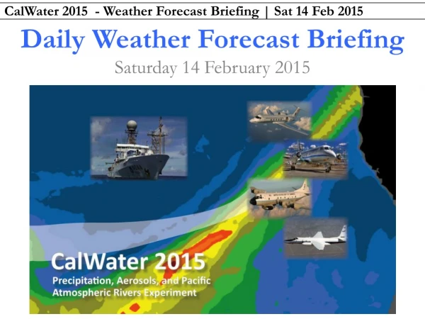
Daily Weather Forecast Briefing Saturday 14 February 2015
13 February – 16 February 2015 AR conditions expected offshore Sat Sun Mon Tue Mon Mon Sun Sun Sat Tue Mon ~2.5-h G-IV Ferry
0600 UTC GFS F+9 h 0700 PST Saturday 14 February 2015 L H L L IWV | SLP | 850-hPa Wind IVT | IVT Vectors “Current Conditions”
PrimaryCyclone Atmospheric River GOES West Infrared Enhanced Satellite http://vortex.plymouth.edu/mapwall/goes/goesWirl.24.png
PrimaryCyclone Atmospheric River GOES West Water Vapor Imagery http://vortex.plymouth.edu/mapwall/goes/goesWwvc.24.png
PrimaryCyclone NOAA ESRL PSD SSM/I Water Vapor: http://www.esrl.noaa.gov/psd/psd2/coastal/satres/data/images/wx_cl/6hr/recent.png
MCCForecast from NWS • Saturday–Friday • Patchy fog before 10 am, then sunny. Highs in the low 70s today and mid-upper 60s after that. Lows in the mid 40s. Winds variable 5–9 knots.
Honolulu Forecast from NWS • Saturday • Widespread showers and possibly a thunderstorm – heavy rain at times. High in the upper 70s. Low in the upper 60s. Winds W 25–29 knots, gusting to 43 knots. • Sunday • Mostly sunny with isolated showers. High in the upper 70s. Low in the lower 60s. Winds N 6-13 knots gusting to 15 knots. • Monday • Sunny with a high near 80. Winds NE 5-7 knots.
0600 UTC GFS F+18 h 1600 PST Saturday 14 February 2015 L H L • Key: • Secondary low deepens and becomes primary center of circulation • IVT exceeds 1250 kg /m /s over fairly broad corridor; more intense than yesterday’s runs
0600 UTC GFS F+36 h 1000 PST Saturday 15 February 2015 H L L L H • Key: • Cyclone moves northward into Gulf of Alaska and deepens to ~975 mb • AR moves eastward and weakens; secondary low development along cold front provides support
0600 UTC GFS F+42 h 1600 PST Sunday 15 February 2015 H L L L H • Key: • Weak cyclone along front dissipates; AR IVT values begin to rapidly decrease • New cyclone and AR approach from the west
0600 UTC GFS F+66 h 1600 PST Monday 16 February 2015 L H L L H H • Key: • Initial AR from west weakens as baroclinic zone reorganizes further north; large IWV remains • New AR begins strengthening northwest of decaying AR
0600 UTC GFS F+90 h 1600 PST Tuesday 17 February 2015 L L H • Key: • AR intensifies with IWV > 44 mm and IVT > 1250 kg /m /s
0600 UTC GFS F+114 h 1600 PST Wednesday 18 February 2015 L H • Key: • AR moves south and east closer to Hawaiian island chain • AR weakens, but maintains greater IVT than in previous days’ solutions
0600 UTC GFS F+138 h 1600 PST Thursday 19 February 2015 L L H • Key: • Cyclone occludes southwest of Aleutian islands; AR weakens further
0000 UTC GFS F+168 h 1600 PST Friday 20 February 2015 • Key: • GEFS suggests reorganization of intense IVT along now-familiar axis of AR activity
0000 UTC GFS F+192 h 1600 PST Saturday 21 February 2015 • Key: • Signal for enhanced AR activity strengthens and progresses eastward – closer to HI
0000 UTC GFS F+216 h 1600 PST Sunday 22 February 2015 • Key: • Corridor of AR activity continues edging closer to HI
0000 UTC GFS F+240 h 1600 PST Monday 23 February 2015 • Key: • Cyclone tracking northeast directs AR activity north and east as well
Palmdale Forecast from NWS • Saturday–Monday • Sunny. Highs in the low-mid 70s. Winds SW < 9 knots.
GOES-W, Cloud Top Height-NASA, Valid 0600 PST Friday 13 Feb 2015 3-6km < 2 km 8-12 km 8-10 km < 1 km 10-14 km < 1 km
1000 PST Sat| Sim. IR 1600 PST Sat • NAM 4-km Simulated IR Brightness Temperature | 06Z 14 Feb 2015 • Clouds departing region to east early this morning with clearing this afternoon • A few clouds over northwestern CA tomorrow afternoon 1600 PST Sun
Temperature (contours), Relative Humidity (Shaded), and Wind (barbs) NAM Valid 1600 PST Saturday 14Feb 2015 Valid 1600 PST Sunday 14Feb 2015 Northern California Central California