Download
1 / 9
100 likes | 271 Views
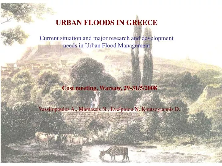
URBAN FLOODS IN GREECE Current situation and major research and development needs in Urban Flood Management. Cost meeting, Warsaw, 29-31/5/2008 Vassilopoulos A., Mamassis N., Evelpidou N, Koutsoyiannis D. URBAN FLOODS IN GREECE Main causes.

E N D
URBAN FLOODS IN GREECE Current situation and major research and development needs in Urban Flood Management Cost meeting, Warsaw, 29-31/5/2008 Vassilopoulos A., Mamassis N., Evelpidou N, Koutsoyiannis D.
URBAN FLOODS IN GREECE Main causes • Intense rainstorms. The 50-year maximum 24-hour rainfall depth (which can be considered as a very rough indicator of the flood severity) is as high as 175 mm in western Greece, a region that receives 1800 mm per year, but also in Athens and Aegean islands, regions that receive less than 400 mm per year • Deforestation and urbanization. They areresponsible for the increasing severity and destructive power of floods. Deforestation, also related to soil erosion, is a major problem in Greece and has been caused primarily by human activities such as fire, illegal land uses, pasturing, etc. • Absence or inadequate protective measures and hydraulic works. Deficient channel cross sections, inadequate storm drainage networks, encroachof torrents beds, absence of intergraded river basin management.
Decrease of the cross section area of the river near the outlet River’s cross section in the urban area near the outlet River’ bed upstream of the entrance to the urban area Urbanization of river basins (Kephisos river) Western Athens (1870) Western Athens (2007)
THE CASE OF ATHENS Facts • The Greater Athens area is the most urbanized part of Greece with a population of about four million. • 179 lives were lost during the last 100 years, 96 of them occurred during the last 35 years. These figures are higher than in any other part of Greece. • Flooding is also the most costly natural hazard in terms of human life. Comparatively, earthquakes claimed less than 50 lives during the last century in the Attica area that surrounds Athens. Flood Causes • The dry climate of Athens (mean annual rainfall depth of about 400 mm) and the high evaporation rate in combination with the natural relief, did not lead to the formation of significant river networks. • The cross-sections of the existing streams are small and unable to route high flows. However, the intense flood-producing rainstorms in Athens are almost as severe as in other parts of Greece • The increase of residential, commercial, and industrial areas and the diminution of natural parks and farmlands affected the flood rate significantly. • The stream network was reduced as many streams were converted into streets. Buildings were even constructed over the old streambeds. • No priority was given to the flood protection.
Absence of intergraded river basin management (Kephisos river basin) Roads and houses on streambeds Basin and river outside of the urban area Structures on riverbed Inside the city river is lined River basin City of Athens River is transformed in main drainage channel The drainage channel is combined with the national road construction
Major research and development needs in Urban Flood Management in Greece The main aim of Greece in UFM for the next decade is the harmonization with the Directive 2007/60/EC The Directive is related to the assessment and management of flood risks and requires from Member States to deliver Flood hazard maps that will cover the geographical areas which could be flooded according to 3 probability scenarios (low, medium, high). In the maps must be shown the flood extent, water depths and the flow velocity Flood risk maps that will show the potential adverse consequences associated with probability flood scenarios and expressed in terms of the (a) indicative number of inhabitants potentially affected, (b) type of economic activity of the area potentially affected, (c) installations concerning integrated pollution prevention and control and (d) other information which the Member State considers useful Flood risk management plans that will focus on the reduction of potential adverse consequences of flooding for human health, the environment, cultural heritage and economic activity. FRM plans must take into account costs and benefits, flood extent, soil and water management, spatial planning, land use, nature conservation, navigation and port infrastructure. FRM plans must focus on prevention, protection, preparedness, including flood forecasts and early warning systems. FRM plans may also include the promotion of sustainable land use practices, improvement of water retention as well as the controlled flooding of certain areas in the case of a flood event.
Major research and development needs in Urban Flood Management in Greece Other issues (except the obligations arisen from directive) Issues related to Greek design regulations • revision of the flood protection design criteria • revision of the methods for estimation of the design storm and flood • regional analysis of recorded intense storms and study of extreme rainfall • probability • 2. development of rainfall runoff models for urban basins • 3. assessment of the existing storm drainage system and the strategic planning • of necessary improvements (measures, construction works) Issues related to study • the improvement of the raingauge network • the installation of modern monitoring networks including weather radars • the development of experimental basins Issues related to measurements • operational use of rainfall runoff model • development of a monitoring, forecasting and warning system for • intense storms and floods Operational issues
COLLECTIVE DATA BASE MEMORY OF FLOOD EVENTS Connection with the Directive 2007/60/EC Article 4.2 Based on available or readily derivable information, such as records and studies on long term developments, in particular impacts of climate change on the occurrence of floods, a preliminary flood risk assessment shall be undertaken to provide an assessment of potential risks. The assessment shall include at least the following: (a)maps of the river basin district at the appropriate scale including the borders of the river basins, sub-basins and, where existing, coastal areas, showing topography and land use; (b)a description of the floods which have occurred in the past and which had significant adverse impacts on human health, the environment, cultural heritage and economic activity and for which the likelihood of similar future events is still relevant, including their flood extent and conveyance routes and an assessment of the adverse impacts they have entailed; (c)adescription of the significant floods which have occurred in the past, where significant adverse consequences of similar future events might be envisaged;
COLLECTIVE DATA BASE MEMORY OF FLOOD EVENTS Under construction