Download
1 / 46
480 likes | 637 Views
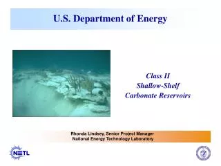
U.S. DEPARTMENT OF ENERGY ADVANCED OIL RECOVERY PROGRAM. CLASS II SHALLOW-SHELF CARBONATE RESERVOIRS 1992 -1995 DE-FC22-93BC14983. Recovery of Bypassed Oil in the Dundee Formation Using Horizontal Drains 1994-1997 James R. Wood Department of Geology Michigan Technological University.

E N D
U.S. DEPARTMENT OF ENERGYADVANCED OIL RECOVERY PROGRAM CLASS II SHALLOW-SHELF CARBONATE RESERVOIRS 1992 -1995 DE-FC22-93BC14983
Recovery of Bypassed Oil in the Dundee Formation Using Horizontal Drains 1994-1997James R. WoodDepartment of GeologyMichigan Technological University
TOW 1-3 HD1 WELL SITECRONUS EXPL. • SPUDDED SEPT. 25, 1995 • COMPLETED OCT. 18, 1995 • DEPTH 3518’ MD (3185’TVD) • FLOWING 50-100 BBLS/DAY • NO WATER CUT
MICHIGAN PROJECTTECHNIQUES • Horizontal Drilling • Well Logging • Modern Reservoir Management • Compile Database of All Historical, Geologic, Engineering, Production Data • Correlate Historical Reservoir Management with Production Histories
LOCATIONMAP • PROJECT OBJECTIVES • Evaluate the Potential for Additional Recovery of Hydrocarbons in Michigan • Develop: • Partnerships with Industry to Test New Technologies for Improving Hydrocarbon Recovery in Existing Fields • Resource Center for Technology and Information Transfer CRYSTAL FIELD STUDY AREA
MICHIGAN PROJECTCentral Basin Study Area MISSAUKEE Prosper & Prosper South Riverside Cranberry Lake & Cranberry Lake East Winterfield OSCEOLA Freeman-Redding Skeels Lake George Sylvan Cedar Evart CLARE Cat Creek Currie Fork Wise Vernon Gilmore Coldwater Rosebush Isabella Sherman Leaton MECOSTA Broomfield Hardy Dam ISABELLA Cato Belly Achers Reynolds Douglas Crystal Field MONTCALM
CRYSTAL FIELD WELLS USED IN STUDY (231)
Regional Distribution of Reservoir Lithology in Dundee Dolomite Limestone Dolomite + Anhydrite
MICHIGAN BASINSTRATIGRAPHIC COLUMNMAJOR PRODUCING HORIZONSTRAVERSEDUNDEENIAGARANTRENTONPDC
EW CROSS-SECTION ACROSS MICHIGAN BASIN THROUGH CRYSTAL FIELD
Reed City Anhydrite Thins and is Absent in Vicinity of Crystal Field Part of Crystal Field Structure is Thought To Be Due to Salt Dissolution
Rogers City Carbonate Thins in Vicinity Of Crystal Field
CRYSTAL FIELD LOCATION MAPMONTCALM COUNTY, MI CRYSTAL FIELD
CRYSTAL FIELD CHARACTERISTICS • 2000 Acre Anticlinal Structure in Central Michigan Basin • Combination Structure/Diagenetic Trap • Fractured, Vuggy Dolomite Reservoir Capped With Thin Limestone and/or Shale • Strong Water Drive Reservoir • Average Pay Thickness 12 Feet, Maximum of 40 Feet. • Initial High Production Rates up to 9000 Bbls/Day Resulted in Inverse Coning of Water
CRYSTAL FIELD DEMONSTRATION WELLS STRUCTURE CONTOURTOP DUNDEE FM.CI – 2 FT. HAPPY HOLIDAY 6-3 TOW 1-3 HD FROST 1-5
CRYSTAL FIELDSTRUCTURE CONTOUR TOW 1-3 HD
CRYSTAL FIELD3D STRUCTURE TOW 1-3 HD TOP DUNDEE SALT COLLAPSE ??
TOW 1-3 HD WELL PLAN 10 5/8” HOLE TRAVERSE LM. KICKOFF POINT 650 FT. 8 5/8” CASING VERTICAL WELL. ACTUAL HORIZONTAL LENGTH 95 FT. BEYOND CASING BELL SH. 5 ½ “ TUBING 7 7/8” HOLE 3175 FT. CORE ORIGINAL OIL/WATER CONTACT 3215 FT. 3235 FT. DUNDEE FM. 3350 FT. 450 FT. 1800 FT. 2250 FT.
RELATIONSHIP BETWEEN DUNDEE LIMESTONE & DOLOMITE AT CRYSTAL FIELD LIMESTONE DOLOMITE
Dundee Reservoir Lithologic Types • Limestone - depositional fabrics • Grainstone shoal sand bodies • Fenestral peritidal packstones and wackestones • Stromatoporoid/coral boundstone patch reefs • Dolomite - burial diagenetic fabrics • Fractured, vuggy, hydrothermal dolomite • Sucrosic, laminated, dolomite with anhydrite
Limestone Reservoir Fabrics • Stromatoporoid-coral boundstone patch reef • Intraparticle and intergranular porosity • Fractures augment moderate to high porosity/permeability • Main reservoir in one field present in others
Hydrothermal Dolomite Cement • Piece of slabbed core from the Leonard Oil-Lee #1 - Dry hole with oil shows Northwest of Crystal Field • Abundant fractures and vugs filled with white ”Saddle” (hydrothermal) dolomite
Limestone Reservoir Fabrics • Fenestral Peritidal packstones and wackestones • Vertical and horizontal fenestrae • High permeability and porosity • Main zone in several large fields
Dundee Reservoir Characteristics • Lithology - Limestone or Dolomite • Pore Characteristics - Matrix, Vugs, and Fractures • Stratigraphy - Rogers City, Dundee, Reed City “Facies” • Production History – Initial High Oil/Water Ratios, Initial High Production Rates
LESSONS LEARNED:EVALUATION KEYS FOR IMPROVED RECOVERY ATTEMPTS • Reservoir Characterization • Accurate Mapping (esp. Dundee Fm.) • Porosity and Permeability • Dolomite Diagenesis Crucial • Production History • Field Development History • Field Wide/Individual Well Production • Well Status/Plugging Record
WHAT SHOULD HAVE BEEN DONE: • Avoid drilling wells low on structure • Map dolomite carefully • Focus on “Attic” oil • Spread DOE funding over more opportunities in more fields
FUTURE PLANS: • Project is ended but: • Re-examine Crystal Field TOW well in light of subsequent attempts to copy its success to see why it succeeded • Map dolomite over central Michigan Basin • Develop model for dolomite diagenesis
Economic Summary: HORIZONTAL WELLS • 27 Additional Devonian Horizontal wells • 20 Dundee, 2 Traverse Lime, 3 Richfield, and 2 Detroit River Wells completed • Average production about 30 bbls oil/day • Total annual production - 300,000 bbls • Gross wellhead value ($17/bbl) - $5,000,000/year • Royalty owners’ share - $630,000/year • State severance taxes - $250,000/year • Federal, State, and local income taxes - $1,650,000/year • Capital investment cost (27 wells) - $10,000,000
Project Summary:BENEFITS • Demonstration Well Tow 1-3 Produced 50,000+ Bbls Oil in 18 Months - No Water • Detailed Characterization of 30 Similar Fields • Drilling and Completion of Horizontal Drain • State Approval of Waiver of Liability for Pre-Existing Pollution in Field - Hundreds of Fields Are Similar Candidates • Stimulation of Interest in Horizontal Drilling - ~20 Dundee Permits in 1996-97; 78 wells currently permitted or drilling by 1998 • Horizontal Drilling has expanded statewide in several other formations. • Numerous undergraduate (50+), Masters (32+) and Ph.D (3) Students entered industry as direct result of DOE projects (1993 – 2002)
Project Summary:ADDITIONAL HD WELLS AT CRYSTAL FIELD • Tow 1-3 HD1, 50-100 BOPD; 135,000+ BBLS • Frost 5-3 HD, water/oil • Happy Holiday Tree Farm 6-3 HD, water/oil
Project Summary:FRACTURES • Fractures are present in most Dundee Dolomite reservoirs, enhancing oil productivity, but also allowing for water transport • Fractures enhance permeability, especially vertically, porosity may be altered by diagenetic changes. • Fractures and diagenesis have relation to structures and fault systems in basement • Fractures have strong relationship to hydrothermal systems that also produce pervasive dolomitization and HTD mineral suites
Project Summary:AWARDS • 2 HART AWARDS • BEST NEW TECHNOLOGY - 1994 • BEST NEW WELL - 1996
DELIVERABLES(actually delivered) • DIGITAL DATA • WELL LOCATIONS (53,000+) • FORMATION TOPS (465,000) • PRODUCTION HISTORY (40 Fields) • FIELD HISTORY – 40 Fields • WIRELINE LOGS - 50 • CORE DATA – 60 ft. Tow 1-3 • STRUCTURE AND ISOPACH MAPS • PROJECT CD-ROM – 500+ COPIES
PROJECT TEAM • MICHIGAN TECH UNIVERSITY • JAMES WOOD - PROJECT DIRECTOR • JACKIE HUNTOON - BASIN MODELING • WAYNE PENNINGTON - LOG ANALYSIS • WESTERN MICHIGAN UNIVERSITY • WILLIAM HARRISON - RES. CHARACTERIZATION • TERRA ENERGY, LTD. • CRAIG TESTER - PETROLEUM ENGINEER • ERIC TAYLOR - PETROLEUM GEOLOGY
Recovery of Bypassed Oil in the Dundee Formation Using Horizontal Drains 1994-1997James R. WoodDepartment of GeologyMichigan Technological University