Download
1 / 34
340 likes | 360 Views
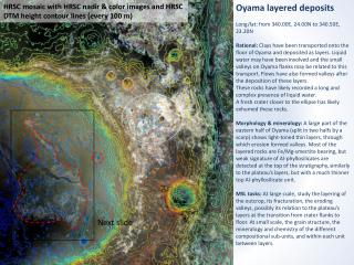
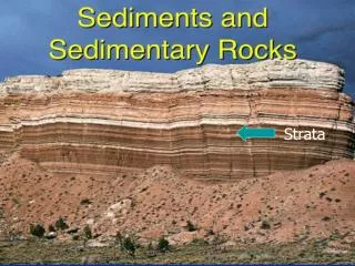
Explore the stratigraphic layers of Meridiani Planum, a thick stack of sediment dating back to the Noachian period. These layered deposits likely formed at the edge of a large sea, potentially containing organic compounds indicating life development.

E N D
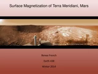
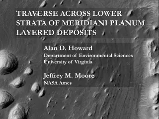
TRAVERSE ACROSS LOWER STRATA OF MERIDIANI PLANUM LAYERED DEPOSITS Alan D. Howard Department of Environmental Sciences University of Virginia Jeffrey M. Moore NASA Ames
General Concept • We have explored only the top few meters of the >800 m thick stack of layered sediment in the Meridiani Planum region • These layered deposits have the greatest areal extent and the most informative regional context of all layered deposit sequences • We argue that these deposits accumulated as a sedimentary wedge at the edge of a large sea or ocean during the Noachian and are thus the most likely deposits to have incorporated organic compounds indicative of development of life
A prominent topographic platform interrupts the northwestward slope of the gradual transition from highlands to lowlands It occurs at elevations from about 0 to -1600 m with a sharp drop off to about -2000 m We provisionally call this the Meridiani Bench
The purple line encloses the Meridiani Bench and separates the Cratered Highlands from the Arabia Lowlands Arabia Lowlands M.B. Cratered Highlands
The blue area is underlain by layered sediments of the Meridiani Planum portion of the Meridiani Bench. These layered sediments include the hematite-rich deposits being visited by the Opportunity Rover as well as sulfate-rich deposits. We suggest that the entire Meridiani Bench, including the Meridiani Planum deposits, are underlain by a sedimentary sequence of sediments eroded from the Cratered highlands extending into a former sea or ocean extending up to at least -1500 m MP
Prominent valley networks are shown in Cyan. They do not extend below about -1500 m White arrows show the ULM outflow channel system that formed subsequent to the landforms discussed here The possibility of a high-level ocean or sea in this region has also been suggested by Edgett and Parker [1997], Fairen et al. [2003], Fairen and Dohm [2004], and Clifford and Parker [2001]
A topographic barrier may have created semi-enclosed conditions that encouraged evaporite deposition as part of the Meridiani Planum sequence. • Mawrth Valles may have been excavated by overflows/density flows over this barrier. • Later outflow channel floods have breached this barrier.
We do not have the space or time here to develop the supporting evidence for our scenario, but a paper is in preparation • Even if we are wrong, the presence of a thick sequence of layered deposits, hematite, hydrated minerals, and sufates warrants further exploration • Previous regional geologic investigations of the Meridiani region have been published by Hynek et al. [2002], Arvidson et al. [2003] and Edgett [2005]. • Edgett compares the region to the terrestrial Colorado Plateau
The Proposed Site • The steep, 300-400 m scarp defining the northwestern edge of the Meridiani Planum/Meridiani Bench deposits exposes probably the most complete section of the lower portions of the sequence, complementing the examination of the higher beds by Opportunity • We have suggested a site near 354°E and 8°N permitting a traverse across this scarp
The Geologic Context • Hynek et al. [2001] and Edgett [2005] have provided geologic context • Two prominent units define the sedimentary sequence occurring here: • A lower set of beds which locally appears to incorporate fluvial channel deposits • An upper sequence characterized by reticulate ridges of layered deposits
X P=Plains-forming Unit R=Ridge-forming Unit S=Scarp Forming Unit L=Lower Unit (Edgett,2005)
(Hynek et al., 2002) X Cs=Cratered, Subdued Cu=Cratered, Undivided IL=Interior Layered P1=Plains, Lower P2=Plains, Upper Ph=Plains, Middle P3=Etched
1 - E2200443 2 – E2200081
1 R1601540 Scarp in lower layered unit – possibly traversable
2 R1601540 In landing ellipse – somewhat scabby texture
3 R1601540 Upper ridged unit – probably can be sampled at various levels
Landing site thermal intertias ~200, about the same as the Opportunity site
Landing Site does not contain extensive exposures of hydrated minerals X
A Possible Extended Mission Target • The ~70 km crater about 20 km to the west of the landing site contains some of the best exposures of rhythmically-layered sediment on Mars • The issue is feasibility of descending into the crater and traversing the rough floor
Landing Site Coordinates: L1: 354.029°E 7.900°N L2: 353.975°E 8.260°N L3: 354.545°E 8.408°N (listed in order of decreasing priority) Regional Polygon Vertices: 352.91°E 8.64°N 354.72°E 8.49°N 354.61°E 7.95°N 353.09°E 7.25°N E ‘E ‘ is the potential extended mission target
Landing site is within mantled portion of Arabia, but detailed images show lots of rock exposures X
SummaryWhy Revisit Meridiani • Meridiani (whether at our proposed site or elsewhere) contains probably the largest and best exposed layered deposits of probable fluvial or lacustrine origin on Mars. • The Meridiani site occurs on a gradual transition from highlands to lowlands and thus provides abundant geologic context for interpretation of age and depositional environment. • A strong case can be made that the Meridiani deposits were deposited into a large regional sea or ocean, either open or ice-covered.
It is likely that a site can be found in the Meridiani Planum region that: • Provides an adequate landing environment • Provides close access to a thick sequence of the lower beds of the stratigraphic column • Contains accessible traverses • Contains low-energy fluvial or lacustrine depositional environments with abundant hydrated minerals and chemical precipitates • Affords dust-free exposures
Issues with Site • Local steep slopes within the 20-km ellipses • Small-scale roughness on portions of the landing sites • Located in a partially mantled portion of Arabia • May not be able to access rhythmically-bedded deposits within crater • No extensive exposures of hydrated minerals seen so far
X Other potential landing site locations with thick exposed sequences of Meridiani layered deposits (arrows)
The next slide shows other potential traverse locations, shown on V037200003 (left) and V04881003 (right)