Download
1 / 21
210 likes | 362 Views
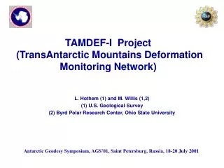
Transantarctic Mountains Deformation Network (TAMDEF) GPS measurements of bedrock crustal motions. Larry Hothem, USGS, Reston, VA Terry Wilson, Department of Geological Sciences, OSU, Columbus, OH Mike Willis, Byrd Polar Research Center, OSU, Columbus, OH.

E N D
Transantarctic Mountains Deformation Network (TAMDEF)GPS measurements of bedrock crustal motions Larry Hothem, USGS, Reston, VA Terry Wilson, Department of Geological Sciences, OSU, Columbus, OH Mike Willis, Byrd Polar Research Center, OSU, Columbus, OH SCAR Antarctic Geodesy Symposium (AGS02) LINZ Building, Wellington, NZ 26-27 November 2002
Ice Sheet History and Mass Balance • Glacial isostatic adjustment (GIA) vertical motions, James & Ivins, 1998 • Sense and pattern of motions differ considerably depending on model parameters • Generally assumed vertical viscoelastic adjustments will exceed significantly any tectonic motions • TAMDEF-VLNDEF network (as shown in figures) ~1100 km in length, crosses substantial predicted vertical motion.
Tectonic Framework • West Antarctic rift system and the Transantarctic Mountains – one of the highest and longest uplifted rift flanks in the world. • Crust of West Antarctic divided into blocks that moved as microplates with respect to East Antarctica • Substantial low-magnitude seismic activity recorded in past couple years in South Victoria Land and central West Antarctica
Terror Rift and Major Strike-slip Faults • Terror Rift is the only area in the Antarctica interior with extensive evidence for neotectonic activity. • Salvini and Storti (1999) proposed that the Terror Rift and major dextral strike-slip faults crossing northern Victoria Land were kinematically linked and remain active. • Fault scarps and Holocene volcanic vents cutting the sea floor have been detected by bathymetric and seismic profiling. • GPS measurements from TAMDEF network between 1996-2002 indicate the Terror Rift is actively extending at a rate of 4.2±3.2 mm/yr [2-sigma] relative to the East Antarctic margin of the TAM.
Transantarctic Mountains Deformation (TAMDEF) NetworkDeployment Strategies • TAMDEF-I consists of an array of 25 primary sites: • Stations established in 1996 & 1997. • GPS measurements conducted 1996-2000, with a few additional measurements in 2001 & 2002. • Initial deployment strategy – attempt to discriminate between the three potential mechanisms of crustal motions thought to be important in the region: • isostatic rebound • rifting • volcanic loading • Primary sites augmented with dense local arrays at three sites: • JPL/NASA Stations (C. Raymond):
Typical Statistics for Uncertainties • Examine errors and biases in relation to baseline length, number of occupations, and duration of occupations. • Three stations selected: • FRK (Franklin Island): critical site to the east of the Terror Rift • ALN (Allan Hills): on inland flank of the TAM • FTP (Fishtail Point): most southerly site with the TAMDEF network
TAMDEF First Results – “Horizontal” Motions • Horizontal velocities between 1996 and 2002 • Fig 6a: Motions referenced to ITRF 1997 frame and relative to MCM4 • Fig 6b: Shows residual horizontal motions when the average motion of local “East Antarctic craton” reference system is removed. Fig. 6a
TAMDEF First Results – “Vertical” Motion • Vertical motions upward over entire region. • Uncertainties in vertical are larger than those for horizontal. • Upward motion ranges • From +0.1 ±3.1 mm/yr • To +5.6 ±0.6 mm/yr • 13 sites have upward motion significant at 2-sigma level • Average vertical motion for entire network: ~3.6 mm/yr • Vertical motions approximately same magnitude as those suggested by the D91 continental post-glacial rebound model (James and Ivins 1998)
Results for Cape Roberts “Footprint” Surveys1996-1999 “i” indicates the result of a single baseline session from a stop-and-go style survey, using “2” GPS survey systems where data were collected for about 10 minutes for each static occupation. All other other surveys performed with “4” GPS survey systems; data collected simultaneously for about 60 minutes at 5-sec rate.
Residuals for Baseline Solution – ARR0 to MCM4 – 12 January 2002
Residuals for Baseline Solution – FLM2 to MCM4 – 12 January 2002
Residuals for Baseline Solution – FTP1 to MCM4 – 12 January 2002
Residuals for Baseline Solution – ROB1 to MCM4 – 12 January 2002
Data Quality – ARGO Stations – JNS EURO-80 Receiver ARR0 to MCM4 FLM2 to MCM4 FTP1 to MCM4 ROB1 to MCM4
TAMDEF-II Network • 13 new sites proposed • Three new remote GNSS observatories • One at Franklin Is. (FRK) • Two at new stations of • TAMDEF, along inland flank • of the where tectonic • motions are expected to • be negligible. TAMDEF-II TAMDEF-I – extends northward to VLNDEF network
November 1996First season for TAMDEF projectEstablishing station at Cape Crozier (CRZ0)Ian Whillans, PI, OSUandLINZ personnel