Download

1 / 66
660 likes | 835 Views
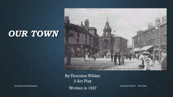
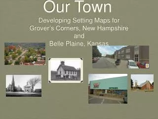
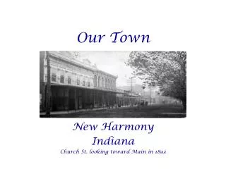
Our Town. New Harmony Indiana Church St. looking toward Main in 1893. A River Runs By It – Harmonie, 1825. Done by a Harmonist. Harmonist land shaded. Given to Robert Owen. Ca. 1840 Drawn by Robert Dale Owen.

E N D
Our Town New Harmony Indiana Church St. looking toward Main in 1893
A River Runs By It – Harmonie, 1825 Done by a Harmonist. Harmonist land shaded. Given to Robert Owen.
The intersection of the two yellow lines is Church and Main Streets. Notice that Main St. extends north to the Wabash River. This is where boats landed in the 1800’s. Notice also that West St. extends north to the Wabash. This extension was called Fretageot Lane. The road to the Cut-off ferry is today Woods Ave. It does not extend to the river today.
Hand drawn map of Fretageot Lane showing location of the sawmill.
By the 1850’s the cut-off was becoming the main channel. As the old river channel dried up, so did commercial traffic on the Wabash. As a stronger current flowed through the cut-off, it washed away sediment leaving rock. The shoals that was formed made commercial traffic on the Wabash impossible. The shoals is called the “Old Dam” by locals.
Attempts to dam the cut-off and redirect the water to the old channel failed.
Rollin’ on the River – before the cut-off became the main channel.
To Miss Caroline Pelham, Los Angeles, CA Just see how badly the Wabash has been behaving. Damaging almost every boat on the river. Down shore big gravel barges and boats over the willow trees. It certainly looked bad for a while. The U. S. Army boats were damaged the most. I think of you 17 degrees below zero. Laugh now. Jan. 29, 1912