Download
1 / 51
510 likes | 533 Views
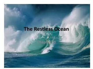
Chapter 10 THE RESTLESS OCEAN Dr. Masdouq Al-Taj. The important concept of this chapter: What forces create and influence surface ocean currents? What two factors are most significant in creating a dense mass of ocean water?

E N D
The important concept of this chapter: • What forces create and influence surface ocean currents? • What two factors are most significant in creating a dense mass of ocean water? • What factors determine the height , length ,and period of a wave? • What are some typical shoreline features produced by wave? • What is the difference between a submerged and an emergent coast? • How are tides produced?
The restless waters of the ocean are powered by: • Winds: generate surface currents which influences coastal climate (carry storms) and provide nutrients ~affect life and algae distribution • Density variation: create deep-ocean circulation which affect ocean circulation and nutrients recycling and mixing • Sun and Moon: produce tides which periodically raise and lower sea level.
1.Ocean water movements • Surface circulation • Ocean currents are masses of water that flow from one place to another: mass can be small or large, at the surface or deep, simple or complex. • Surface currents develop from friction between the ocean and the wind that blows across the surface: short-lived and affected by seasonal influences or permanent that extend over large portion of the oceans, hence related to circulation pattern of atmosphere. • Ocean circulation pattern, Huge and slowly water circular –moving current system within an ocean basin called gyres (gyros=a circle) ,
Correlation between direction of surface –current flow and major wind belts • Subtropical gyres rotate clockwise in NH and counter-clockwise in SH ITCZ:Inter-tropical convergence zone
Ocean water movements • Five main gyres • North Pacific gyre • South Pacific gyre • North Atlantic gyre • South Atlantic gyre • Indian Ocean gyre • The center of each gyres coincides with the subtropics at about 30 degrees N-S (subtropical gyres) related to atmospheric circulation
Average ocean surface currents in February–March* In N-pacific ocean, one circle takes3 yrs which is about half of N-pacific ** A-Large central area with no well-defined current : sargasso sea: “sargassum” is type of floating seaweed (algae) Sluggish No landmasses, continuous loop ,encircle the earth N & S-thern hemisphere are the same gyres influenced by Wind belt, position of continent, Coriolis effect
Ocean water movements • Surface circulation • Deflected by the Coriolis effect • To the right in the Northern Hemisphere • To the left in the Southern Hemisphere • Four main currents generally exist within each gyre • Importance and effects of surface currents (Wind, ocean current, coriolis effect) Ocean Currents Influence Climate 1. Temperature: Currents from low latitudes into higher latitudes (warm currents) transfer heat from warmer to cooler areas: NAC keeps Great Britain warmer during winter , in contrast the cold current tend to moderate warm water: Benguela current along western Africa.
Ocean water movements 2. Changing Desert climate: such as Atacma in Peru and Chile and Namibia in SW of Africa. The aridity along these coast are intensified where the lower atmosphere is chilled (تبريد )by cold offshore water. THUS, these area characterized by relative high humidity and fog!. Exclamation point 3. Maintain Earth’s heat balance: ocean water movement account for about one quarter of heat transport, and winds transport the remaining.
2. Deep-ocean circulation Upwelling (vertical water movements) The rising of cold water from deeper layers • Coastal upwelling: Most characteristic along west coasts of continents. • When winds blow toward the equator and parallel to the coast , coastal wind combined with the Coriolis effect, causing surface water to move away from the coast (50-300m slow upward movement). Bring great concentration of nutrients. i.e. nitrate and phosphate to feed plankton and support fish and others
Deep-ocean circulation • A response to density differences • Factors creating a dense mass of water • Temperature—Cold water is dense • Salinity—Density increases with increasing salinity • Called thermohaline circulation
Ocean water movements • Deep-ocean circulation • Most water involved in deep-ocean currents begins in high latitudes at the surface: near Antarctica , the cold saline brine slowly sinks to the sea floor , where it moves through out the ocean basin in sluggish خاملcurrents, it will not appear for 2000 years as maximum at the surface. • A simplified model of ocean circulation is similar to a conveyor belt that travels from the Atlantic Ocean, through the Indian and Pacific Oceans, and back again : warmer surface water flows poleward, convert to dense water , and returns equatorward as cold deep water, As this conveyor or belt moves around the globe, it influences global climate by converting warm water to cold and liberating heat to atmosphere
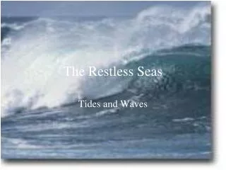
3.The Shoreline: Dynamic Interface • Waves • Energy traveling along the interface between ocean and atmosphere • Derive their energy and motion from wind • The power of waves is most noticeable along the shore: waves are constantly rolling in and breaking • When a breeze نسيم is less than 3km/hr , only small waves appear • Parts • Crest :tops of the wave • Trough: the area separated between two crests
4. Ocean Waves • Waves • Characteristics • Wave height—The distance between a trough and a crest • Wavelength—The horizontal distance between successive crests (or troughs) • Wave period—The time interval for one full wave to pass a fixed position
Ocean water movements • Waves • Wave height, length, and period depend on • Wind speed • Length of time the wind blows • Fetch—The distance that the wind travels • As the wave travels, the water passes energy along by moving in a circle called circular orbital motion • the energy contributed by the wind to the water is transmitted to a depth equal to one half of wavelength, this depth is called wave base. • The turbulent water created by breaking waves is called surf امواج متكسرة
Changes that occur when a wave moves onto shore Swash: sheet of water from collapsing breakers *A critical point is reached where waves grow so tall that they topple overانقلب , forming ocean breakers called whitecaps **When the wind stops or changes direction, or wave leave storm area • Continue without relation to local wind • Swell, lower height and longer in length Back swash: the water flow back down the beach toward the surf zone
5. Beaches and shoreline processes • Beaches are composed of whatever material is available • Some beaches have a significant biological component • Material does not stay in one place. Thus, beaches can be thought of as material in transit along the shoreline. A. Wave erosion • Caused by • Wave impact and pressure (hurl اندفع thousand tons of water) • Breaks down rock material and supplies sand to beaches, filling cracks rocks and any opening area i.e.Atlantic waves cause pressure around 10,000 kg/m2 In addition, Abrasion is important particularly at surf zone where grinding of fragments is so effective
Beaches and shoreline processes B. Wave refraction • Bending of a waves because wave nearest the shore touch the bottom first and slow down , it plays an important part in shoreline process such as energy distribution, sediment transport and deposition, degree of erosion. • Wave arrives parallel to shore (slight angle) • Results • Wave energy is concentrated against the sides and ends of the headland and weakened in bays • Wave erosion straightens an irregular shoreline and sediments accumulate at the bay area
Beaches and shoreline processes C. Longshore transport: both Beach drift and longshore current are created by obliquely breaking waves • Beach drift—Sediment moves in a zigzag pattern along the beach face, the breaking wave at the swash area move water at oblique angle and the backwash is straight down the slope of the beach- it can transport sand and pebbles at rate of 5 to 10 m per day • Longshore current • Current in surf zone • Flows parallel to the shore • Moves substantially more sediment than beach drift • Easily move fine suspended sand and roll larger sandand gravel along the bottom
6. Shoreline features • The shoreline features vary depending on the type of rocks exposed , the wave intensity, the natural of coastal current, and whether the coast is stable, sinking or rising. • Features owe their origin from erosion called erosional features (most common) while deposits of sediments produce depositional feature Erosional features: ex. New England coast and West coast of USA • Wave-cut cliff: cutting action of the surf against the base of coast land • Wave-cut platform: relatively flat, bench like surface by recending cliff • Marine terraces: The wave-cut platform is exposed by uplifted area above sea level caused by tectonics forces • Sea arch and Sea stack:Associated with headlands which are areas that extend into the sea and attacked by refracted waves
Sea arch and sea stack Sea stack Sea arch
Shoreline features • Depositional features : deposits eroded from the beach are transported along the shore and deposited in areas where wave energy is low. Such processes produce a variety of depositional features • Spits, Bars, and Tombolos produced where beach drift and longshore currents are active • Spit—is an elongated ridge of sand extending from the land into the mouth of an adjacent bay with an end that often hooks landward in response to dominant longshore current • Baymouth bar—A sand bar that completely crosses a bay and sealing it off from the open sea • Tombolo—A ridge of sand that connects an island to the mainland, form in much the same manner as a spit • Barrier islands : 1-5 km wide and 15-30 long • Mainly along the Atlantic and Gulf Coastal Plains: • Parallel the coast at about 3-30 km • Originate in several ways : spit severed from mainland by erosion and rise in sea level, or former sand dune or breakers heaped up متراكمsand from the bottom.
7. Stabilizing the shore • If shoreline remains stable , marine erosion and deposition will eventually produce a straight , more regular coast. However human activity jeopardizes يعرض للخطرcoast area since the coastal landform are relatively fragile هش , short –lived features • Shoreline erosion is influenced by the local factors: • Proximity to sediment-laden مثقلrivers • Degree of tectonic activity • Topography and composition of the land • Prevailing wind and weather patterns • Configuration of the coastline During the past 100yrs , growing influence and increasing demands for recreation have brought unprecedented development to many coastal areas, so too have efforts to protect property from storm waves by stabilizing the shore
Stabilizing the shore • Responses to erosion problems • Hard stabilization —Building structures to protect coast from erosion or to prevent of sand along beach • Types of structures • Groins—Barriers built at a right angle to the beach that are designed to trap sand • Breakwaters—Barriers built offshore and parallel to the coast to protect boats from breaking waves
Stabilizing the shore • Responses to erosion problems • Seawalls—Armors the coast against the force of breaking waves • Often these structures are not effective, once the width of the beach is reduced , it is subjected to even greater pounding by the waves
Stabilizing the shore • Responses to erosion problems : Armoring the coast with hard stabilization has several potential drawbacks عائق ; cost of structure and the loss of sand on the beach • Alternatives to hard stabilization • Beach nourishment: by adding sand to the beach system: it is not permanent solution but appears to be economically viable long-range solution ~same processes to remove additional sand. Another is can lead to unwanted environmental effects ~ increase water’s turbidity and killing offshore coral reefs • Relocating buildings away from beach: structures are abandoned and relocated on higher, safer ground
Stabilizing the shore • Erosion problems along U.S. Coasts • Atlantic and Gulf Coasts • Development occurs mainly on barrier islands • Face open ocean • Receive full force of storms • Development has taken place more rapidly than our understanding of barrier island dynamics
8. Erosion problems along U.S. Coasts • Pacific Coast • Characterized by relatively narrow beaches backed by steep cliffs and mountain ranges • Major problem is the narrowing of the beaches • Sediment for beaches is interrupted by dams and reservoirs • Rapid erosion occurs along the beaches
Coastal classification • Shoreline classification is difficult~ variety of shoreline types • Classification based mainly on changes with respect to sea level, others related to rocks type, size and direction of wave, storms, tidal range, and offshore topography 1. Emergent coast : Caused by: • Uplift of the land, or • A drop in sea level ----- leads to expose wave-cut cliffs and marine terraces (i.e. portions of coast California). Other example regions that were once buried beneath ice sheets; their weight depressed the crust.
Coastal classification 2. Submergent coast Caused by Land adjacent to sea subsides, or Sea level rises Features of a submergent coast Highly irregular shoreline : because the sea floods the lower reaches of river valleys flowing into the ocean. The ridges separating the valleys, however, remain above sea level and project into the sea as headlands. Theses drowned river mouths called Estuaries (characterize many coasts today).
9.Tides Daily changes in elevation (rise and fall) of the ocean surface Caused by the gravitational forces exerted upon the Earth by the Moon, and to a lesser extent by the Sun . • Moon’s Gravitational force can cause the water to bulge on the side of Earth nearest the Moon, in addition, however , an equally large tidal bulge is produced on the side of Earth directly opposite the Moon. • Moon’s changes in position moderately in a single day, the tidal bulges remain in place while Earth rotates. Therefore, most places on earth experience two high tides and two low tides each day. Tidal bulges may be inclined relative to Earth’s equator causes two unequal high tides during a day.
Tides • Monthly tidal cycle The primary body that influences the tides is the Moon, one complete revolution around Earth every 29 and a half days. Te Sun effect is only 46% that of the Moon. * If Sun and Moon are aligned and their forces are added together which produce spring tide (no connection to spring season): 1. Spring tide • During new and full moons • Gravitational forces added together • Especially high and low tides • Large daily tidal range • Occurs twice a month
Tides 2. Neap tide • First and third quarters of the Moon • The Sun and Moon Gravitational forces are offset the influence of the other • Daily tidal range is least • Occurs twice a month
Tides • Tidal patterns Many factors influence the tides which means that theoretical considerations cannot be used to predict either the height or the time of actual tides at particular place • Shape of the coastline • Configuration of the ocean basin • Water depth Main tidal patterns 1. Diurnal tidal pattern (daily) • A single high and low tide each tidal day • Occurs along the northern shore of the Gulf of Mexico 2. Semidiurnal tidal pattern (twice daily) • Two high and two low tides each tidal day • Little difference in the high and low water heights • Occurs at Atlantic coast of USA
Tides 3. Mixed tidal pattern • Is similar to semidiurnal pattern: Two high and two low waters each day • Large inequality in high water heights, low water heights, or both • Prevalent along the Pacific Coast of the United States
Tides • Tidal currents • Horizontal flow accompanying the rise and fall of tides • Types of tidal currents • Flood current—Advances into the coastal zone • Ebb current—Seaward moving water • Sometimes tidal deltas are created by tidal currents