Download
1 / 32
320 likes | 408 Views
Explore climate change impacts in SE Australia, downscaling solutions, synthetic time series generation, & future projections. Collaborations with SEACI colleagues & stakeholders to enhance understanding and prediction. Visit mdbc.gov.au for updates.

E N D
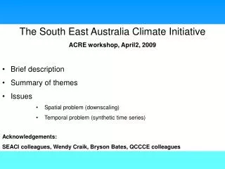
The South East Australia Climate Initiative • ACRE workshop, April2, 2009 • Brief description • Summary of themes • Issues • Spatial problem (downscaling) • Temporal problem (synthetic time series) • Acknowledgements: • SEACI colleagues, Wendy Craik, Bryson Bates, QCCCE colleagues
14% of Australia Over 2 million people The Murray-Darling Basin 1million sq. km
Snapshot of the MDB O’Reilly’s • Major river systems • Murray River 2530 km • Darling River 2740 km
August 2008 http://www.mdbc.gov.au
http://www.mdbc.gov.au/__data/page/1366/Drought_Update_Issue_14_-_July_2008.pdfhttp://www.mdbc.gov.au/__data/page/1366/Drought_Update_Issue_14_-_July_2008.pdf
Key Features SEACI (Phase 1) 2006-2008 SEACI2 (Phase 2) July, 2009 - June, 2012 Further extension (2 years) subject to review • Investigating the causes and impacts of climate change and variability across south eastern Australia, and developing improved short-term predictions for hydrological and agricultural applications • Research themes: • 1. Understanding past hydroclimate variability and change in SEA • 2. Long-term hydroclimate projections in SEA • Seasonal hydroclimate prediction in SEA
MDBA VDSE MCVP DCC STAKEHOLDERS SEACI CAWCR SCIENCE
1. Understanding past hydroclimate variability and change in SEA
Detection and attribution:Observed trends Role of: GH gases ? Aerosols ? Ozone ? Land cover change ? Natural variability ? Other ?
Probable causes: sub-tropical ridge intensity Adapted from Timbal (2007)
Understanding observed changes in runoff 1997–2006 rainfall and runoff Percent difference (1997-2006 relative to 1895-2006) Rainfall Runoff Rainfall
Assessment of GCMs • Ranking of (AR4) GCM performance to improve of regional climate change projections and impacts. • There are models which consistently perform relatively well, and also models which consistently underperform • Provides a basis for better weighting, if not excluding, some model results when forming projections • There is (but not always) evidence of clustering in the projected changes from better performing models
Downscaling Relating local-scaleweather & climate to large-scaleatmospheric variables(modelled or observed)
Downscaling Applications • Investigations of interannual and multidecadalclimate variability at regional scales • Climate change scenarios at local and/or regional scales • Detection & attribution of climate change at regional scales • Seasonal prediction at local &/or regional scales
Spatial problem:Getting from GCM coarse scale results (100kmx100km)to catchment scales. 200km
Spatial problem:GCMs cannot represent regional scale features that drive local climate Sea level
Spatial problem:Statistical downscaling c.f.Antonio Cofino U Z RH Rainfall=f2(T,RH,Z,U,….) T Rainfall=f1(T,RH,Z,U,….)
Spatial problem:Dynamical downscaling? c.f.Antonio Cofino Still only ~ 10km Expensive 200km
We need PDF for natural varib. and model greenhouse signal uncertainty rainfall 1900 2008 2100 Temporal problem:Integration of historical climate data with projection information Currently 2050 climate projection PDF for natural varib. Sample obs rainfall 1900 2008 2100 Current (2008) climate and future climate can be estimated the same way: model signal plus natural variability Climate envelope will be modified as time goes by based on model improvement and evaluation, and assimilation of the observed trend by some means (Penny Whetton)
One option for generating synthetic weather series which capture climate change signals Assume the climate at site A is projected to resemble the present-day climate at site B by 2100. A feasible synthetic weather series may be Past to the present: site A as observed 2100: Site B as observed Present to 2100: Weighted between A and B (preserves correlation between variables) Warmer and drier B A
Summary • SEACI is tackling the following problems: • Better understanding of the drivers of observed climate change over SEA • Improving projections of climate change • Improving estimates of impacts on runoff, water storages which can inform medium term management practice and long term policy • Developing seasonal prediction products which can inform agriculture • Quality reanalysis products are essential for: • Assessing GCMs • Interpreting the outputs from climate models via statistical downscaling
RAINFALL ET ET RUNOFF Water Availability Hydrologic sensitivity to runoff Climate change projections < 2 2 – 2.5 2.5 – 3 > 3 Estimation of impact on runoff Runoff projections P Q Qt – Q eP = median Pt – P