Download
1 / 39
390 likes | 795 Views
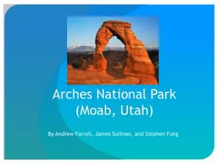
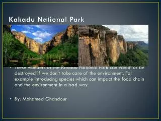
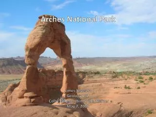
Arches National Park. James Silvestro Geology 142 Colby College, Waterville, Maine May 7, 2008. The History of Arches NP. Oldest evidence of inhabitants is from 10,000 years ago just after the last ice age In 1929 President Hoover signed legislation that established Arches National Monument

E N D
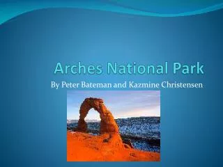
Arches National Park James Silvestro Geology 142 Colby College, Waterville, Maine May 7, 2008
The History of Arches NP • Oldest evidence of inhabitants is from 10,000 years ago just after the last ice age • In 1929 President Hoover signed legislation that established Arches National Monument • Congress changed the status of the Arches in November 12, 1971 to a National Park
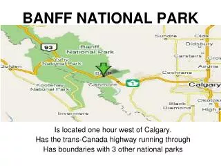
Where is Arches NP? • Arches NP covers an area of 73,379 acres • Includes more than 2,000 natural stone arches
Geologic History of Arches NP • Range: Paradox Formation in the Pennsylvanian to the Mancos Shale in the Cretaceous Period (285 – 65 my Bp) • Most rocks are sandstones deposited by the various Eolian Seas • Highly erosional landscape • > 25 % of the park is exposed bedrock • Arch Rock = Entrada SS (salmon) and Navajo SS (pale/tan) • Moab Fault and Paradox salt deposits are the source of the instability that creates the world famous arches
How are the Arches formed? • 1. -Under the weight of massive sandstone deposits the salt begins to flow • -Movement below causes surfaces rock to fracture • -Water seeps into cracks and joints, leaving a series of independent “fins” • -Ice wedging breaks off pieces of rock that sometimes created opening in the fins • 4. -Fins with the perfect level of hardness and balance have withstood the strain of gravity and create the arches
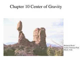
“For a few moments we discover that nothing can be taken for granted, for if this ring of stone is marvelous then all which shaped it is marvelous, and our journey here on earth, able to see and touch and hear in the midst of tangible and mysterious things-in-themselves, is the most strange and daring of all adventures.” -Edward Abbey Desert Solitaire
References "Arches National Park." National Park Service. 23 Aug. 2007. 4 May 2008 <http://www.nps.gov/arch/>. "Arches National Park, Utah." Gorp.Com. 2008. 4 May 2008 <http://gorp.away.com/gorp/resource/us_national_park/ut/geo_arch.htm>. "Geology Fieldnote: Arches." National Park Service. 4 Jan. 2005. 4 May 2008 <http://www.nature.nps.gov/geology/parks/arch/index.cfm>. Gohr, Dorian. "Arches National Park." EIU. Edu. May 2000. 2 May 2008 <http://www.ux1.eiu.edu/~cfrbj/parks/arch/archpk.html>.
Petrified Forest National Park • Located in Northwest Arizona • Petrified Forest Declared Nat’l Monument Dec. 8, 1906 • Painted Desert added Dec. 9, 1962 when whole area was made Nat’l Park. • Covers 93, 532.57 acres
Petrified Forest Painted Desert
Paleo-Climate Bedrock Composed of Mesozoic Sedimentary Rocks. During the Late Triassic, region was on the southwestern edge of Pangaea just north of the equator. Climate was humid and sub-tropical Large river system covered the area Chinle Formation Deposited during this time period
Chinle Formation • Shinarump Member: Basal conglomerate made up of Paleozoic clastic igneous cobbles • Lower/Upper Petrified Forest members = Primarily sandstone • Black Forest Tuff = Shale contains petrified logs
Chinle Formation Cont’d • As oceans retreat in the Late Triassic, park area becomes site of river system and flood plains depositing muds and silts of the Black Forest Tuff. Petrified forest deposited in Black Forest Tuff.
How to Petrify a Forest • Large, pine like trees felled by flooding in Late Triassic • Silts and muds deposited from fluvial/ lacustrine environments on top of fallen trees • Volcanic activity in and around the area deposits layer of volcanic ash • Layers of sediment cut off oxygen to fallen trees, slowing their decay • Groundwater, rich with silica from volcanic ash seeps into the fallen trees, slowly preserving its tissue structure with silica deposits. • Given time and pressure, silica becomes quartz and logs are preserved as petrified wood, colored with oxides of iron and manganese
Painted Desert • Chinle Formations coloration reflect its ancient soil horizons. • Red and Green layers caused by Iron and Manganese • Differences in color come from the position of the water table when the soils were formed • High water table Lack of Oxygen in Sediments Green/Blue hues in Iron minerals • Low water table More Oxygen Available Reddish hues from oxidized iron minerals • Reflect seasonal flooding throughout Triassic
Pliocene / Quaternary Deposits Unconformity between Triassic and Pliocene leaves no geologic record until Bidahochi Formation (192 million yrs) Bidahochi Formation = more fluvial and lacustrine deposits ( silt clay, sand), and volcanic ash deposits. Today Most fluvial/ lacustrine deposits of Bidahochi Formation has been eroded away, leaving exposures of resistant volcanic basalts. Quaternary Deposits = windblown dunes and land sediments.
Effects of Erosion: The look of the park. Wind and water erosion over millions of years, in addition to the significant uplift after the Triassic, has sculpted the hills, mesas and buttes that have come to characterize the park.
Sources • http://www.nature.nps.gov/geology/parks/pefo/ • http://www.us-parks.com/petrified/geology.html • http://www.americansouthwest.net/arizona/petrified_forest/geology.html • http://geology.about.com/library/bl/images/blfossilwood.htm • http://www.petrifiedforest.org/geology.html
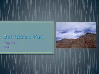
Zion National Park by Libby Kugel http://parkphoto.gruzi.info/images/NationalParksUSA/ZionNationalParkUtah.jpg
Located in the southwestern corner of Utah Established in 1909 as Mukuntuweap National Monument In 1919 the monument was expanded to become Zion National Park Will celebrate centennial in 2009 Utah’s first national park http://www.americaswonderlands.com/images/DesertS/029ZION200003.jpg
http://z.about.com/d/gocalifornia/1/0/g/K/ut-natlpark-nps.gifhttp://z.about.com/d/gocalifornia/1/0/g/K/ut-natlpark-nps.gif
The Grand Staircase • Nine exposed formations in Zion are part of a super-sequence • Where the Grand Canoyn’s story ends, Zion’s story begins • The youngest formation in Zion is the oldest in Bryce Canyon – The Dakota Sandstone Formation http://jan.ucc.nau.edu/~rcb7/Grand_Staircase.jpg
Depositional History • Mud, silt and sand deposited • Weight caused the land to sink at an even rate, maintaining the elevation, until it sank below sea level and flooded • The compression and the mineral bearing sea water caused the sediments to turn to stone
Depositional History • Permian • Deposited in warm, shallow seas • Kaibab Limestone Formation • Triassic • Moenkopi Formation • Chinle Formation • Jurassic • Deposited in streams, ponds and lakes • Moenave Formation • Kayenta Formation • Deposited in desert • Navajo Formation • Temple Cap Formation • Deposited in dry, near-shore environment • Carmel Formation • Cretaceous • Dakota Sandstone Formation http://my-photo-blog.com/wp-content/uploads/2007/10/zion-national-park.jpg
Uplift occurred over the Colorado Plateau • Rivers increased in strength and began to carve into the rocks • Virgin River carved out Zion Canyon • Uplift still happening today – 5.8 Earthquake in 1992 http://www.regensburgerphotography.com/images/galleries/nature/water/narrows_fall.jpg
Erosion • Downcutting • Zion Narrows • Canyon Widening http://www.dankat.com/mstory/photos/phzio1.JPG http://www.weddingpartydjs.com/sitebuilder/images/ZION_NARROWS-450x293.jpg
Arches • Freestanding arches are a unique feature to the park • Part of the Navajo Sandstone formation • Kolob Arch http://www.nationalparkstraveler.com/files/storyphotos/ZION-KolobArch2%20copy.JPG
References • Zion National Park: A Tweak of History and a Tweak of Geology, http://fgms.home.att.net/zion.htm • National Park Service, http://www.nature.nps.gov/geology/parks/zion/geol_history.cfm • http://gorp.away.com/gorp/resource/us_national_park/ut/geo_zion.htm • http://www.nps.gov/zion/naturescience/geologicformations.htm