Outline Spatial Databases Theme Map Geographic objects Modeling geographic data
Outline Spatial Databases Theme Map Geographic objects Modeling geographic data Temporal Databases - Transaction time, valid time - Anchored time, instance, interval - Modeling temporal data. Spatial data management
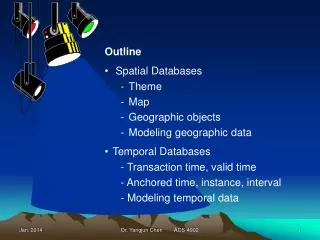

Outline Spatial Databases Theme Map Geographic objects Modeling geographic data
E N D
Presentation Transcript
Outline • Spatial Databases • Theme • Map • Geographic objects • Modeling geographic data • Temporal Databases - Transaction time, valid time - Anchored time, instance, interval - Modeling temporal data Dr. Yangjun Chen ACS-4902
Spatial data management - A spatial database is a data management system for the collection, storage, manipulation and output of spatially referenced information. • Theme: refers to data describing a particular topic (e.g., scenic lookouts, rivers, cities) and is the spatial counterpart of an entity type. When a theme is presented on a screen or paper, it is commonly seen in conjunction with a map. Color may be used to indicate different themes (e.g., blue for rivers and black for roads). - Map: A map will usually have a scale, legend, and possibly some explanatory text. Dr. Yangjun Chen ACS-4902
Spatial data management • Geographic objects: A geographic object is an instance of a theme (e.g., a river). • attributes • spatial components: geometry and topology Geometry refers to the location-based data: shape, length Topology refers to spatial relationships among objects: adjacency Dr. Yangjun Chen ACS-4902
Spatial data management • Data type for spatial elements: points, lines and regions Data type Dimensions Example Point 0 Scenic lookout Line 1 River Region 2 County Dr. Yangjun Chen ACS-4902
has unit-population boundId boundPath cityLocation unitName unitCode cityName A database for political units: 1 n political-unit boundary 1 contains A boundary is represented by an ordered set of line segments (a path). m city Example: Canada has a boundary for the continental portion, and each of its sovereign islands, such as Prince Edward Island. Dr. Yangjun Chen ACS-4902
Map a geographic data model to tables: Geometric data type in PostgreSQL: Geometric type BOX CIRCLE LINE LSEG PATH PATH POINT POLYGON Representation ((x1, y1), (x2, y2)) <(x, y), r> ((x1, y1), (x2, y2)) [(x1, y1), (x2, y2)] ((x1, y1), …) [(x1, y1), …] (x, y) ((x1, y1), …) Description Rectangular box Circle (center and radius) Infinite line Finite line segment Closed path (similar to polygon) Open path Point in space Polygon (similar to closed path) Dr. Yangjun Chen ACS-4902
Map a geographic data model to tables: Table definition for Political unit data model: CREATE TABLE political_unit ( unitname VARCHAR(30) NOT NULL, unitcode CHAR(2), unitpop DECIMAL(6, 2), PRIMARY KEY (unitcode)); CREATE TABLE boundary ( boundid INTEGER, boundpath PATH NOT NULL, unitcode CHAR(2), PRIMARY KEY (boundid), CONSTRAINT fk_boundary_polunit FOREIGN KEY (unitcode) REFERENCES political_unit); CREATE TABLE city ( cityname VARCHAR(30), cityloc POINT NOT NULL, unitcode CHAR(2), PRIMARY KEY (unitcode, cityname), CONSTRAINT fk_city_polunit FOREIGN KEY (unitcode) REFERENCES political_unit); Dr. Yangjun Chen ACS-4902
Londonderry Northern Ireland Belfast Sligo Galway Dublin Republic of Ireland Limerick Tipperary Cork Dr. Yangjun Chen ACS-4902
Insert statements for populating database INSERT INTO political_unit VALUES (‘Republic of Ireland’, ‘ie’, 3.9); INSERT INTO political_unit VALUES (‘Northern Ireland’, ‘ni’, 1.7); INSERT INTO boundary VALUES (1, ‘[(9, 8), (9, 3), (4, 1), (2, 2), (1, 3), (3, 5), (3, 6), (2, 6), (2, 9), (5, 9), (5, 10), (6, 11), (7, 11), (7, 10), (6, 9), (7, 8), (7, 9), (8, 9), (8, 8), (9, 8)]’, ‘ie’); INSERT INTO boundary VALUES (2, ‘[(7, 11), (9, 11), (10, 9), (10, 8), (8, 8), (8, 9), (7, 9), (7, 8), (6, 9), (7, 10), (7, 11)]’, ‘ni’); INSERT INTO city VALUES (‘Dublin’, ‘(9, 6)’, ‘ie’); INSERT INTO city VALUES (‘Cork’, ‘(5, 2)’, ‘ie’); INSERT INTO city VALUES (‘Limerick’, ‘(4, 4)’, ‘ie’); INSERT INTO city VALUES (‘Galway’, ‘(4, 6)’, ‘ie’); INSERT INTO city VALUES (‘Sligo’, ‘(9, 6)’, ‘ie’); INSERT INTO city VALUES (‘Tipperary’, ‘(5, 3)’, ‘ie’); INSERT INTO city VALUES (‘Belfast’, ‘(9, 9)’, ‘ni’); INSERT INTO city VALUES (‘Londonderry’, ‘(7, 10)’, ‘ni’); Dr. Yangjun Chen ACS-4902
Returns Description double precision length of item integer Number of points Geometric functions and operators in PostgreSQL for processing spatial data Functions: Function LENGTH(OBJECT) NPOINTS(PATH) Operators: Operator Description <-> Distance between << Is left of? <^ Is below? >> Is right of? >^ Is above? Dr. Yangjun Chen ACS-4902
Queries: • What is the length of the Republic of Ireland border? SELECT SUM(LENGTH(boundpath)) * 37.5 AS “Border (kms)” FROM Political_unit, boundary WHERE unitname = “Republic of Ireland” AND political_unit.unitcode = boundary.unitcode; Border (kms) 1353.99 Dr. Yangjun Chen ACS-4902
Queries: 2. How far, as the crow flies, is it from Sligo to Dublin? SELECT (orig.cityloc<->dest.cityloc) * 37.5 AS “Distance (kms)” FROM city orig, city dest WHERE orig.cityname = ‘Sligo’ AND dest.cityname = ‘Dublin’; Distance (kms) 167.71 Dr. Yangjun Chen ACS-4902
Queries: 3. What is the closest city to Limerick? SELECT dest.cityname FROM city orig, city dest WHERE orig.cityname = ‘Limerick’ AND orig.cityloc <-> dest.cityloc = (SELECT MIN(orig.cityloc<->dest.cityloc) FROM city orig, city dest WHERE orig.cityname = ‘Limerick’ AND dest.cityname <> ‘Limerick’); cityname Tipperary Dr. Yangjun Chen ACS-4902
Queries: 4. What is the westernmost city? SELECT west.cityname FROM city west WHERE NOT EXISTS (SELECT * FROM city other WHERE other.cityloc << west.cityloc); cityname Limerick Galway Dr. Yangjun Chen ACS-4902
Queries: 5. What is the westernmost city in the Republic of Ireland? SELECT west.cityname FROM city west, political_unit p WHERE west.unitcode = p.unitcode and p.unitname = ‘Republic of Ireland’ and NOT EXISTS (SELECT * FROM city other WHERE other.cityloc << west.cityloc) and other.unitcode = p.unitcode and other.unitname = ‘Republic of Ireland’ cityname Limerick Galway Jan. 2014 Dr. Yangjun Chen ACS-4902 Dr. Yangjun Chen ACS-4902 15
Queries: 6. What is the westernmost city in the Northern Ireland? SELECT west.cityname FROM city west, political_unit p WHERE west.unitcode = p.unitcode and p.unitname = ‘Northern Ireland’ and NOT EXISTS (SELECT * FROM city other WHERE other.cityloc << west.cityloc) and other.unitcode = p.unitcode and other.unitname = ‘Northern Ireland’ cityname Londonderry Dr. Yangjun Chen ACS-4902
Queries: 7. What is the westernmost city in Ireland? SELECT west.cityname FROM city west, political_unit p WHERE west.unitcode = p.unitcode and (p.unitname = ‘Republic of Ireland’ or p.unitname =‘Northern Ireland’) and NOT EXISTS (SELECT * FROM city other WHERE other.cityloc << west.cityloc) and other.unitcode = p.unitcode and (other.unitname = ‘Republic of Ireland’ or other.unitname = ‘Northern Ireland’) cityname Limerick Galway Dr. Yangjun Chen ACS-4902
R-tree: • A B-tree, often used to store data in one-dimensional database, Can be extended to n dimensions, where n 2. • An R-tree is the extension of a B-tree. Each internal node of an R-tree is a tuple of the following form: p1, v1, p2, v2, …, pm-1, vm-1, pm where pi (i = 1, …, m) is a pointer and vj (j = 1, …, m -1) is a pair: <(x1, y1), (x2, y2)>, where x1 and y1 are the coordinates of the lower-left corner of the minimum boundary rectangle, the smallest possible rectangle enclosing an object; and x2 and y2 are for the upper-right corner. Dr. Yangjun Chen ACS-4902
A D B E R-tree: A D B E C Y X … X Y C data file Dr. Yangjun Chen ACS-4902
R-tree: • How is an R-tree used to accelerate searching? Using a mouse, a user could outline a region on a map displayed on a screen. The minimum bounding rectangle for this region would then be calculated and the coordinates used to locate geographic objects falling within the minimum boundary, which would be used to search the R-tree along a path. Dr. Yangjun Chen ACS-4902
Managing temporal data - With a temporal database, stored data have an associated time period indicating when the item was valid or stored in the database. • Transaction time: the timestamp applied by the system when data are entered and cannot be changed by an application. It can be applied to a particular item or row. For example, the old and new price of a product would automatically have separate timestamps when they are entered into the database. Dr. Yangjun Chen ACS-4902
- Valid time: the actual time at which an item was a valid or true value. It can be changed by an application. For example, consider the case where a firm plans to increase its prices on a specific date. It might post new prices some time before their effective date. Difference between transaction time and valid time: Valid time records when the change takes effect, and transaction time records when the change was entered. - Storing transaction time is essential for database recovery because the DBMS can roll back the database to a previous state. - Valid time provides a historic record of the state of the database. Dr. Yangjun Chen ACS-4902
- Anchored time: a time having a defined starting point (e,g., October 15, 2003) DATE TIMESTAMP instance anchored [instance1, instance2] interval temporal time unanchored Example: 45 minutes Example: [2003-01-01, 2003-01-23] Dr. Yangjun Chen ACS-4902
- Interval (unanchored time) in SQL-99 It is a single value expressed in some unit or units of time (e.g., 6 years, 5 days, 7 hours). Example: CREATE TABLE planet ( pltname VARCHAR(7), pltday INTERVAL, pltyear INTERVAL, pk_planet PRIMARY KEY(pltname)); pltday – rotationl period pltyear – orbital period Dr. Yangjun Chen ACS-4902
Example: INSERT INTO planet VALUE (‘MERCURY’, ‘1407.51 hours’, ‘0.24 years’); Planet Rotation period (hours) Orbital period (years) Mercury 1407.51 0.24 Venus -5832.44 0.62 Earth 23.93 1.00 Mars 24.62 1.88 Jupiter 9.92 11.86 Saturn 10.66 29.45 Uranus 17.24 84.02 Neptune 16.11 164.79 Pluto 153.28 247.92 Dr. Yangjun Chen ACS-4902
SHARE shrprice shrcode shrname shrqty shrdiv shrearn Modeling temporal data Consider an application for managing information on Shares: However, share price, quantity owned, dividend and price-to-earning ratio are all time-varying. The above data model is not able to capture this feature. So temporal information should be added. Dr. Yangjun Chen ACS-4902
shrdivdate shrpricetime shrtansprice shrqtytime shrearndate S-P S-E S-T S-D shrcode shrprice shrname shrdiv shrearn shrqty Modeling temporal data 1 1 SHARE 1 1 M J L N Trading-TRANSACTION DIVIDEND EARNINGS PRICE Dr. Yangjun Chen ACS-4902
Modeling temporal data Comments: Adding attributes to tables to handle temporal data does not make it a temporal database. - no built-in functions for querying time-varying data - queries with time concepts cannot be specified in SQL TSQL (Temporal Structured Query Language): - there is a proposal to make TSQL and ANSI and ISO standard - TempDB project in IBM - Microsoft working on a temporal database Dr. Yangjun Chen ACS-4902