Download
1 / 46
460 likes | 616 Views
Airborne Studies of Atmospheric Dynamics. Thomas R. Parish Department of Atmospheric Science University of Wyoming. Newton’s Second Law – The Equation of Motion. Total Derivative. Local Derivative. Advection (Inertia) Term. Horizontal Pressure Gradient Force. Coriolis Force.

E N D
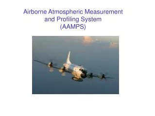
Airborne Studies of Atmospheric Dynamics Thomas R. Parish Department of Atmospheric Science University of Wyoming
Newton’s Second Law – The Equation of Motion Total Derivative Local Derivative Advection (Inertia) Term Horizontal Pressure Gradient Force Coriolis Force Geostrophic component Ageostrophic component
Geostrophic Wind • Balanced flow state • Purely rotational (non-divergent) • Often the largest component of wind • Relatively inert component of the wind Vg L H P C
Ageostrophic Wind • Unbalanced flow state • Often contains significant divergent component • Generally small component of wind • Isallobaric and inertia/advective components generally largest • Important forcing component of the wind
Measurement of Geostrophic Wind • Write Equation of Motion in isobaric coordinates • Variation of height on a pressure surface proportional to horizontal pressure gradient force • Airborne applications – use autopilot
Pre-GPS Era (before 2004) • Radar Altimeter measurements provide height above surface • Terrain maps (digital) provide terrain height assuming geographic position known with high accuracy • Height of isobaric surface is sum of above signals
Problems: • Two signals (radar altimeter heights, terrain height) large and of opposite sign • PGF is the sum of those terms, being quite small and noisy • Potential errors in both radar altimeter height, terrain height • “Artifact” problem for radar altimeter • Footprint issue for altimeter • Uncertainties in aircraft position estimates • Issues with terrain height data sets • Resulting uncertainty with “terrain registration”
Example: Great Plains Low-Level Jet • Nocturnal summertime jet maximum ~400 m agl • Competing theories for LLJ formation • Blackadar frictional decoupling • Holton sloping terrain influence
Results of PGF measurements at lowest level Flight Strategy – Repeating isobaric legs
Conclusions: • Isallobaric component of wind ~4 m/s at level maximum wind • Large changes in turbulent intensity at jet level • Blackadar frictional decoupling dominant mechanism in • forcing Great Plains LLJ
GPS Era • Avoid “terrain registration” issues • GPS provides a means to accurately map isobaric surface • Position errors from standard GPS receiver insufficient to • resolve isobaric slopes • Differential GPS required • Requires fixed base station • Position errors at base station can be used to correct • position errors for rover platform (aircraft) • Importance of acceptable satellite constellation (5 or 6?) • Position accuracy on order of decimeters • Relative accuracy probably much better
GPS04 Study – Arcata CA • Frequent summertime LLJ at top of marine boundary layer • Comparison with altimetry-derived geostrophic wind • Tested GrafNav differential processing software
GPS04 LLJ Example • Isobaric east-west flight leg south of Cape Mendocino • Nearly identical signals • dGPS calculations of Vg from most legs within 1 m/s altimetry Vg • GPS04 validated dGPS technique
Application of dGPS on atmospheric dynamics – Coastally Trapped Wind Reversals (CTWRs, also CTDs, southerly surges) 0000 UTC 22 June - 0000 UTC 26 June 2006
CTWR Forcing Issues • Kelvin Wave • Cross-coast PGF • Variations in MBL Height • Topographic Rossby Wave • Topographically-Trapped Wave • Density Current • Synoptic-scale response • Ageostrophic acceleration • Importance of synoptic-scale pressure field
23 June 2006 Example • Isobaric east-west • flight leg • Little detectable • cross-coast PGF
23-25 June 2006 CTWR Conclusions • CTWR density current • No Kelvin-wave features observed during this event • Active propagation phase highly ageostrophic • Little detectable cross-coast PGF at any time during the life history • Onset and propagation dependent on synoptic pressure field
Application: CloudGPS08 • May-June 2008, flights over high plains WY, NE, CO • Measure horizontal perturbation pressures associated with clouds • Clouds mostly in cumulus congestus phase • Differential GPS dependent on accurate measurement of static pressure
Isobaric Height Liquid Water Content (g/kg) u v W (m/s) Horizontal Pressure Perturbation (mb) θV
Liquid Water Content (g/kg) W (m/s) Horizontal Pressure Perturbation (mb)
Leg 1 Liquid Water Content (g/kg) Isobaric Height W (m/s) u v Horizontal Pressure Perturbation (mb) θV
Leg 2 Liquid Water Content (g/kg) Isobaric Height W (m/s) u v Horizontal Pressure Perturbation (mb) θV
Leg 3 Liquid Water Content (g/kg) Isobaric Height W (m/s) u v Horizontal Pressure Perturbation (mb) θV
Leg 4 Liquid Water Content (g/kg) Isobaric Height W (m/s) u v Horizontal Pressure Perturbation (mb) θV
Leg 5 Liquid Water Content (g/kg) Isobaric Height W (m/s) u v Horizontal Pressure Perturbation (mb) θV
Application: Ocean Surface Topography • Differences between GPS height, radar altimeter signal measure of ocean surface topography
Application: Ocean Surface • Topography • Reciprocal legs along 40.8°N • Consistent pattern of height • differences • Validate using multiple altimeters? • Gulf Stream flights?
Application: Ocean Surface • Topography • Reciprocal legs along 40.8°N • Consistent pattern of height • differences • Validate using multiple altimeters? • Gulf Stream flights?
Application: Ocean Surface • Topography
Conclusions • dGPS can provide precise mapping of aircraft height • Base station data rate 1 Hz • Baseline ~ 100 km? • dGPS accuracy within decimeters? • Relative accuracy higher? • Accurate measurement of static pressure permits PGF calculations • Assessment of atmospheric dynamics for a wide variety of flows Thanks to Dave Leon, Larry Oolman, Dave Rahn and Eric Parish