Clouds
Clouds. Spring 2012, Lecture 8. Problems with Clouds. Clouds are a major problem for climatologists trying to understand how the atmospheric system works, and to make predictions about how GHG will change the climate system

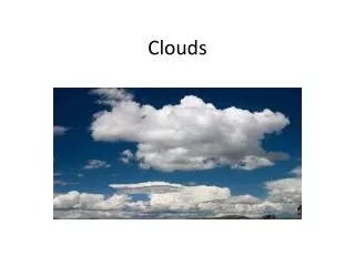
Clouds
E N D
Presentation Transcript
Clouds Spring 2012, Lecture 8
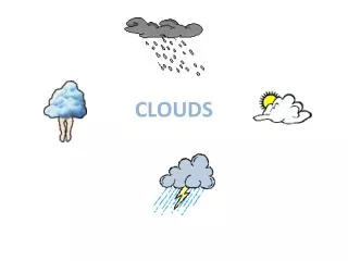
Problems with Clouds • Clouds are a major problem for climatologists trying to understand how the atmospheric system works, and to make predictions about how GHG will change the climate system • The IPCC has indicated clouds as a major problem for their predictions, and as an area needing much more research
Interaction with Radiation • Clouds interact with both visible and infrared radiation • Clouds reflect visible light, should act as a negative feedback, helping to cool the planet • Clouds trap infrared radiation, and should act as a positive feedback, warming the planet
Altitude • Clouds can occur at different altitudes within the troposphere • The interaction with radiation depends greatly on the cloud altitude • High altitude clouds play a large role in blocking IR radiation, but reflect little visible light, so they heat the planet • Low clouds reflect a great deal of visible radiation, but are ineffective at trapping IR, so they cool the planet
Clouds and Altitude • Clouds are good examples of blackbody radiators • They radiate to space at whatever temperature the cloud top is at • They trap IR radiation emitted from the much warmer ground • They radiate back to the ground at the temperature of the bottom of the cloud • This means they are net contributors of energy to the atmosphere below the cloud, and high altitude clouds are much more effective than low altitude clouds
Scattering of Visible Light • The electric field of incoming visible light excites vibrations in the water molecules • They then reradiate the same frequency light, mostly in a direction similar to the direction of the incoming radiation • The shape of the droplet influences scattering direction • The process is called scattering
Scattering vs. Absorption • In scattering, the reradiated light is visible, at the same frequency as the incoming radiation • In absorption, the incoming light is converted to thermal motion of the absorbing molecule, and is reradiated in the IR • There is always competition between scattering and absorption • Some light is scattered, some is absorbed
Scattering Fraction • The amount of light scattered depends on a number of factors • The most critical factor is the length scale of all of these structural features relative to the wavelength of the light being scattered • Density • Anisotropy (unequal variation of physical properties within a particle) • Concentration fluctuations • And others
Inability to Model • The light scattering problem is complex, and our understanding of this and other factors associated with clouds means that no physically realistic models have been developed for clouds, or how clouds might change as conditions change • This is a major roadblock, and IPCC has urder research in this area
Factors Affecting Cloud Albedo • Factors that increase albedo • Low clouds contain more water than high clouds • Clouds about to rain have more water than clouds that are not raining • Ice crystals are better at reversing the direction of light, sending it back into space
Formation of Clouds • Clouds should start to form when the relative humidity reaches 100% • Often, this doesn’t happen • It is very hard for water vapor molecules to adhere to each other and condense to form a droplet • Initially, all droplets have high surface area: volume ratios • The molecules on the surface tend to escape, destroying the droplet
Condensation Nuclei • Water will form droplets much more readily if there is something in the air to which vapor molecules can attach themselves • The “something” are known as cloud condensation nuclei • Dust particles • Smoke • Salt particles (from ocean spray) • Small biological organisms
Droplet Size • Condensation nuclei need to be about 0.1 microns in size in order to be effective • Once nucleated, droplets grow to around 5 microns • Smaller droplets will join larger droplets – Archer suggests this is urbanization of water droplets • Rain clouds will have larger droplets
How Much Water is There in a Cloud? • More than most people would think! • Animation from NPR
Types of Clouds • There are three main types of clouds • Low-altitude • Cumulus • Stratus • High altitude • Cirrus
Cloud Type Diagram:Cumulus • Cumulus clouds form when there is strong upward convection, and they resemble towers • They are low, usually between 1 and 4 kilometers • They are difficult to model because their size is smaller then the grid size of climate models
Cumulonimbus • If convention is strong they form cumulonimbus storm clouds
Cloud Type Diagram:Stratus • Stratus clouds are layered, and occur over large geographic areas where air motion is upward but slow • Slow motion makes modeling quite difficult • They are typically quite low, up to about 2 kilometers
Stratus Clouds • Dull, feature-less low clouds • Layered clouds at slightly different elevations
Cloud Type Diagram:Cirrus • Cirrus clouds form at higher altitudes, usually 8-12 kilometers • They contain only about 1-10% as much water as low altitude clouds • They are often composed of ice crystals, either by freezing of water, or by direct condensation from vapor
Cirrus Clouds • Cirrus cloud images • Image on the right is at low sun angle, when clouds may be illuminated after the sun is not reaching the ground
Effect of Cirrus Clouds • Cirrus clouds are thin, and do not block incoming radiation much, so they have little effect on visible albedo • They absorb IR radiation from the ground • Because they are cold, they re-emit the radiation at much lower temperatures • Intensity is less • Half of the re-emission is directed downward
Clouds in the Future • It has often been said that as climate warms, there will be more clouds • Warmer temperatures will mean more water will evaporate • However, warmer temperatures also mean that the amount of water vapor the air can hold will go up, so relative humidity may not reach 100% • This also contributes to the difficulties with modeling cloud behavior correctly
How Does Cloud Temperature Affect Albedo? • It had been thought that warmer clouds would have higher albedo, because they contain more water vapor • George Tselioudis, William Rossow and David Rind of GISS examined satellite data measuring the amount of sunlight reflected by low-level clouds • They found these clouds were actually brighter when the air was cold than when it was warm
Why Are Cold Clouds Brighter • Anthony Del Genio and Audrey Wolf helped to explain why • “The atmosphere above cold ground tends to remain calm, like a pot of water on a stove before the flame is turned on • Water vapor molecules evaporated into such air, or blown in from other places, can build up and form a thick layer of clouds that reflects sunlight well • However, the air above warm ground becomes turbulent, like a pot of hot or boiling water • The warm currents of rising air (the kind that gliders use to stay afloat) carry water vapor molecules up and away, preventing clouds from forming close to the ground • Instead, only a thin layer of not very reflective clouds develops a kilometer or two above the ground, at the altitude where rising air currents terminate”
How Will This Effect Climate Change? • Yao et al. used the GISS global climate model to predict changes in different types of clouds, and the sensitivity of the climate, to a doubling of carbon dioxide concentration • They found that low-level clouds in the model behaved much the same as anticipated from satellite and surface data. • At midlatitudes, clouds became a bit thinner and less reflective in the simulated warmer climate • Clouds became less reflective in the tropics as well, but for a different reason: clouds in the warmer climate lost more of their water due to greater rainfall • Other types of clouds did not behave in the same way - For example, the big "anvil" clouds that accompany thunderstorms at high altitudes became more extensive and brighter in the warmer climate, instead
Cancellation of Effects • Changes in low- and high-level clouds mostly cancelled each other out, so the net global effect of the clouds did not differ very much in the warmer climate scenario from that in today's climate • This scenario differs considerably from what many climate scientists had been assuming in the 1990s • It had been thought that brighter clouds would partly "save" us from significant global warming, by reflecting more energy into space • Instead, these results suggest that clouds are not necessarily the white knight that will rescue us from climate change
TC4 Project • NASA’s study of the Tropics • TC4 stands for Tropical Composition, Cloud and Climate Coupling
Anthropogenic Modification of Clouds • Humans can modify, or create, clouds in a variety of ways • Cirrus clouds may be created by jet contrails • In the absence of condensation nuclei, air may remain supersaturated almost indefinitely • Water may be inserted into the stratosphere • As jets fly, they emit water vapor, formed by combustion of hydrogen in the hydrocarbon fuel, and particles, some of which can serve as condensation nuclei
Jet Contrails • The white contrail is caused by condensation of water as the emissions cool off • The contrail grows with time due to droplets serving as condensation nuclei, taking water from the air • The cloud particles spread with time, becoming indistinguishable from cirrus clouds • Particle matter and CO2 are usually not visible
Jet Contrails vs. CO2 • Contrails would dissipate within a few days if we stopped creating them • They warm the planet, just as CO2 does • CO2 will remain in the atmosphere for a century or so
Pollution and Low-Altitude Clouds • Smoke particles can affect low clouds • The most effective particles are those composed of sulfur compounds, usually from coal • Sulfur is usually emitted as sulfur dioxide, SO2 • It oxides in air, with a time frame of about 1 week • SO2 + 2 H2O→ H2SO4 • H2SO4 is sulfuric acid
Sulfuric Acid Properties • Sulfuric acid is hygroscopic, which means it as a great affinity for water • Sulfuric acid rapidly forms droplets in the atmosphere • These droplets are weaker solutions of sulfur acid, but they attract still more water, and the droplets grow • When it rains, the sulfuric acid droplets are washed out of the atmosphere as acid rain • Acid rain is a serious environmental problem • It is typically found in areas downwind of major industrial or population centers, especially those using coal
Other Condensation Nuclei • Natural condensation nuclei include sea salt, dust, pollen, and smoke • Anthropogenic sources include dust and smoke generated by man • The next slide shows an example of manmade cloud formation, as observed by the MODIS satellite