Download
1 / 25
250 likes | 272 Views
Join us at the Missouri Mid-America Contingency Planning Forum Fall Symposium for a discussion on earthquake preparedness, outreach, and education efforts in Missouri. Learn about the state's earthquake program and participate in earthquake exercises. Don't wait for the next earthquake - be prepared!

E N D
Earthquakes in Missouri Mid-America Contingency Planning Forum Fall Symposium September 17, 2015 Ballwin, MO
Missouri’s Earthquake Program • Outreach and Education (Preparedness) • Earthquake Awareness Month during February • Great Central U.S. ShakeOut during October • Catastrophic Planning Efforts • MO Seismic Safety Commission • Structural Assessment & Visual Evaluation (SAVE) Coalition • Support for Earthquake Exercises
50+ Years Of Events Source: Dr. Greg Hempen, MO Seismic Safety Commission
St. Louis Area Earthquakes Since 1811 at least a dozen earthquakes have caused minor damage in St. Louis. (Public domain information: Saint Louis University Earthquake Center, St. Louis, Mo., 1999, http://www.eas.slu.edu/Earthquake_Center/EQInfo/Flyers/central_u.html)
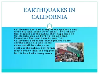
Mt. Carmel, IL. April 2008 • Felt in more than 20 states and across Missouri Photos: St. Louis University Earthquake Center
Earthquake ground motions stay Stronger over greater distances in the Eastern US M5.4 Alum Rock, CA Oct 30, 2007 M5.2 Mt. Carmel, IL, April 18, 2008 400 km 400 km 200 km 200 km Figure courtesy of Dave Wald, USGS
New Madrid Seismic Zone Catastrophic Planning: • The Response Challenges Approximately 7 million people at high risk • No notice event that is not commonly recognized • Large area of impact - 126,575 Sq. Miles • Multiple jurisdictions with multiple governors • Significant infrastructure impacts • Response challenges multiple earthquakes/ aftershocks • Poor situational awareness • Security demands • Mass care/shelter needs • Major housing, evacuation, & relocation needs • Urban & Isolated areas St. Louis 348 K 2 mil metro 5 Million Rural Pop. 160 – 200 Cities IL IN MO KY TN AR AL MS Memphis 655K 1.3 mil metro
Planning: New Madrid Seismic Zone Concerns • Earthquakes are no-notice events • Midwest geology allows quakes to be felt over a much wider area than those in places like California • Softer soils commonly located in river valleys amplify the earthquake effects • Those same soils can also liquefy for a short time • Many older buildings are made of unreinforced masonry and are vulnerable to shaking • The public generally does not prepare for “low probability, high-consequence events” • The effects of such an earthquake or earthquakes could be far beyond other disasters we have faced in Missouri • Missouri will not be the only state affected by these quakes and so will not be able to assist neighboring states, while competing with them for outside resources
Missouri SAVE Coalition Engineers Architects Building Inspectors Other Qualified Individuals Certified Under SAVE All Volunteer Professionals
What SAVE Does • Mostly Rapid Visual Inspections per Applied Technology Council-20 and ATC-45 • Exterior Only, Structural Life Safety • Post Inspection Placards: • Joplin EF-5 Deployment Data used by FEMA, Missouri National Guard, NIST, and ASCE Researchers
How SAVE Activates EVENT OCCURS Governor Declares Emergency Local Government Requests Building Inspection Help from SEMA S.A.V.E. Teams Begin Deployment
Joplin EF-5 Event Time Line • May 22nd 5:41 pm Tornado Strikes • May 22nd 5:42 pm Search and Rescue Efforts Begin • May 23rd 8:10 am S.A.V.E. Regional Coordinators Begin Phone Tree Call Down • May 24th 10:39 pm City of Joplin Requests Building Inspection Help from SEMA • May 25th 10:19 am S.A.V.E. SW Regional Coordinator Deploys to Joplin • May 26-28 S.A.V.E. Inspection Team Deployment
SAVE Members in Joplin - 2011 Photo Credit: Jeff Hower – S.A.V.E.
Example Unsafe Building Photo Credit: Ben Ross – S.A.V.E.
Results • More than 7,700 Structures Inspected • 36% Unsafe • 6% Restricted Use • 58% Did Not Present Life Safety Problems
Exercising Our Plans • October 15, 2015 – Great Central U.S. ShakeOut earthquake drill • October 16-17, 2015 – SAVE Coalition exercise at Jefferson Barracks • August 2016 – National-Level Mass Care earthquake exercise in Missouri
St. Louis Area Earthquake Hazard Mapping Project Expanded area of the House Spring and Maxville 1:24000 quadrangle map Shows areas of Liquefaction Collapse Landslide potential
Thank You! Steve Besemer, SNS/Medical Countermeasures Planner Office: (573) 526-9377 E-Mail: steve.besemer@sema.dps.mo.gov Jeff Briggs, Earthquake Program Manager Office: (573) 526-9232 E-Mail: jeff.briggs@sema.dps.mo.gov Missouri State Emergency Management Agency P. O. Box 116, 2302 Militia Drive Jefferson City, MO 65102