Download
1 / 1
10 likes | 82 Views
Analyzing earthquake footage to simulate M7.8 ShakeOut Scenario, capturing low-frequency, long-duration shaking with varying intensities and distances. Utilized Google Earth Pro and iMovie for accurate depiction.

E N D
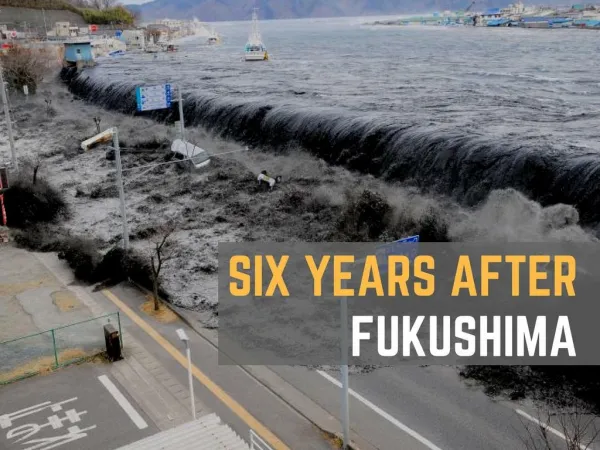
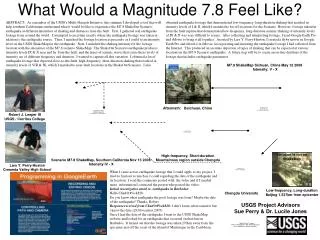
obtained earthquake footage that demonstrated low-frequency, long-duration shaking that resulted in intensity levels of I & II, which I matched to far off locations for the Scenario. However, footage taken far from the fault rupture that demonstrated low-frequency, long-duration seismic shaking of intensity levels of IX & X was very difficult to secure. After collecting and interpreting footage, I used Google Earth Pro and iMovie to bring it all together. Assisted by Lars Y. Perry-Huston, I created a flyby movie in Google Earth Pro and edited it in iMovie, incorporating and narrating the earthquake footage I had collected from the Internet. This produced an accurate depiction of types of shaking that can be expected at various locations in the M7.8 Scenario earthquake. A future step will be to create an on-line database of the footage that includes earthquake parameters. M7.9 ShakeMap Sichuan, China May 12 2008 Intensity: V - X What Would a Magnitude 7.8 Feel Like? Aftermath: Beichuan, China Robert J. Leeper III USGS / Cerritos College ABSTRACT: As a member of the USGS’s Multi-Hazards Initiative, this summer I developed a tool that will help southern Californians understand what it would be like to experience the M7.8 ShakeOut Scenario earthquake at different intensities of shaking and distances from the fault. First, I gathered real earthquake footage from around the world. I attempted to ascertain exactly where the earthquake footage was taken in relation to the earthquake source. Then, I matched the footage location as precisely as I could to an intensity level on the USGS ShakeMap for the earthquake. Next, I matched the shaking intensity for the footage location with the intensities of the M7.8 scenario ShakeMap. The ShakeOut Scenario earthquake produces intensity levels IX & X near and far from the fault, and the types of seismic waves that cause these levels of intensity are of different frequency and duration. I wanted to capture all this variation. I obtained a lot of earthquake footage that depicted close-to-the-fault, high-frequency, short-duration shaking that resulted in intensity levels of VIII & IX, which I matched to near-fault locations in the ShakeOut Scenario. I also Location is not on ShakeMap High-frequency, Short-duration Mountainous region outside Chengdu Scenario M7.8 ShakeMap, Southern California Nov 13 2008 Intensity IV - X Lars Y. Perry-Huston Cresenta Valley High School When I came across earthquake footage that I could apply to my project, I tried to find out as much as I could regarding the date of the earthquake and its location. I read the comments posted with the video and if I needed more information I contacted the person who posted the video: Initial investigative email re. earthquake in Barbados: Hello Chad@#%ck828. Do you know what earthquake the pool footage was from? Maybe the date of the earthquake? Thanks, Robert Response received from Chad@#%ck828: I don’t know what caused it but i know the date.(29,November,2007) Once I had the date of the earthquake I went to the USGS ShakeMap website and looked for an earthquake that occurred on that date in Barbados. It turned out that the footage was taken 270km away from the epicenter just off the coast of the island of Martinique in the Caribbean. Low-frequency, Long-duration Beijing 1,537km from epicenter Chengdu University USGS Project AdvisorsSue Perry & Dr. Lucile Jones