Download
1 / 30
340 likes | 951 Views
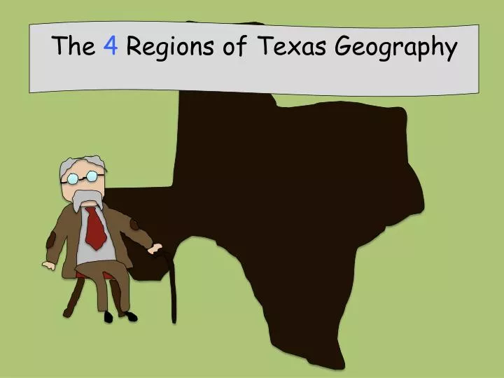
The 4 Regions of Texas Geography. region: an area of land with similar characteristics (like a desert) escarpment: a steep cliff formed by fracturing of the Earth’s crust border: the line that separates two countries, states, etc. plains: flat land

E N D
region: an area of land with similar characteristics (like a desert) escarpment: a steep cliff formed by fracturing of the Earth’s crust border: the line that separates two countries, states, etc. plains: flat land product: something produced by labor soil: dirt
More Vocab… • Prairie- Large area of flat land, with few or no trees(similar to a plain). • Plateau- High, wide area of flat land, with steep sides. • Bayou(swamp)- Very shallow and marshy water covering low lying land filled with trees…and gators!!!
Even more vocab…. • Coast- Land at the edge of a large body of water, such as the ocean. • Desert- Very, very, dry land. • Aquifer- Underground, water bearing formation that is used for irrigation and drinking water.
Seriously. More?? • Canyon- Steep, narrow valley with high sides, and often has a river or stream flowing through it. • Barrier Island: An island that protects the coast from erosion. • Climate: Average weather of a place over a period of 20 to 30 years.
What kind of weather do you like? Do you like it better hot or cold? What kind of elevation/terrain do you like? Hilly or flat, grassy or desert etc? Would your answers change if you lived two hundred years ago?
Notice how the elevation of Texas keeps going up as you travel WEST. Why does the elevation of Texas change as you head west? Elevation- How high above sea level is the land?
Answer: The Balcones Escarpment. Balcon means balcony in Spanish. The Balcones Escarpment
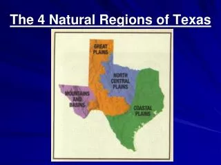
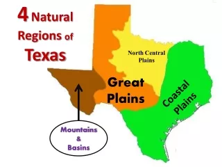
The 4 Regions of Texas Back in Mrs. Green’s day, she had to memorize the 26 regions of Texas: you have it easy! 3 2 1 Balcones Escarpment 4
Products- Population- Landscape- Oklahoma Lumber, cotton, rice, fishing, oil, citrus fruits, cattle ranching. ARKANSAS Red River 48 Big population. The largest cities are here: Dallas, Austin, Houston, San Antonio Dallas Mostly flat. Becomes more hilly as you move west. Lots of rivers and lakes. Houston San Antonio Gulf of Mexico Mexico
The “5th” Region: The Piney Woods (located in the Gulf Coastal Plains)
Caprock escarpment Red River 35 Products- Population- Landscape- Cattle and sheep ranching, oil, farming (wheat and cotton). Medium. Less than the GCP. Fort Worth, Abilene, Waco, San Angelo, Austin. Mostly flat. Some hills. Hottest summers in the state, violent storms and tornadoes, cold winters.
This region is mostly flat, but does have some other landforms: plateaus canyons
New Mexico Lubbock 20 Products- Population- Landscape- Cattle and sheep ranching, oil, farming (wheat and cotton). Low percentage. Amarillo, Lubbock, Midland, Odessa, Austin. Mostly flat. Some hills, plateaus and canyons. Palo Duro Canyon. Windy, dry, very cold in winter-coldest region of Texas! Sand and snow storms!
8 Products- Population- Landscape- Some cattle ranching. A little farming along the Rio Grande. Oil, trade with Mexico. El Paso Very low. Very few towns. Alpine, El Paso, Fort Stockton. Deserts and mountains. Driest area of the state. Warm most of the year. Rio Grande Mexico
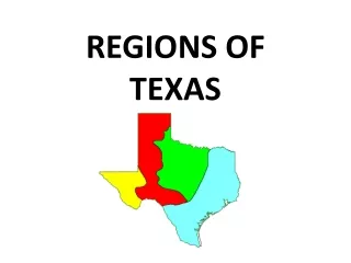
Caprock Escarpment Balcones Escarpment Mountains and Basins Great Plains Central Plains Gulf Coastal Plains