Download
1 / 18
180 likes | 201 Views
Welcome to the CCNMP Transportation Study Open House! Please look at the displays, ask questions, and give us your comments on transportation issues in Chickamauga Battlefield and surrounding areas.

E N D
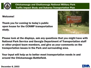
Welcome! Thank you for coming to today’s public open house for the CCNMP transportation study. Please look at the displays, ask any questions that you might have with National Park Service and Georgia Department of Transportation staff or other project team members, and give us your comments on the transportation issues in the Park and surrounding area. Your input will help us to better meet transportation needs in and around the Chickamauga Battlefield.
Study Purpose The National Park Service (NPS) is sponsoring a consultant study to evaluate changes in traffic patterns in and around the Chickamauga Battlefield Park resulting from the completion of the US 27 Relocation in Walker County, Georgia. The study has 2 components: a Traffic Impact Study and a Subarea Transportation Plan. • Study Focus • Analyze current travel patterns • Evaluate impacts of future growth and development in the area • Recommend short- and long-term transportation improvements that reflect needs of both the Chickamauga Battlefield Park and surrounding communities
Subarea Transportation Plan Study Area Chickamauga Battlefield unit of the Chickamauga and Chattanooga National Military Park Approach Address the unique needs of the Park and its role as an important local, and national cultural and historic resource. Consider the visitor experience within the transportation context. • Products • Set of viable transportation alternatives that reflect the unique needs of the Park and preserve its role as an important local and national cultural and historic resource. • Recommendations will be considered by NPS in preparation of Park’s new General Management Plan.
Traffic Impact Study Study area Portions of Walker and Catoosa Counties surrounding the Park • Approach • Review existing and future transportation needs and identify short and long term solutions. • Evaluate the impact of the US 27 relocation on traffic volumes and congestion in the surrounding area. • Address environmental justice considerations as part of the process. • Products • Program of transportation improvements in a format suitable for consideration in Chattanooga Hamilton County Metropolitan Planning Organization transportation planning process.
We need your input! We need your input on how you travel in the area and your experience with the transportation facilities. • We specifically want to know: • Any problems that you may have as a motorist, cyclist or pedestrian. • Suggestions on any changes to area transportation facilities or services. • Please take a few minutes to fill out the public comment form and place it in the box. • Your comments will be reviewed and included in our analysis. • Thank you.
Sensitivity Rating High Moderate Low Chickamauga Battlefield Road Sensitivity
Traffic Impact Study Area Crash Rates Source: Georgia Department of Transportation For planning purposes only
Study Area – Refined 2025 MinUTP Model LRTP Network Source: Cambridge Systematics For planning purposes only
Traffic Impact Study – Questionnaire Responses • US 27 Relocation • 79 percent use US 27 relocation • 60 percent said US 27 relocation • saves time • 23 percent do not use US 27 relocation because it is not convenient or they enjoy using LaFayette Rd. • Desired Improvements • Improve commuter routes and transportation network • Better signage and wayfinding around Chickamauga Battlefield Park • Enhance gateways to Park through street-scaping and beautification • Study Area Concerns • Traffic Operations • Mis-timed signals on Battlefield Pkwy • Access limitations on US 27 relocation and • Wilder Rd., Osburn Rd., McFarland Gap Rd. Source: 52 questionnaires received from the public, Environmental Justice communities and stakeholders
Traffic Impact Study – Capacity • Existing Capacity Findings • V/C* ratios > 1 primarily on North - South roads leading into Chattanooga • US 27/LaFayette Road/Chickamauga Ave. • Page Rd./McBrien Rd. from Lakeview Dr. to US 41 • Schmidt Rd. from McFarland Gap Rd. to Battlefield Parkway • Existing Capacity Findings • V/C >1 on East - West roads • Battlefield Pkwy. from Dietz Rd. to Pine Grove Rd. • Future Capacity Projections • Traffic will nearly double • Redirection of traffic from LaFayette Rd. vehicles to US 27 Relocation will continue Source: Cambridge Systematics *V/C – Volume-to-Capacity ratio: Vehicle volume on roadway divided by capacity as calculated in the Highway Capacity Manual ** E+C – Existing and committed projects in the Chattanooga 2004-06 Transportation Improvement Program *** LRTP – Chattanooga 2025 Long Range Transportation Plan projects
Traffic Impact Study – Safety • Findings • GDOT Crash Data • Major Roads (2001) – • 813 crashes and 1 fatality • US 27 Relocation (2002 partial) - • 24 crashes • Crash Profile • Manner of Collision • Head on collisions with a vehicle – 2.3% • Angle – 27% • Rear end – 42% • Sideswipe – 9% • Non-vehicle collisions – 20% Crash Rates Source: GDOT
Traffic Impact Study – Gateway to the Chickamauga Battlefield • Planned Gateway Improvements and Surrounding Activity • Primary Gateways • LaFayette Road • Bike lanes • McFarland Road • Interpretive signage • Reed’s Bridge Road • Part of West Chickamauga Creek greenway • NPS interest in the bridge • Secondary Gateways • Alexander Bridge Road • Residential development • US 27 Relocation • Walker County land use overlay under development • Lytle Road • Residential development • Burning Bush Road • Residential development • Other Gateways and Surrounding Areas • West Chickamauga Creek • Recommended planned greenway • City of Chickamauga • Desire to be the Gettysburg of the South
Subarea Transportation Plan – Questionnaire Responses • LaFayette Road • 46 percent use LaFayette every week • 44 percent rarely use LaFayette Rd. • 57 percent use LaFayette Rd. to travel through Park to other destinations • 36 percent use LaFayette to visit Park • Desired Improvements • Increase speed limit within the Park • Decrease speed limit within the Park • More facilities for transportation alternatives such as bicycle lanes, improved walking paths and equestrian facilities • Study Area Concerns • Motorist Concerns • Speed limit – Too Fast/Too Slow • Poor condition of roads • Cyclist and Pedestrian Concerns • Too much traffic and cars moving too fast Source: 52 questionnaires received from the public, Environmental Justice communities and stakeholders
Subarea Transportation Plan – Park Road Sensitivity Evaluation • Evaluation factors • Association with Historic Period • Interpretive Value • Historic Integrity • Auto Tour Route • Visitor Experience • Scoring scale of 3 points per factor • (15 maximum per feature) • Sensitivity Rating Categories • Based on cumulative score • High Sensitivity – 13 to 15 points • Moderate Sensitivity – 10 to 12 points • Low sensitivity – 9 or fewer • Out of 28 Miles of Park Roads: • 66% rated High Sensitivity • 20% rated Moderate Sensitivity • 14% rated Low Sensitivity • High Sensitivity Roads included: • Glenn-Kelly Road • Alexander Bridge Road • LaFayette Road • Reeds Bridge Road • Glenn-Viniard Road • Brotherton Road
Subarea Transportation Plan – Capacity, Parking, Safety • Safety Analysis Findings • Examined Park Crash Data for 1996, 1997, 2002, 2003 (Jan-May) • Crashes have decreased since the opening of the US 27 relocation • Before – 75% on LaFayette Road • After – 26% on LaFayette Road • 38% of crashes occurr during the Fall • 46% involved striking a deer • Capacity Findings • Current • Special standards for Park area were used • No apparent capacity problems • Future 2025 LRTP • Volume increases have occurred, but no excessive capacity problems were found • Parking • No reported parking problems • Parking deficiencies are sporadic • Surface Type: Asphalt/Gravel/Curb & gutter • Number: 1 to 2 spaces at interpretive stations to 90 spaces at the Visitor Center Source: National Park Service
Summary to Date • Traffic Impact Study • Qualitative Findings • US 27 relocation has improved mobility • Traffic operations improvements needed • Economic development is important • Quantitative Results • Safety is a problem at select locations • Capacity improvements needed • Traffic operations improvements needed • Subarea Transportation Plan • Qualitative Findings • Visitor Experience • Too much traffic on LaFayette • Speed a problem • Quantitative Results • Safety improved after US 27 relocated • Capacity does not appear to be a problem • Sensitivity of Park Roads
Next Step – Alternatives Testing • Traffic Impact Study • Potential Alternatives • Additional capacity • US 27 extension from Battlefield Parkway terminus north to SR 146 • Widening of SR 146 • North-South improvements east of Park • Capacity improvements on LaFayette Rd. leading into Tennessee • Traffic operations improvements • Battlefield Parkway, capacity, geometrics or timing improvements • Streetscape and signage • Improved signage/wayfinding • Pedestrian/streetscape improvements on LaFayette Road between Battlefield Parkway and Park • Subarea Transportation Plan • Potential Alternatives • Alternative modes in the Park • Parking improvements • Wayfinding and visitor information • Operational implications on capacity and safety at critical sensitive sights • Create one-way loop in Park in conjunction with expanded auto tour • Speed modifications on LaFayette Road