Download
1 / 16
160 likes | 171 Views
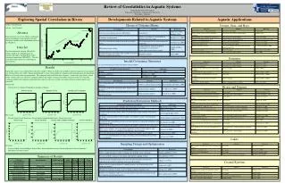
This analysis examines the results of GSVS14 GPS data, including pointwise accuracy, leveling data analysis, and geoid models used for comparisons. The study also highlights potential areas for improvement and future research.

E N D
GPS data analysis • sh (OPUS-S) : pointwise ±2 cm • GPSCOM combination sDh: ~ 4 mm • no significant baseline (length and number of sites) dependency
Leveling data analysis • Interpolated NAVD88 gravity employed in adjustment to determine NAVD88 published height • Measured gravity used determine the orthometric height for geoid validation • Empirical accuracy formula used for the orth. Height differences • => Maximum error of 12.5mm between any pair marks along GSVS14
DoV data analysis • DoV accuracy estimated from star images and re-observations: • sx , sh: better than ± 0.05” No systematical error detected from CODIAC • Accuracy of geoid profile computed from DoV: ~ ±0.2 mm /1km =>Maximum error of 6.5 mm between any pair of marks along GSVS14 by law of error propagation
Geoid models used in comparisons • GEOIDA: Combination of GOCO03S, GRAV-D data and terr. data by spherical harmonics • GEOIDB: Combination using Stokes integral • GEOIDC: xGEOID type solution, using EIGEN6VC4 as reference model • EGM2008 • Geoid_DoV: computed from DoV data Additional models tested • USGG12: Older NGS scientific geoid • xGEOID15B_ref: see NGS website • xGEOID15B: see NGS website
Differential Goied Comparison (removing 40km at west side, cm)
Additional geoid comparisons(GPSL-model) at 204 official marks
Conclusions GPS/L geoid profile of GSVS14 should have an accuracy better than ±1.0 cm between any two marks. CODIAC camera accuracy may be at ± 0.05”, implying a ± 6.5 mm accuracy between any two marks. GRAV-D airborne gravity and satellite model GOCO3S help improve the geoid accuracy to 1.5 - 2.0 cm A larger discrepancy at the west side of the survey near the Rocky Mountains leaves room for further improvement by cleaning the surface gravity data.
Future Work Research on clearing the terrestrial gravity data Better spectral weights for satellite, airborne and terrestrial data Terrain effect Better understanding of GPS errors by using DoV data GSVS17 – High elevation, rough topography (Rocky Mountains!)