Download
1 / 13
130 likes | 140 Views
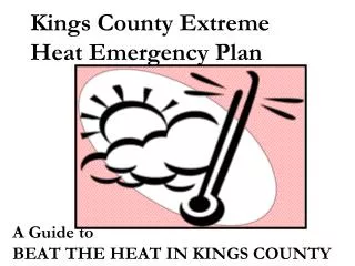
This study aims to spatially identify population risk to extreme heat and options for urban green adaptation at the neighborhood level in El Paso and Ciudad Juárez. Using a conceptual framework of risk, exposure, and vulnerability, the analysis examines the relationship between extreme heat exposure, vegetation abundance, and social vulnerability. The findings can inform urban greening strategies to mitigate the impacts of extreme heat in these border metropolises.

E N D
Spaces of Heightened Risk to Extreme Heat in a Border Metropolis Tim Collins, UTEP Sociology & Anthropology Collaborators: Sara Grineski, Paula Ford, Raed Aldouri, Gilberto Velázquez-Angulo, Lourdes Romo Aguilar, Rosa Fitzgerald, Marcelo Korc El Paso Heat-Health Workshop, 13 July 2016
Study Purpose/Framework • Purpose: To spatially characterize population risk to extreme heat and urban greening adaptation options at the neighborhood level for El Paso and Ciudad Juárez • Conceptual framework (Wisner et al. 2004) • R(risk) = H(exposure to extreme heat) × V(social vulnerability) (Wisner et al. 2004)
Methods: Unit of Analysis • El Paso (TX) and Ciudad Juárez (CH) • “Neighborhoods”: census block groups and áreasgeoestadísticasbásicas (AGEBs)(Collins et al. 2009)
Methods: Approach to Analysis Several linked steps: develop variables for extreme heat exposure and vegetation abundance at the neighborhood level construct variable for social vulnerability to extreme heat at the neighborhood level map extreme heat, vegetation abundance, and cumulative heat vulnerability at the neighborhood level conduct spatial statistical analysis of extreme heat—vegetation abundance—social vulnerability relationships to identify areas most suitable for urban greening
Cumulative Heat Vulnerability (social) 9 variables (corresponding with Reid et al. 2009): Mean income (-) Mean education (-) Percentage age ≥ 65 (years) (+) Population density (+) Percent disabled (+) Percent lacking plumbing (+) Percent lacking kitchen (+) Percent lacking telephone (+)
Some of the Limitations • Lack of compatible bi-national health data • In general, lack of data on heat-health outcomes at fine spatial scales • Data are centered on the year 2000, and it’s 2016 • Not focused on the stakeholder engagement and coordination needed to implement extreme heat adaptation projects (including those involving urban greening)
Acknowledgements • We dedicate this work to Paula Ford. • To Bill Hargrove (CERM at UTEP) and Marcelo Korc (PAHO, El Paso Office) for helping to assemble the research team and for supporting our efforts on this the project. • This project was supported by the Southwest Consortium for Environmental Research and Policy (SCERP) EPA Cooperative Agreement EM 83486101-01. The content is solely the responsibility of the authors and does not necessarily represent the official views of CERM, UTEP, SCERP, or the US Environmental Protection Agency.