Download
1 / 21
210 likes | 386 Views
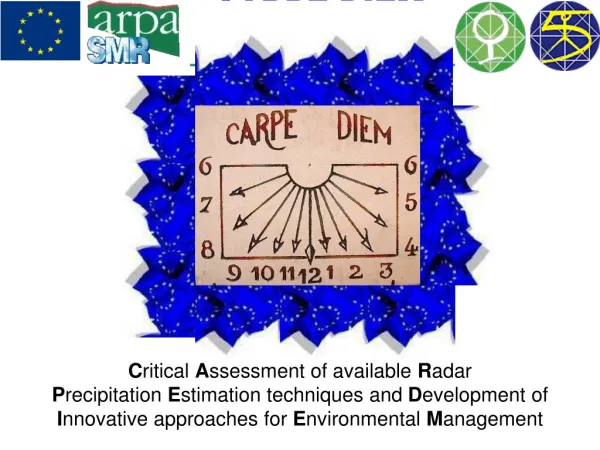
C ritical A ssessment of available R adar P recipitation E stimation techniques and D evelopment of I nnovative approaches for E nvironmental M anagement. Once upon a time …. Starting Point PADRE DARTH May 1998 - Meeting at Teolo June 1999 - RANSHA Feb 2000 - RAINFLOOD

E N D
Critical Assessment of available Radar Precipitation Estimation techniques and Development of Innovative approaches for Environmental Management
Once upon a time ….. • Starting Point • PADRE • DARTH • May 1998 - Meeting at Teolo • June 1999 - RANSHA • Feb 2000 - RAINFLOOD • Feb 2001 - CARPE DIEM • Jan 1st 2002
General Overview • What is CARPE DIEM ? • It is a shared-cost project co-founded by the Research DG of the European Commission within the RTD activities of a generic nature of the Environment and Sustainable Development sub-program (5th Framework Programme) • Duration: 36 months • Status: started • Period : 01/2002 - 12/2004
General Overview • 7 European Countries (I,D,UK,FIN,S,IRL,ES) • 9 Partners • 2 National Weather Services (SMHI, FMI) • 1 Regional Weather Service (ARPA-SMR) • 3 Universities (U.Essex, U.Barcelona, NUID) • 2 Research Institutes (DLR, ISAO-CNR) • 1 Research private company (PROGEA) • One sub-contractor (SMC) • Total Budget 2,501,444 • EU-Founded1,659,747 • Total work-load 476 man-months ( 395 + 81)
General Overview The Consortium
Project Objectives • Problem to be solved • Flooding is a major world-wide problem which seems to have increased in severity within the last decade. • The crucial role-played by rainfall accumulation, that is the main forcing variable of surface hydrological processes, need to be better examined to understand the flood forecasting uncertainty linked with the present state of the art rainfall estimation and forecasting techniques. • The accuracy of extreme precipitation forecasts and consequent floods forecasts is of extreme importance in preventing loss of life, health and psychological damage and infrastructure and property loss or damage. • Extreme rainfall events are also important in the generation of landslides and benefits in terms of risk assessment will follow from the increased understanding of the generating mechanisms and spatial distribution of heavy rainfalls.
Project Objectives • CARPE DIEM aims to improve the quality of flood forecasting for small and medium size catchments developing an innovative methodology to exploit radar data (Doppler moment, reflectivity and polarisation information) in order to enhance rainfall estimation and prediction. • SCIENTIFIC OBJECTIVES • The processing of the retrieved atmospheric parameters so that they can be ported into NWP algorithms. The information injected into the NWP will be processed be to be compatible with the atmospheric state. • Improve the techniques for assimilation of radar data in NWP models, with emphasis on the forecasting of flooding events and on nowcasting. • Improve the quality of radar products using NWP results. • Improve the quality of radar rain retrieving techniques. • Establish quality control procedure for filtering raw data. • Improve the quality of the rainfall field inputs to hydrological models. • Assess the sensitivity of hydrological models to input data. • Improve the useful lead-time and reliability of forecasted floods.
Project Objectives • GENERAL POSITIVE FALLOUT • Generate synergy between radar-meteorologists, numerical modelling groups and hydrologists, as well as river basin managers and flood control/disaster relief personnel. • Improve the transnational collaboration and the complementary skills of the participants. • Involve a panel of pan-European End-Users in the definition of project outcomes. • Involve a panel of pan-European End-Users in the validation of project outcomes.
Project Objectives The essential contribution coming from the End-Users panel ensure that the CARPE DIEM results will be directly put into action with immediate benefits at local/national and European scale. Direct advantages are foreseen in flood management.
Project Objectives • Expected impacts: CARPE DIEM’s main goal is to improve the overall quality of flood and flash-flood forecasting. The improvements in severe storm precipitation deposit both estimated and forecasted, are of primary importance, also, for users community beyond that the “flood users”. Ancillary advantages are also expected in other fields. • A better identification of the rain phase, as well as a better snow forecast, is important in all Northern European countries for snow clearance procedure. • Better precipitation phase identification is also crucial for forecasting winter floods, which have been severe in Central Europe during the 90s. In heavy winter precipitation the areal distribution of phase determines whether preventive actions should be started against accumulated snow. • An improved estimation of rain deposit in urban catchment has a direct feedback into the sewage management. • A better understanding of how the Doppler radar data could be used in operational suite of NWP models. In this context weather radar can be used in a secondary role to fill gaps in a network of wind profilers and autosondes. • The software tools developed to identify ANAPROP could be easily adapted and adopted for exploitation by a wide range of end users, particularly weather bureaux employing radar to quality-control radar data • The involvement of members of CARPE DIEM in the HIRLAM team and the COSMO consortium ensures that the assimilation systems developed to ingest radar data are, in future, used in the operational suite of these advanced models.
Project Objectives RELATED PROJECTS • COST-717 – Use of radar observation in hydrological and NWP models. • International HIRLAM-5 • COSMO – Consortium for Small scale Modelling. • The Baltic Sea Experiment (BALTEX) • Mesoscale Alpine Program (MAP)
Structure & workplan TSC End-UserPanel
Structure & workplan • Technical Steering Committe • Provide advice, criticism and guidance to the Co-ordinator and project participants in order to ensure a more efficient execution of the proposed tasks and WP. • Provide requirements and feedbacks for the correct development of products following specific users’ needs. • Evaluate contributions from all partners and decide on their quality.
Structure & workplan Co-ordination Area WP 1 Research Area Data Assimilation Flood Forecasting Improving radar derived parameter WP 2 WP 6 WP 3 WP 7 WP 9 WP 4 WP 8 WP 5 WP 10 Results Feedback Requirements WP 11 WP 12 Dissemination Area End- users Area
Structure & workplan WORK to do We are here
Structure & workplan project deliverables Great total : 41 First Year: 6+5
Structure & workplan MUSIC EURAINSAT
Dissemination plan • End-Users • Web site • Conferences • Mid-term Workshop (SMHI) • Final Workshop (ARPA) • Scientific Papers