Download
1 / 23
230 likes | 429 Views
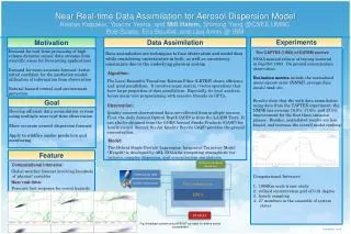
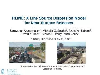
RLINE: A Line Source Dispersion Model for Near-Surface Releases. Saravanan Arunachalam 1 , Michelle G. Snyder 2 , Akula Venkatram 3 , David K. Heist 2 , Steven G. Perry 2 , Vlad Isakov 2 1 UNC / IE, 2 U.S.EPA/NERL/AMAD, 3 UCR.

E N D
RLINE: A Line Source Dispersion Model for Near-Surface Releases Saravanan Arunachalam1, Michelle G. Snyder2, Akula Venkatram3, David K. Heist2, Steven G. Perry2, Vlad Isakov2 1UNC/IE, 2U.S.EPA/NERL/AMAD, 3UCR Presented at the 12th Annual CMAS Conference, Chapel Hill, NC October 28 – 30, 2013
Background • 59.5 million people live within 500m of roads with > 25,000 Annual Average Daily Traffic (AADT) Source: Rowangould, Transport Research Part D, 2013
Illustrative AADT in Urban Area Source: Michigan DOT
Why was RLINE Developed? • Based on Science Advisory Board and the National Research Council recommendations, EPA-ORD initiated research on near-road air quality and health effects • Field measurements indicated that exposures to traffic-emitted air pollutants near roads can be influenced by complexities of roadway configurations (noise walls, depressed sections, etc.) • To improve exposure metrics for future health studies, ORD initiated model development project to account for these important parameters
What is RLINE? • RLINE is EPA -ORD's research dispersion modeling tool for near roadway assessments • based on a steady-state Gaussian formulation • currently formulated for near-surface releases • contains new formulations for the vertical and lateral • dispersion rates • accounts for low wind meander • includes M-O similarity profiling of winds near the surface • uses the surface meteorology provided by AERMET • includes user-friendly input requirements for road network
EPA-ORD: Model Development Focus • Account for near-road complexities and very near road concentrations (i.e., within a few meters of the road) • Design and conduct wind tunnel and field studies for development and evaluation of improved line source algorithms • RLINE is • initial modeling product of this development program • research tool designed primarily to support risk assessments and health studies related to near-road pollutants
What RLINE is NOT? • RLINE is not designed for regulatory applications (e.g., NAAQS enforcement, New Source Review, PM Hot Spot Conformity, SIP analyses, etc). • It is contained in a research platform and has not gone through the rigorous review and public comment required for inclusion in the list of recommended regulatory models
Model Algorithm Steady-state, Gaussian based plume model and where Concentration at a receptor is the integrated contributions from points along the line using a Romberg Iteration Scheme. Plume For each point source within the integration, a wind-direction following plume is simulated. Meander • For each point source within the integration, meander is handled in the same way as • AERMOD point source meander. Snyder et al, Atmos. Environ, 2013
Model Algorithm Mean Plume Height Concentration is a function of mean plume height (similar in nature to the effective parameter concept used in AERMOD). Meteorological Inputs Snyder et al, Atmos. Environ, 2013 RLINE uses the meteorological inputs from the AERMOD met. preprocessor (u*, w*, mixing height, Lmo, z0, Wspd, Wdir, heat flux, T) then corrects u* for light wind conditions. Other surface parameters are then recalculated to be internally consistent with M-O theory. This method was developed and evaluated by Qian and Venkatram (BLM 2011).
Model Development Databases • Tracer Studies • Idaho Falls 2008 • Prairie Grass • Wind Tunnel Studies • Field Studies • Raleigh, Detroit, Phoenix
How is RLINE being used? • The model can support health and risk assessments, epidemiology studies, and community based tools. • RLINE is designed to handle urban situations with thousands of line sources and receptors. • RLINE is used in a) “Near-Road EXposures to Urban air pollutants Study” (NEXUS) in Detroit examining the role of near-road exposures on asthmatic children who live near major roadways; b) Portland, ME and c) North Carolina Piedmont • RLINE can be used to estimate spatial variability in urban areas with many roadways. See Talks by Snyder et al, and Chang et al, and Poster by Isakov et al.
How does RLINE support community tools? R-LINE algorithm is used in C-LINE, a decision support tool for evaluating effects of alternate transportation options on community health EPA’s C-LINE Tool See Poster by Barzyk et al
Ongoing Development Work • The model framework is designed to accommodate algorithms for simulating near-source effects of complex roadway configurations (noise barriers, depressed roadways, roadway vegetation, etc). • These configurations could be used in mitigation, to reduce exposure near high emission roadways. Idaho Falls 2008 tracer study _____ no barrier ------ barrier Finn et al., Atmos. Environ., 2010
Ongoing Development Work Field studies Field and wind tunnel studies show noise barriers and depressions reduce downwind concentrations under multiple stability conditions. These features are being added to the flat terrain RLINE model.
Inter-comparison against other models • 4 models applied for 2 Tracer Studies • Idaho Falls 2008 • CalTrans Highway 99 • All models showed ability to estimate majority of observations within a factor of 2 • Models performed best for near-neutral conditions in both tracer studies • Mixed results in convective and stable conditions AERMOD-A AERMOD-V Heist et al, Trans. Res. D, 2013
Features in Release Version of RLINE • Uses hourly meteorological data from AERMET v12345 • Similar to AERMOD applications • Contains updated σyand σz formulations • See Venkatram et al, 2013 • Can handle inputs in the form of activity (in AADT) or emissions (in g/m/s) • AADT outputs can be post-processed with TAFs and species-specific emissions to obtain variable emissions • Output in μg/m3 • Produces grouped source outputs • Hourly (for entire simulation period or monthly) • Daily average
Features Available as Beta Options • Analytical solution for near-source receptors • Speeds up computation • Input # lanes per roadway • Spreads emissions over the lanes of traffic • Solid/noise barrier algorithm • Depressed roadway algorithm
Where to get RLINE from? • Summer 2013: Availability of pre-release version announced via Community Modeling & Analysis System (CMAS) website • November 2013: Full public release expected via CMAS to include: • Explanation of model code, use, and inputs required • Documented evaluation and evaluation data • Qualifications on appropriate use • Spring/Summer 2014: Planned repository of tools and utilities for pre- and post-processing to support user community
Disclaimer: Although this work was reviewed by EPA and approved for publication, it may not necessarily reflect official Agency policy.
Model Algorithm New Dispersion Formulations Vertical Dispersion Venkatram et al, Atmos. Environ, 2013
Model Algorithm New Dispersion Formulations Lateral Dispersion Prairie Grass Venkatram et al, Atmos. Environ, 2013
Ongoing Development Work H = 6 m Wind tunnel studies Baldauf et al, 2009 Heist et al, Atmos. Environ, 2009 Flat terrain Downwind barrier Depressed Roadway