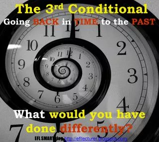
Going Back in Time
Going Back in Time. Hamilton County Auditors Office Transfer & Mapping Department Nick Christiansen Barton Griesenauer David Cetola. Going Back in Time. Parcel Mapping 112,000+ parcels in the county 3,900+ Plats recorded since 1827

Going Back in Time
E N D
Presentation Transcript
Going Back in Time Hamilton County Auditors Office Transfer & Mapping Department • Nick Christiansen • Barton Griesenauer • David Cetola
Going Back in Time Parcel Mapping • 112,000+ parcels in the county • 3,900+ Plats recorded since 1827 • 94,000+ (83%) Parcels in Hamilton County are from recorded subdivisions
Plats • Plat – “survey diagram, drawn to scale, of the legal boundaries and divisions of a tract of land.” * • Plat – recorded survey that designates an area of land into subdivision lots. • All subsequent transfers will be referenced to this plat. * Dictionary of GIS Terminology, Heather Kennedy, ed., ESRI Press, Redlands, CA, 2001
Going Back in Time Parcels & Plats since 2000 • Average 4500 new platted parcels per year • Average 200 new plats per year • 16,000+ transfer deeds per year
Software Tools Bentley Geographics • All database and linework maintenance • Adjoiners • Parcel data ArcGIS • Any analysis, hyperlinks, etc. • Custom maps • Bridges Bentley (parcel) data & MVP (tax) data MVP • Tax System
Going Back in Time History of GIS in Transfer & Mapping Department • Converted to GIS in 1998 • Parcel was only intelligent layer • Plats & subdivision were represented on GIS with non-intelligent lines & text
Real Time Dilemmas • Missing Real Estate Transfers • Incorrect Real Estate Transfers • Time consuming
Short Comings Plat Text • Missing text • Incomplete text • Tell you subdivision name but not section
Shortcomings Tax system was incomplete • Subdivision code incorrect or not even present • Wrong section designated • Lot Numbers were inconsistent • Gives limited plat information (recorders office location not noted)
Creating a Plat Layer in GIS Create database March 2002 (Larry Stout) Data from the plat & recording information • Designation name • Plat date • Instrument number • Plat cabinet • Owner/developer • Number of lots • Acreage • Engineer
Creating a Plat Layer in GIS Data from MVP Tax • Tax year • Tax ID • Map number • Block number • MVP subdivision name
Creating a Plat Layer in GIS Creating Plat Intelligence • Pulling plats from plat cabinet • Started database at PC 2 Slide 274 (March 2002) back to PC 1 Slide 1 (January 1989) • 63,000 ~67% platted parcels • 2642 plats in database • Using scanned plats from Surveyor & Recorder • 31,000 parcels (33% platted parcels) 1330 plats • Include original town plats
Creating a Plat Layer in GIS Refining tax system database • Validate MVP subdivision codes • Consolidate subdivision codes • Assign correct subdivision codes to parcels • Create subdivision layer in GIS • Validate MVP block value • This correlates plat section number • Update parcel lot numbers
Creating a Plat Layer in GIS Populating a database in GIS • Linking parcel & plat • Using Primary Key from Plat Layer • Adding Path to the Excel Write up • Populate Common Area Name in Parcel layer • Adding Path to Scanned Plats
Benefits • Subdivision maps • QC’ed tax system • Query plat database • Linked scanned plats to plat database • Linked writeup to plat database • Analyze development in Hamilton County by tax year
Benefits Subdivision Maps
Benefits QC’ed tax system • Tax system works more efficiently • Reduced questions for staff
Benefits Query plat database • Answers questions for consultants, engineers, other depts, & public • Create list of parcels based on set parameters
Benefits Link scanned plats to plat database
Benefits Linked writeup to plat database
Benefits Analyze development in Hamilton County by tax year
Platted Parcels 1827-1889 1890-1946 1947-1971 1972-1987 1988-1998 2000-2007