Advanced Spatial Analysis
1.11k likes | 1.39k Views
Advanced Spatial Analysis. October 7, 2002. Dr. Charles Noon Department of Management The University of Tennessee. Agenda. Beyond mapping, Geographic Information Systems (GIS) with examples Buffer and Overlay Transportation Analysis Advanced Descriptive Modeling example

Advanced Spatial Analysis
E N D
Presentation Transcript
Advanced Spatial Analysis October 7, 2002 Dr. Charles Noon Department of Management The University of Tennessee
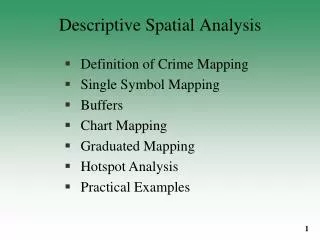
Agenda • Beyond mapping, Geographic Information Systems (GIS) with examples • Buffer and Overlay • Transportation Analysis • Advanced Descriptive Modeling example • Advanced Prescriptive Modeling example
Geographic Information Systems (GIS): A tool for spatial analysis • GIS: a computer platform which allows chain-wide data to be easily integrated for display and analysis. • GIS is not map making software • Data stored and handled in Layers • Data is attached to each Feature • Display can be a function of the data • Query and Analysis within or between layers
Buffer and Overlay • Buffer around points, lines or polygons • Overlay can, for example, merge maps together, clip one map based on another map, find the intersection of two maps, or find the union of two maps that combine both spatial and attribute data.
Clip customer sites that fall within 500-mile buffer zones around the DCs.
Select all counties that intersect with the 500-mile buffer zones around the DCs.
Transportation Analysis • With the addition of a network layer, a number of analyses can be performed, such as • Shortest Path • Service areas • Vehicle Routing
Transportation Analysis • With the addition of a network layer, a number of analyses can be performed, such as • Shortest Path • Service areas • Vehicle Routing
An Example of Overlay: Recommended Market Niche Pharmaceuticals • Large growing industry with much of the consumption in the Southeast • Majority of current flights are into Northeast • Most DCs within 2 day delivery • US Xpress and Averitt Express both currently carry pharmaceuticals
Chattanooga Catchment Area Two Day Delivery 70.6% One Day Delivery 23.7%
Charlotte Catchment Area Two Day Delivery 64.5% One Day Delivery 24.8%
Population served by Charlotte Population served by Chattanooga
2-Day Delivery Coverage Population served by Charlotte Population served by Chattanooga Population served by both
Results of Analysis: • Population within two-day catchment • Chattanooga – 70.6% • Charlotte – 64.5% • Approximately $8 billion in additional pharmaceutical potential in Chattanooga catchment
Transportation Analysis • With the addition of a network layer, a number of analyses can be performed, such as • Shortest Path • Service areas • Vehicle Routing
An Example • A distributor to fast-food restaurants with 12 DC’s serving 3922 restaurants with 80 vehicles. • Currently, DC’s serve from 209 to 644 restaurants. • TransCad was first used to determine optimal weekly delivery routes under the current restaurant-to-DC assignments.
CURRENT STORE-TO-DC ASSIGNMENTS Total Mileage Per Week = 192,998
An Example • A distributor to fast-food restaurants with 12 DC’s serving 3922 restaurants with 80 vehicles. • Currently, DC’s serve from 209 to 644 restaurants. • TransCad was first used to determine optimal weekly delivery routes under the current restaurant-to-DC assignments. • TransCad was then used to re-assign restaurants-to-DC’s and determine approximately 400 vehicle routes that must be run each week.
OPTIMIZED STORE-TO-DC ASSIGNMENTS Total Mileage Per Week = 173,702
STORES WITH CHANGED ASSIGNMENTS Note: a total of 381 stores had changed DC assignments. Each dot may represent more than one store (in the same zipcode)
STORES WITH CHANGED ASSIGNMENTS Currently AssignedDC Optimally AssignedDC Cluster Net savings of 19,296 miles per week (10% reduction)
Agenda • Beyond mapping, Geographic Information Systems (GIS) with examples • Buffer and Overlay • Transportation Analysis • Advanced Descriptive Modeling example • Advanced Prescriptive Modeling example
Locating a proposed NICUmarket analysis and visualization with “perfect” data