Download
1 / 23
230 likes | 422 Views
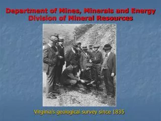
Department of Mines, Minerals and Energy Division of Mineral Resources. Virginia’s geological survey since 1835. Key Responsibilities Geologic Mapping Mineral Resource Studies Geohazards Geologic Research Development of underlying geologic framework Maintain Repositories and Archives

E N D
Department of Mines, Minerals and EnergyDivision of Mineral Resources Virginia’s geological survey since 1835
Key Responsibilities Geologic Mapping Mineral Resource Studies Geohazards Geologic Research Development of underlying geologic framework Maintain Repositories and Archives Publish and Disseminate Geo-Information Act as geologic advisors to state agencies DMME - Division of Mineral Resources
Accurate elevation data and topo maps are essential for geologic studies • Topographic maps provide the base upon which geologic maps are created • Allows three-dimensional calculations of features Rock formations, contacts, faults, ore bodies, overburden, trends, etc DMME - Division of Mineral Resources
DMR Criteria for Useful/Ideal Elevation Data • Bare-earth digital elevation data • High resolution • Scalable • Ability to generate contours to USGS standards • Can reacquire periodically for monitoring change • Defines detailed features on steep slopes • Detects holes, pits, and local subsidence • Detects faults and other linear trends DMME - Division of Mineral Resources
1962-72 DMR/USGS co-op program expanded Virginia 1:24,000 topographic map coverage from 10% to 100%. DMME - Division of Mineral Resources
The updates are photorevisions that updated the culture but not the contours DMME - Division of Mineral Resources
Existing topographic contours useless in areas of rapid man-made alteration such as coal mining DMME - Division of Mineral Resources
TVA did not use the same standards as the USGS when creating contours and topographic maps. DMME - Division of Mineral Resources
Additional DMR Uses for Detailed Digital Elevation Data • Geohazards • Mineral Resource Studies • Geologic Mapping DMME - Division of Mineral Resources
Geohazards • Mapping of slope susceptibility to landslides and debris flows • Improved mapping of historical landslides and debris flows DMME - Division of Mineral Resources
1969 Nelson Co • Occurred at night • 150 Dead • $116+ million property damage • 1995 Madison Co • Occurred during the work day • 1 Dead • $100+ million property damage DMME - Division of Mineral Resources
Nelson County - 1969 Hurricane Camille DMME - Division of Mineral Resources
North Carolina Landslide Hazards Program In 2004, Hurricanes Frances and Ivan triggered landslides in NC’s western mountains. Impact: 5 deaths 16 homes destroyed 140 total landslides Response: a series of digital county maps to enable communities to evaluate and reduce the risks of building homes and other structures in landslide-prone areas of the NC mountains. High-resolution LiDAR and post-hurricane imagery, along with decades of previous soil and geologic mapping are critical data sets needed to make the maps. DMME - Division of Mineral Resources
Geohazards • Mapping of slope susceptibility to landslides and debris flows • Improved mapping of historical landslides and debris flows • Assessment of unstable slopes above surface water impoundments in coalfields, and others • Assess potential for “blowouts” from underground coal mines • Subsidence related to mining • Karst-related sinkholes and potential for their development DMME - Division of Mineral Resources
Mineral Resource Studies • Accurate locations of coal outcrop lines • Accurate locations of surface mines • Accurate surface elevations for 3D modeling of SW VA coalfield • Mapping surface fracture systems impacting production and safety • 3D models aid planning for drilling coalbed methane and unconventional gas targets • Improve Mine Rescue Planning • Assessment of trends and controls of mineral occurrences DMME - Division of Mineral Resources
Reclamation of Abandoned Mine Lands Elevation data is necessary to assess the difference between current and Approximate Original Ground contours, as required by SMCRA Before and after photographs of Straight Hollow Gob Pile Project DMME - Division of Mineral Resources
Accurate elevation data enable volumetric calculations of spoil piles, tailings, and valley fills, reducing the cost of reclamation to state and the operator.
Geologic Mapping • Identification and accurate location of contacts, faults, other surface features • Differentiation between surface and bedrock geology • Accurate DEM provides greater regional perspective and improves planning and effectiveness of fieldwork • Mapping the geologic framework that is essential for groundwater characterization studies • Reviews of Environmental Impact Statement (EIS) • Coastal erosion and beach re-nourishment DMME - Division of Mineral Resources
Figure 4 A from 2006 article “Mapping Active Faults in the Houston Area Using LIDAR” by Richard Engelkemeir, Shuhab Khan, and Carl Norman – University of Texas
Figure 4 B from 2006 article “Mapping Active Faults in the Houston Area Using LIDAR” by Richard Engelkemeir, Shuhab Khan, and Carl Norman – University of Texas
DMR’s Interest Summary We are seeking an optimal mix of available tools and processes that will provide elevation data at an appropriate level of scientific accuracy and cost effectiveness to fulfill our mission. DMR’s highest priorities for elevation data are: Blue Ridge Mtns SW Virginia coalfield Valley & Ridge karst terrains Acquire as soon as possible. • Possible pilot test in one or more of above areas. DMME - Division of Mineral Resources