Download
1 / 23
230 likes | 401 Views
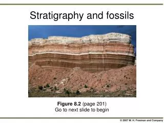
MESOZOIC STRATIGRAPHY BIG HORN AND POWER RIVER BASINS. Early Permian. Late Triassic. Triassic System. Thick succession of red beds. Variable amounts of soft sandstone and mudstone.

E N D
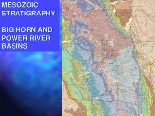
MESOZOIC STRATIGRAPHY BIG HORN AND POWER RIVER BASINS
Early • Permian
Triassic System • Thick succession of red beds. Variable amounts of soft sandstone and mudstone. • Chugwater Formation here, Spearfish in the Black Hills. Dinwoody Formation is included in the Absarokas. • Dense, thin, laminated, light-colored limestones (Alcova and Popo Agie) occur near the top. • Thick gypsum at top to the west (in part Early Jurassic). • Arid coastal plane.
Middle Jurassic (160 Ma). • Major arc magmatism Initial collision between southern Wrangellia and Cordilleran margin at approximately the latitude of Klamaths and Sierras Fringing arcs south of collision zone Ophiolitesobducted in collision zone and in inter arc region between Cordilleran arc and fringing arcs Foreland basin in Utah and thrusting in Nevada Rift basin in southwestern North America related to opening Gulf of Mexico
Jurassic System • Disconformably overlies the Triassic. Only Upper Jurassic rocks are present here. • Sundance Formation - Here it is largely marine, and consists of green shale with some thin limestone and sandstone. Shale has belemnite fossils. “Oyster Bed” is present near the top. Yellow rippled sandstone near the top. Ripples are symmetric. • Morrison – Generally poorly exposed here. Consists of interbedded red, yellow, and purple mudstone, sandstone and conglomerate. Humid coastal plane? Dinosaur bones.
Sundance Formation Largely marine, Lower green shale with some thin limestone and sandstone. Shale has belemnite fossils. “Oyster Bed” is present near the top. Yellow rippled sandstone near the top. Ripples are both asymmetric &symmetric.
Morrison Fm. • Morrison – Generally poorly exposed here. Consists of interbedded red, yellow, and purple mudstone, sandstone and conglomerate. • Humid coastal plane? Dinosaur bones.
Late Cretaceous (85 Ma) Major magmatic activity in two belts (110-85 Ma) followed by strong decline and null in magmatic activity (80-40 Ma) Andean-style segmentation of Farallon arc from Central America to Southern California Sevier thrusting continued and foreland basin shifted locus of subsidence southward in response to shallow Laramide subduction (shallow angle)
Lower Cretaceous System • Disconformably overlies the Jurassic System. • Cloverly Formation. Interbedded sandstone and shale. “Rusty Beds” locally form hogbacks. Deltaic system with channels, delta bay, and pro-delta facies. • Thermopolis Formation – Black marine shale similar to the Pierre. • Mowry Formation – Resistant silicified mudstone. Distinct silver-grey, rarely fully vegetated. Environment uncertain. Some bentonite beds in the Bighorn Basin are mined.
Cloverly Formation. Interbedded sandstone and shale. “Rusty Beds” locally form hogbacks. Deltaic system with channels, delta bay, and pro-delta facies.