Download
1 / 16
160 likes | 254 Views
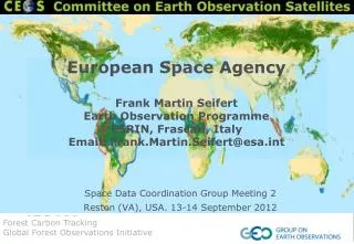
Space Data Coordination Group Status September 2012. Co-chairs: John Faundeen , USGS Ake Rosenqvist , for NSC Frank Martin Seifert, ESA Secretariat: Stephen Ward, DCCEE George Dyke, DCCEE. Contents. SDCG Scope Membership and representation

E N D
Space Data Coordination Group Status September 2012 Co-chairs: John Faundeen, USGS AkeRosenqvist, for NSC Frank Martin Seifert, ESA Secretariat: Stephen Ward, DCCEE George Dyke, DCCEE
Contents • SDCG Scope • Membership and representation • The CEOS Data Strategy for GFOI • 2012 progress • Issues & obstacles • SDCG#2 • Expansion • Missions • Level-1 Acquisition Plan • Next steps
Scope of the SDCG • Support coordinated acquisition planning of all relevant Earth observing missions supporting GFOI and FCT. • Emphasis on CEOS agency missions, but also to communicate needs to commercial operators. • Initially limit coordination to acquisition planning. • Data processing and distribution through GFOI implementation with potential future roles for the SDCG.
SDCG Membership and representation • Participation is open to all CEOS space agencies willing to support and contribute to the CEOS Data Strategy. • Current Members: • Co-chairs: USGS/USA, ESA, NSC/Norway • Secretariat: DCCEE/Australia • Members: CNES/France, CONAE/Argentina, CRESDA/China, CSA/Canada, CSIRO/Australia, DLR/Germany, INPE/Brazil, JAXA/Japan, NASA/USA • Pending invitations: ISRO/India, KARI/Korea, ASI/Italy
SDCG –Data Strategy for GFOI OverallSDCG objective: To build a living global archive of spatio-temporally consistent data for each sensor type, that responds to GFOI information requirements Level-1: A baseline, coordinated global data acquisition strategy(wall-to-wall) involving a number of ‘core data streams’ that can be used free-of-charge for GFOI purposes. Level-2: Coordinated national data acquisition strategies in response to national needs assessments undertaken in the course of GFOI implementation. • Level-3[GEO-FCT National Demonstrator countries]: Data supply in support of the GEO-FCT, including in support of the R&D studies assisting the development and evolution of the GFOI Methods and Guidance Document.
2012 progress, issues, obstacles • 2012 Progress (1/2) • Successful start of the SDCG [Completed] • 13 member agencies to-date • 1st SDCG meeting (CSA/Montreal March 6-8 2012) • 2nd SDCG meeting (USGS, Sep 13-14 2012) • Development of Terms of Reference and Management Plan [Completed] • Approved by SDCG members at SDCG#1 • Development of GFOI information requirements [Completed] • Coordinated with GFOI MGD product definitions • Development of first draft of the Level-1 Global Baseline Acquisition strategy [On-going] • Phased Implementation Plan – gradual upscaling [FCT NDs –> UN-REDD / World Bank FCPF countries –> pan-tropical –> global]
2012 progress, issues, obstacles • 2012 Progress (2/2) • Global Baseline Acquisition strategy development • Input from member agencies • Business-as-usual (BAU) observation plans • Strategic mission objectives (e.g. regional focus) • Mission acquisition capabilities and constraints • SDCG = BAU+ D • Multi-mission gap analysis • Development of mitigation plan proposals for each mission and each epoch to bridge spatial and temporal gaps • Iterative collaborative process to achieve a sustainable best-effort coordinated acquistion strategy
2012 progress, issues, obstacles • Issues and obstacles (1/2) • Data availability • 2012 low-water mark for CEOS mission availability (loss of Landsat 5, Envisat, CBERS-2, ALOS within past 1.5 yrs) • Procedures for large-scale gap filling and data provision by commencial missions not yet in place. • Near-future however looks positive! (CBERS-3, LDCM, Sentinels, ALOS-2 potentially in orbit within next year) • Strategy development • Difficulties to assess capacity and development of detailed plans for missions not yet in orbit. • Many key parameters still TBD also by agencies themselves (BAU plans, ground station network, record/downlink capacities, etc.) • CEOS Data Strategy document inevitably a living document that will be continuously refined as new missions become operational.
2012 progress, issues, obstacles • Issues and obstacles (2/2) • Illustrating complex information • CEOS Data Strategy highly complex given the large number of missions and sensor types involved, the extensive geographical focus and the multi-annual timeline for implementation and operations. • Challenge to visualise this multidimensional information both for internal plan development purposes as well as for promotion and communication of outcomes (e.g. for reporting to the CEOS and GEO Plenaries) • CEOS SEO has been supportive and COVE tool holds potential as key graphical interface. Further development very likely to be required. • SDCG would welcome help to assess both our needs in this respect, and to explore possible solutions
SDCG#2 • SDCG#2 at USGS, Reston (VA) September 13/14 2012 • Objectives • To review agencies inputs to the GFOI Baseline Global Data Strategy • To refine the draft GFOI Baseline Global Data Strategy • To characterize the data gaps and strategize means of mitigation • To assess sensor programming proposals (BAU+ D) • To establish a timetable to finish the GFOI Baseline Global Data Strategy
Expansion Strategy • Expansion Criteria: • National Demonstrators from GEO FCT expanded to full national coverage (except Australia) • Country receives funding from UN-REDD or is selected for the Supplementary Grant Agreement of the Forest Carbon Partnership Facility of the World Bank • Neighboring countries or entire regions to facilitate seamless satellite observation of large areas • Other elements: • countries and donor countries suggestions seeking access to GFOI will be taken into consideration by SDCG if satellite resources allow.
Gradual Up-scaling • Up to now: FCT National Demonstrator countries • Brazil (Legal Amazon), Cameroon, Colombia, Democratic Republic of The Congo, Guyana, Indonesia (Borneo, Sumatra), Nepal, Mexico, Peru, Tanzania, Australia (Tasmania) • Near Term: 2012 – mid 2013 • Expand ND Indonesia to whole country • Add Cambodia, Republic of Congo, Costa Rica, Ecuador, Panama, Viet Nam • Mid term: mid 2013 – end 2014 • Whole tropical and subtropical forest • Long term: 2015+ • Temperate and boreal forest
Missions • 2012 • Core: Landsat-7, Radarsat-2 (hybrid in 2012 as data free for FCT NDs) • Non-core: RapidEye, TerraSAR-X/TanDEM-X • 2013 - 2014 • Core: Landsat-7, LDCM, CBERS-3 • Non-core: Radarsat-2, RapidEye, TerraSAR-X/TanDEM-X • 2014 - 2015 • Core:Landsat-7, LDCM, CBERS-3, Sentinel-1A, Sentinel-2A, Amazonia-1 • Non-core: Radarsat-2, SPOT-4, SPOT-5, RapidEye, ALOS-2 • 2015+ • Core:Landsat-7, LDCM, CBERS-3, Sentinel-1A, Sentinel-2A, RCM, Amazonia-1, SAOCOM-1A • Non-core: Radarsat-2, SPOT-4, SPOT-5, RapidEye, ALOS-2
CEOS Global Acquisition Plan – L1 Document Status: 1. Introduction (relatively complete) Purpose, scope, contents 2. Data Requirements (partial draft) Requirements that will drive the design of the global baseline data acquisition strategy. 3. Coverage and Gap Analysis (key analysis missing) Business as usual coverage, gaps, and suggestions on how to mitigate gaps. 4. Baseline Global Acquisition Plan Concept (outline, but limited content) Defines the baseline global strategy. 5. Implementation Time Schedule (not started) Summarises the way forward for the SDCG and CEOS. Annex: Mission Sensors (baseline information gathered) Detailed information on missions and instruments.
Next Steps • CEOS Plenary (Oct. 2012) • Proof of significant progress • Presentation of outline for CEOS Data Strategy document (with compelling visualisations?!) • ‘Super Meeting’ in Australia (Feb. 2013) • Methods & Guidance Documents Advisory Group Meeting • Science & Data Summit • SDCG#3 • Consolidation of the Level-1 Baseline Strategy • Start of Level-2 strategy (national focus) planning • Further discussions on related activities – GEO-GLAM
SDCG • Thank you.