Download
1 / 18
180 likes | 329 Views
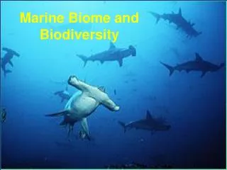
Marine biodiversity and spatial management. Setting the stage. Conserving biodiversity → sustainable provision of present and future ecosystem services

E N D
Setting the stage • Conserving biodiversity → sustainable provision of present and future ecosystem services • Spatial management provides a useful mechanism to integrate a variety of management approaches and capitalizes on patterns that are relatively more predictable • AERD has the requisite information and expertise but we need to make opportunity for integration
Ecosystem Services • The “Antarctic mystique” • Tourism opportunities • Fishing opportunities and seafood products • “Nutriceuticals” and bio-prospecting • Roles in the Earth’s climate system and carbon cycle • …
Spatial Heterogeneity of Services WG-EMM-09/06 krill fishing (CCAMLR) invertebrate composition (US AMLR) tourist landings (IAATO)
The US AMLR approach and requirements for advice integrated spatial advice data analysis AERD has a substantial amount of spatial data – these can be integrated with other data To date, analysis limited to mapping, spatial smoothing and SSMU-level risk assessments Need to provide some – recast the MPA concept Marine Spatial Planning (MSP)
“Componentized” Spatial Management Some Mandates • MPA network (WSSD and CCAMLR) • Prevent adverse impacts to VMEs (UNGA Resolution 61/105 bottom fishing CMs) • CCAMLR’s precautionary approach (krill CMs and exploratory fishery CMs) • Harmonization with CEP Some Tools • MPAs* • VME risk areas* • SSMUs (krill fishery)* • SSRUs (toothfish fisheries) • Experimental harvest blocks (crab fisheries)* • [ASPAs and ASMAs]
MPAs • World Summit on Sustainable Development (WSSD) called for a representative network of MPAs by 2012 • Performance Review Panel and NGOs have urged CCAMLR to meet the WSSD objective • CCAMLR has agreed that MPAs are a matter of priority • WG-EMM suggested 11 “priority areas” and an analytical approach – these were endorsed in 2008 • “MPAs” may delay sustainability – the “P” provides little acknowledgement that consumptive uses are services too or that conservation includes rational use
Priority Areas and an Approach SC-CAMLR-XXVII bioregions conservation objectives
Layers to Describe Bioregions Physics Krill Phytoplankton Krill Predators (fishes)
Layers to Describe “Conservation Objectives” Humpbacks Fins Cape Petrels VMEs Bransfield Strait Geomorphology courtesy of Phil O’Brien (Geoscience Australia)
Layers to Describe “Service Objectives” WG-EMM-09/06 fishing bioprospecting treat service opportunities as objectives rather than costs? tourism
Spatial Consistency vs. Temporal Variability 1998 – 38,709 mt G. gibberifrons 2003 – 9,898 mt kg
MPAs, SSMUs, VMEs, etc. → MSP • The various tools are mostly compatible • Performance Review Report – provide “coherence” and “compatibility” of CMs • Need to be practical in application – perhaps parsimony should provide the cost function? • Ditch the term MPA? Grant (2009) – WG-EMM-09/09
Gaps, threats, and opportunities • Gap – What about winter? • Threat – How good will lines on a map be if climate change impacts the distributions of animals and ecosystem services? • Opportunities – Facilitate collaboration, use “conventional” and “unconventional” information to develop management advice within a common framework, and provide an even broader foundation for ecosystem-based management.
Extending the Program and addressing climate change • Identify new opportunities or re-prioritize existing work to facilitate data integration and analyses • Use new and improved technologies to expand the spatio-temporal coverage of the AMLR field program • Develop new habitat models, behavioral models, etc. and utilize downscaled IPCC scenarios to predict how the spatial distributions of animals and ecosystem services may change as functions of climate
2009/10 AMLR Extensions Winter! Range extender? Collaboration with SWFSC Protected Resources Division, NOAA Unmanned Aircraft Systems Program, and NOAA Office of Marine and Aviation Operations 2 birds (1 long range, 1 short) Calibration flights (including ship-based launch and recovery) and proof of concept • Fur seals = 20 Argos PTTs + 10 solar powered geolocators • Leopard seals = 5 Argos CTDs + 6 Argos PTTs • Weddell seals = 5 Argos CTDs • Chinstraps = 15 Argos PTTs + 10 solar powered geolocators • Gentoos = 15 Argos PTTs
Trigger Questions 1 • Is the current approach sufficient? What should be expanded? What should be de-emphasized? • Move beyond data collection towards data integration and analysis in a spatial management framework • Need winter data relevant to spatial management • How should the AERD balance the collection of time-series data with project-based studies? • Project-based studies can help fill “spatial holes” but multiple years often useful to confirm pattern
Trigger Questions 2 • Are the AMLR survey areas and study taxa appropriate given the likely impacts of climate change? • Expand south to characterize spatial baselines where animals may redistribute? Should we predict spatial distributions before we answer? • What specific aspects of climate change should be the focus of future research? • Predict future habitats and distributions • Consider adaptive boundaries