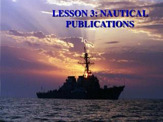
Session I NAUTICAL PUBLICATIONS
250 likes | 279 Views
Discover essential web resources, nautical chart catalogs, tide tables, and more in this comprehensive guide. Learn about aids to navigation, corrections, local notices to mariners, and important maritime data.

Session I NAUTICAL PUBLICATIONS
E N D
Presentation Transcript
Session INAUTICAL PUBLICATIONS Revised: WDM 18APR14
Objectives Introduction to: • Important Web Sites • Nautical Chart Catalog. • Light List. • Coast Pilot. • LNM—Local Notice to Mariners. • Tide Tables. Revised: WDM 18APR14
Important Web Sites • 1 SR Navigation Systems (NS) Department: uscgaux1sr-aton.org • 1 NR Navigation Systems Department: uscgaan.com • PATON Data Base / Harbor Master: usharbormaster.com • Bridge Database: uscgaux1sr-aton.org/BridgeDB/Bridges • NOAA – Office of Coast Survey (OCS): nauticalcharts.noaa.gov/staff/chartspubs.html Revised: WDM 18APR14
PUBLICATIONS • Coast Pilot 2 (MA to Sandy Hook, NJ): nauticalcharts.noaa.gov/nsd/coastpilot_w.php?book=2 • Light List Vol. I (Maine to Sandy Hook, NJ): navcen.uscg.gov/pdf/lightLists/LightList%20V1.pdf • Summary of Corrections, Vol. I: navcen.uscg.gov/pdf/lightLists/corrections/V1D01.pdf • Local Notice to Mariners (LNM) 1 District: navcen.uscg.gov/?pageName=lnmDistrict®ion=1 Revised: WDM 18APR14
Data Bases • Bridge Database: uscgaux1sr-aton.org/BridgeDB/Bridges • NOAA Nautical Chart On-line Viewer – Atlantic: charts.noaa.gov/OnLineViewer/AtlanticCoastViewerTable.shtml • NOAA Tides & Currents: tidesandcurrents.noaa.gov/tide_predictions.html Revised: WDM 18APR14
Light List Revised: WDM 18APR14
Light List • To provide mariners with more complete details about Aids to Navigation—AtoNs. • A catalog of: • All Aids to Navigation—AtoNs. • Lights. • Sound Signals. • Color. • Type. • Structure. • Latitude and longitude. • Ownership of private or federal aids. Revised: WDM 18APR14
Height above water explained • Floating Aid – The height is measured from the water line to the level of the light bulb—focal plane. • Fixed Aid – The height is measured from Mean High Water (MHW) level to the height of the light bulb—focal plane. Revised: WDM 18APR14
Light List Information • Nominal Range of Light • Maximum distance at which a light can be seen in clear weather. • Distance is expressed in nautical miles. • Structural Characteristics • Special construction features or material is indicated. Revised: WDM 18APR14
Light List - Typical Page Revised: WDM 18APR14
Coast Pilot Revised: WDM 18APR14
Coast Pilot - Sections 1. General Information 2. Navigational Regulations 3. General information about the area 4. Specific information about the area 5. Appendix 6. Tables Revised: WDM 18APR14
Coast Pilot - Purpose • Supplements information shown on Nautical Charts. • Shows data that can’t be coded or abbreviated on a Nautical Chart. Revised: WDM 18APR14
Coast Pilot- Updates • Received from: • NOAA Field Inspections • LNM Information • Hydrographic Vessels • Other Government Agencies • State and local Governments • Maritime and Pilotage Associations • Port Authorities • USCGAUX Aid Verifiers Revised: WDM 18APR14
Coast Pilot Tables • Climatological Tables. • Meteorological Tables. • Mean surface water temperature and densities. • National Weather Service coastal warning displays. • Nautical miles between points. Revised: WDM 18APR14
Coast Pilot – Tables (Continued) • Radio bearing conversion table • Distance of visibility of objects at sea. • Conversion table—degrees to points and vice versa. • Conversion tables. • Table for estimating time of transit. • Index. Revised: WDM 18APR14
COAST PILOT - Corrections • Corrections are published in the Local Notice to Mariners Revised: WDM 18APR14
Local Notice to Mariners Revised: WDM 18APR14
Local Notice to Mariners • Also known as LNM • Updated weekly • No cost to the user On-Line Revised: WDM 18APR14
LNM Sections ISpecial Notices II Discrepancies III Temporary changes - Temporary changes corrected IV Chart corrections V Advance Notices VI Proposed changes to AtoNs VII General VIII Light List corrections Marine Events Coast Pilot Updates Bridge Section Revised: WDM 18APR14
TIDE TABLESPurpose • To provide a means of predicting the height of tide for each day of the year. • Provide other astronomical date and tables to the mariner. Revised: WDM 18APR14
Chart No. 1 Symbols, Abbreviations and Terms Revised: WDM 18APR14
CHART No 1 – Nautical Chart Symbols Abbreviations and Terms • Contains every abbreviation and symbol used of a Nautical Chart. • A must for every Aids Verifier Revised: WDM 18APR14
End of Session I Revised: WDM 18APR14