Nautical Publications: Essential Navigation Tools
230 likes | 460 Views
Explore essential nautical publications for safe navigation, including charts, guides, and correction systems. Learn about pilot charts, hazard symbols, and plotting equipment. Improve your maritime knowledge today!

Nautical Publications: Essential Navigation Tools
E N D
Presentation Transcript
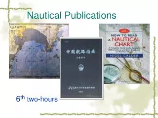
Lesson 3: Nautical Publications • AGENDA: • Navigator’s Reference Library • Chart/Publication Correction System • Plotting Equipment • Applicable reading: Hobbs, pp. 42-52, 57-78.
Coast Pilots • Provide supplemental information about navigation in U.S. coastal waters. • Information includes: • topographical features • navigation aids • normal local weather conditions • recommended tracks • pilot information • descriptions of ports and harbors
Sailing Directions • Provide supplemental information about navigation in foreign coastal waters. • Information provided is similar to that found in Coast Pilots. • Divided into different volumes • 8 volumes are Planning Guides for ocean basin transits • 35 are Enroute Directions for piloting in coastal waters.
Fleet Guides • Provide information for use by U.S. Navy ships, including: • Fleet Guides exist for ports frequently visited by the U.S. Navy in both the U.S. and foreign countries. • Command information (e.g. SOPA) • Navigation information (e.g. prevailing tides/currents) • Logistics (e.g. fuel/water) • Port operations (e.g. Comms facilities etc.) • Repair facilities
Light List • Lists aids to navigation in U.S. waters, including: • lighted aids to navigation • unlighted buoys • daybeacons • fog signals • radiobeacons • Loran-C coverage
List of Lights • Describes aids to navigation found in foreign waters and selected U.S. coastal regions. • Similar to Light List but does not contain information on unlighted navigation aids.
Distances Between Ports (Pub 151) • Lists great circle distances among the most frequently traveled sea routes throughout the world.
Hazard and Depth Symbology • Symbols are also used to denote specific hazards to navigation, such as partially submerged wrecks, etc. • Chart Number 1 is the reference for all chart symbology.
Pilot Charts • Name is misleading- they really cover major ocean basins and not piloting (coastal) waters. • Provide meteorological, hydrographic, and navigational information for a particular ocean area. • Extremely valuable in voyage planning.
NIMA Catalogue of Maps, Charts, and Related Products • Illustrated catalog of maps, charts, publications, and other related products produced by NIMA. • Contains serialized drawings of the world which allow the navigator to locate charts and Sailing Directions that cover areas of interest. • Published as an eleven volume set.
Step #1 Identify the Coastal Region/Subregion Example: The navigator is planning to visit Rio de Janeiro, Brazil.
NOS Nautical Chart Catalogue • Set of drawings, very similar to those found in the DMA catalog. • Cover U.S. waters
Chart and Publication Correction System • Corrections to charts and publications are disseminated via Notice to Mariners and Local Notice to Mariners. • Notice to Mariners - issued by NIMA and contain changes relating to oceanic and coastal areas worldwide. • Navigators are not required to immediately enter changes on every chart/publication.
Plotting Equipment DIVIDERS COMPASS / DIVIDER
Plotting Equipment BEAM COMPASS
Plotting Equipment PARALLEL RULERS
Plotting Equipment ROLLING PLOTTERS / PARALLEL PLOTTER PMP ARM
Nautical Slide Rule If two of three quantities are know, you can solve for the third.
REVIEW • What book would I look in to find: • Information on a port such as Repair facilities and command information? • A lighted navaid in US waters? • A lighted navaid in foreign waters? • Chart corrections? • Chart symbology? • The distance traveled from Norfolk to Ingleside Texas? • What 3 pieces of information can you find on a nautical slide rule?