Download

1 / 14
140 likes | 273 Views
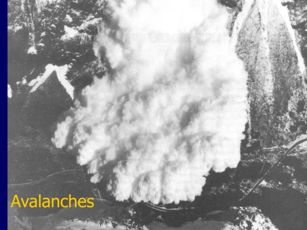
Four Elements that Affect the Formation and Release of Avalanches. Snow falls to the ground at different times, rates and weather conditions. This creates different layers in the snow. Fronts. 4 different types: 1. Cold front 2. Warm front 3. Stationary 4. Occluded.

E N D
Four Elements that Affect the Formation and Release of Avalanches
Snow falls to the ground at different times, rates and weather conditions. This creates different layers in the snow.
Fronts 4 different types: 1. Cold front 2. Warm front 3. Stationary 4. Occluded Fronts are the basic building blocks of weather systems. Fronts occur where two large air masses collide at the earth's surface. Each air mass has a different temperature associated with it. Fronts are caused by winds moving one air mass away from its birthplace.
Fronts 1. Cold front Cold fronts occur when heavy cold air displaces lighter warm air, pushing it upward. Cumulus clouds form and usually grow into snow storms. Temperatures drop anywhere from 5° to 15°. Winds become gusty and erratic. Rain, snow, sleet, and hail can occur with a cold front.
Fronts 2. Warm front Warm fronts occur when warm air replaces cold air by sliding over it. Altocumulus clouds form and may be associated with rain, snow, or sleet. Temperatures may warm slightly. Winds are usually gentle with this kind of front.
Fronts 3. Stationary Stationary fronts occur when neither warm nor cold air advances. The two air masses reach a stalemate. These type of conditions can last for days, producing nothing but Altocumulus clouds. Temperatures remain stagnant and winds are gentle to nil.
Fronts 4. Occluded Cold occlusion: When a cold air mass follows a warm air mass, the cold air mass, which moves faster, eventually catches up the warm front. This then lifts the warm air (behind the warm front) off the ground, creating an occluded front, where the two fronts are joined. Usually associated with rain or snow and cumulus clouds. Temperature fluctuations are small and winds are gentle. May indicate the end of a storm cycle
Lifting Mechanisms Convection and convective lifting Air is heated by the Earth's surface. The air is heated unequally, areas of warmer air are formed amidst cooler air. Since warm air is lighter, it will tend to rise and this may lead to the formation of localized clouds and showers.
Lifting Mechanisms Orographic lift takes place when a moving mass of air runs up against a mountain range and is forced upwards. Moist ocean air is lifted orographically and can cause precipitation without any associated storms or frontals systems. The warm and cold fronts that bring heavy snowfalls to the Cascades Mountains often dissipate by the time they reach eastern Washington; little moisture remains and lesser amounts of snow fall at Mission Ridge
Storm Tracks • Pineapple Express • SW Storm Track • Pineapple express • These storms can leave over 7” of water • High snow accumulation at the highest of elevations in the mountains • High elevation freezing levels
Storm Tracks • Pineapple Express • SW Storm Track • Pineapple express
Storm Tracks • West-SW Storm Track • Temperature and humidity is lower than for the “pineapple express • A common storm track • A break between storms, sometimes a few hours, sometimes a full day. • Cooler air moves in after each disturbance, • Freezing level is 3000’ to 5000’, when these systems move through.
Storm Tracks West-NW Storm Track Precipitation is short-lived, producing fairly rapid cooling These systems drop light (low SWE) snow in the mountains Freezing level is 1500’ to no more than 3000’ or so in winter.
Storm Tracks Northerly Storm Track Cold air travels from the north, passes just long enough over the ocean to pick up moisture (but not long enough to warm the air and produce rain). Winds slide along, rather than across the ranges, so more snow may fall in the flatlands than in the mountains. Freezing level is at ground level.