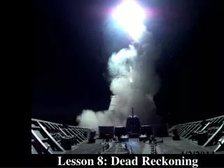
Chapter 5: Dead Reckoning
Chapter 5: Dead Reckoning. Instructor: Reggie Hollar. All Questions and Problems from the Study Guide. PowerPoint Presentation by Forrest Meiere. S5-1. The practice of estimating position by advancing a known position for courses and distances run is called ___________________.


Chapter 5: Dead Reckoning
E N D
Presentation Transcript
Navigation Study Guide Chapter 5: Dead Reckoning Instructor: Reggie Hollar All Questions and Problems from the Study Guide PowerPoint Presentation by Forrest Meiere
Navigation Study Guide S5-1. The practice of estimating position by advancing a known position for courses and distances run is called ___________________. dead reckoning (DR) S5-2. In the process of dead reckoning, courses are drawn on the chart as solid lines from a known starting position called a ___. fix S5-3. Courses and speeds are appropriately labeled, and DR positions and times are plotted at each ____________________. course or speed change
Navigation Study Guide S5-4. The DR position is labeled by a ____ surrounded by a __________, and the _____, using the 24-hour system, is written on the chart at an ______ to the horizontal. dot semicircle time angle heading S5-5. Course (C) is the average ________ and the horizontal _________ in which a vessel is intended to be steered, expressed as the angular distance relative to north, 000 to 359 degrees clockwise from the point of departure or start of the course to the point of arrival. The reference direction is ____ and if so used, need not be labeled. Magnetic courses, if used, are labeled after the three-digit direction with the letter ___. direction true M
Navigation Study Guide S5-6. An improved position based upon the DR position and which may include, among other things, factoring in the effects of wind and current, or a single line of position, is termed an ________________ (EP). estimated position S5-7. The most accurate visual fix is obtained from _____ objects above the horizon ___ to ___ degrees apart in azimuth. A dead reckoning plot is always renewed (restarted) at a fix or running fix. three 50 70 120° separation is ideal; FM S5-8. The speed in knots (nautical miles per hour) at which a current is moving is termed _____. drift
Navigation Study Guide S5-9. The instantaneous direction of a vessel's bow is termed ________. heading S5-10. The ________________ (S0A) indicates the speed intended to be made relative to the ground along the track line. Speed of Advance S5-11. A ____________ (RFIX) is a fix obtained by means of LOPs taken at different times and adjusted to a common time. This practice involves advancing or retiring LOPs as discussed in Chapter 6. Running Fix
Navigation Study Guide S5-12. The mechanism used to accomplish calibration of speed logs or tachometers in terms of actual speed through the water is the development of the ____________, a graphic plot of observed speed versus RPM. Speed Curve S5-13. In solving for distance when speed and time are known, what formula is used? ___________. D= S · T/60 S5-14. In solving for speed when distance is known and time can be calculated, what formula is used? ___________. S= 60 · D/T
Navigation Study Guide S5-15. In solving for time when speed and distance are known, what formula is used? ___________. T= 60 · D/S S5-16. The intended or desired horizontal direction of travel with respect to the ground is termed ___________. Track (TR) End of Questions
Navigation Study Guide PROBLEMS: Use the 1210- Tr chart and the deviation table in Lesson 2. P5-1. Convert the following civil times to corresponding 24-hour system times: Civil 24- Hour Civil 24- Hour a. 10:15 p.m. f. 1:38 p.m. b. 9:28 a.m. g. 8:15 p.m. c. 9:28 p.m. h. 7:25 a.m. d. 1:25 a.m. i. 12:03 p.m. e. 10.15 a.m. j. 12:03 a.m. P5-1. Convert the following civil times to corresponding 24-hour system times: Civil 24- Hour Civil 24- Hour a. 10:15 p.m. 2215 f. 1:38 p.m. 1338 b. 9:28 a.m. 0928 g. 8:15 p.m. 2015 c. 9:28 p.m. 2128 h. 7:25 a.m. 0725 d. 1:25 a.m. 0125 i. 12:03 p.m. 1203 e. 10.15 a.m. 1015 j. 12:03 a.m. 0003
Navigation Study Guide P5-2. For the following departure and arrival times, indicate the time interval between these times: DEPARTURE ARRIVAL HOURS MIN TOTAL MINUTES a. 0800 0819 0 19 19 b. 0200 1525 13 25 805 c. 0928 2335 14 7 847 d. 0948 1822 8 34 514 e. 1327 1506 1 39 99 P5-2. For the following departure and arrival times, indicate the time interval between these times: DEPARTURE ARRIVAL HOURS MIN TOTAL MINUTES a. 0800 0819 b. 0200 1525 c. 0928 2335 d. 0948 1822 e. 1327 1506
Navigation Study Guide P5-3. Using the forms of the Speed, Time, and Distance formulas, complete the following table: SPEED (kts) TIME (hr, min) DISTANCE (NM) a. 8.0 1 34 12.5 b. 15.0 2 28 37.0 c. 6.5 0 46 5.0 d. 9.0 1 40 15.0 e. 6.0 3 23 20.3 f. 13.1 0 45 9.8 g. 7.0 1 30 10.5 h. 17.9 1 19 23.6 i. 5.0 0 12 1.0 j. 8.0 0 22 or 23 3.0 P5-3. Using the forms of the Speed, Time, and Distance formulas, complete the following table: SPEED (kts) TIME (hr, min) DISTANCE (NM) a. 8.0 ___ ___ 12.5 b. 15.0 2 28 ___ c. ___ 0 46 5.0 d. 9.0 ___ ___15.0 e. 6.0 3 23 ___ f. ___ 0 45 9.8 g. 7.0 1 30 ___ h. ___ 1 19 23.6 i. 5.0 ___ ___ 1.0 j. 8.0 ______3.0
Navigation Study Guide P5-4. At 0900, depart from Buoy R "16" Fl R 6 sec BELL just south of the entrance to Falmouth Inner Harbor (L: 410 32.0'N Lo: 700 36.5'W), and set a course for Buoy R "26" Fl R4 sec BELL, running at 8.0 knots. Plot this course line, labeling it with course and speed, time of departure and time expected to pass Buoy R "26" close aboard. a. True Courseb. Magnetic Course c. Compass Coursed. DEP e. Time at BuoyR "26" a. True Course C225 b. Magnetic Course C240M c. Compass Course C244Cd. DEP: 0900 e. Time at BuoyR "26": 0918
Navigation Study Guide P5-5. We pass buoy R "26" close aboard at 0920, a little late because of some extra maneuvering, and turn to pass close aboard buoy "27" Fl G 4 sec BELL, maintaining our speed of 8.0 knots. What are our new true, magnetic, and compass courses? When do we expect to arrive at buoy "27"? Plot and label the new course and DR plot. a. True Course b. Magnetic Course c. Compass d. Time at buoy "27“ a. True Course C225 b. Magnetic Course C239M c. Compass C243 d. Time at buoy "27“ 0943
Navigation Study Guide P5-6. We pass buoy "27" at 0940, change course for buoy "29" Fl G 4 sec GONG, and bring up our speed to 10.0 knots. Draw and label our new DR plot, indicating true, magnetic, and compass courses, speed, and DR positions for 1000 and 1030. Indicate latitude and longitude for the 1000 and 1030 positions, and the time expected to arrive at buoy "29". • True Course C231 b. Magnetic Course C246M • c. Compass Course C250C • d. 1000 DR L: 41° 26.0’N; Lo: 70° 45.0’W • e. 1030 DR L: 41° 22.8’N; Lo: 70° 50.2’W • f. Time at buoy "29" 1039 • True Course ________ b. Magnetic Course ________ • c. Compass Course ________ • d. 1000 DR L: _________ ; Lo: ________ • e. 1030 DR L: _________ ; Lo: ________ • f. Time at buoy "29" ________
Navigation Study Guide P5- 7. After passing buoy "29" at 1039, we turn to a true course of 1810 and come up to a speed of 15.0 kn. Calculate our magnetic and compass courses. Construct a DR plot for 1100 and 1130, and indicate the latitude and longitude for these positions. Remember to label the plot with the course and speed, and the DR positions with the time and DR position symbol. a. Magnetic Course C196M; b. Compass Course C201C c. 1100 DR L: 41° 16.5’N; Lo: 70° 51.9’W d. 1130 DR L: 41° 09.0’N; Lo: 70° 52.1’W • Magnetic Course b. Compass Course • c. 1100 DR L: _________; Lo: _________; • d. 1130 DR L: _________; Lo: _________.
Navigation Study Guide P5-8. As we run on CI81/S15.0, above, we note a white orange can buoy (W Or C) off our port beam (270R) at 1048. What are its compass (looking over the vessel's compass while on the above heading), magnetic, and true bearings, and which buoy is it? Draw a line from the buoy along the true bearing and label it with the time on top of the line and the true bearing from the vessel on the bottom of the line. a. Compass bearing 111C; b. Magnetic bearing 106M; c. True bearing 091 d. Chart identification of buoy W Or C “AA” Ra Ref e. Bearing line label 1048/091 a. Compass bearing _____; b. Magnetic bearing ______; c. True bearing ________; d. Chart identification of buoy ___________________; e. Bearing line label ___________.
Navigation Study Guide P5-9. Develop a Speed Table for the following information obtained from a speed trial over a measured nautical mile. Plot a speed curve. See Table in Study Guide P5-10. Your vessel Mei Toi is 47 ft. long. You have a crewman drop a small block of wood overboard at the bow and, using a stopwatch, record the number of seconds it takes for your stem to pass the wood. You record 7 seconds. What is your estimate of Mei Toi's speed in knots? 6.7 feet/sec=4.0 kts End of Problems